Garfield Township, Clare County, Michigan
| Garfield Township, Michigan | |
|---|---|
| Township | |
 Garfield Township Location within the state of Michigan | |
| Coordinates: 43°51′37″N 85°1′34″W / 43.86028°N 85.02611°WCoordinates: 43°51′37″N 85°1′34″W / 43.86028°N 85.02611°W | |
| Country | United States |
| State | Michigan |
| County | Clare |
| Area | |
| • Total | 35.8 sq mi (92.6 km2) |
| • Land | 33.4 sq mi (86.5 km2) |
| • Water | 2.4 sq mi (6.2 km2) |
| Elevation | 1,063 ft (324 m) |
| Population (2010) | |
| • Total | 1,882 |
| • Density | 56/sq mi (21.8/km2) |
| Time zone | Eastern (EST) (UTC-5) |
| • Summer (DST) | EDT (UTC-4) |
| ZIP codes |
48632 (Lake), 48622 (Farwell) |
| FIPS code | 26-31560[1] |
| GNIS feature ID | 1626336[2] |
| Website |
www |
Garfield Township is a civil township of Clare County in the U.S. state of Michigan. The population was 1,882 at the 2010 census.[3]
Communities
- Lake is an unincorporated community within the township off US Highway 10 at 43°51′07″N 85°00′19″W / 43.85194°N 85.00528°W.[4] The settlement began as a depot on the Pere Marquette Railway named Lake Station in 1877, after its location next to Crooked Lake. A post office named Lake Station was established on February 28, 1877, with Charles Howard Bates as the first postmaster. The post office name was shortened to simply Lake on March 11, 1909,[5] though the community is still colloquially referred to as Lake Station. The Lake ZIP code 48632 serves most of Garfield Township, as well as nearly all of Freeman Township to the north, and a large portion of Coldwater Township to the south in Isabella County. The ZIP code also serves smaller areas of Redding Township to the north of Freeman, Lincoln Township to the east of Freeman, Surrey Township to the east of Garfield, all in Clare County, as well as small areas of Gilmore Township to the east of Coldwater and Sherman Township in Isabella County to the south of Coldwater in Isabella County; Fork Township to the southwest of Garfield in Mecosta County; and Orient Township to the west of Garfield in Osceola County.[6]
- The village of Farwell is to the east, and the Farwell ZIP code 48622 serves a portion of eastern Garfield Township.[7]
Geography
Garfield Township is located in southwestern Clare County and is bordered by Osceola County to the west and Isabella County to the south.
According to the United States Census Bureau, the township has a total area of 35.8 square miles (92.6 km2), of which 33.4 square miles (86.5 km2) is land and 2.4 square miles (6.2 km2), or 6.66%, is water.[3] There are numerous lakes in the township, the largest of which are Eight Point Lake, Crooked Lake, and Big Cranberry Lake. Big Mud Lake is on the northern boundary of the township.
Demographics
As of the census[1] of 2000, there were 1,968 people, 852 households, and 581 families residing in the township. The population density was 58.9 per square mile (22.8/km²). There were 1,936 housing units at an average density of 58.0 per square mile (22.4/km²). The racial makeup of the township was 98.07% White, 0.66% Native American, 0.05% Asian, 0.20% from other races, and 1.02% from two or more races. Hispanic or Latino of any race were 0.86% of the population.
There were 852 households out of which 23.5% had children under the age of 18 living with them, 54.8% were married couples living together, 8.5% had a female householder with no husband present, and 31.7% were non-families. 26.5% of all households were made up of individuals and 12.6% had someone living alone who was 65 years of age or older. The average household size was 2.29 and the average family size was 2.68.
In the township the population was spread out with 21.4% under the age of 18, 6.7% from 18 to 24, 24.1% from 25 to 44, 27.7% from 45 to 64, and 20.1% who were 65 years of age or older. The median age was 43 years. For every 100 females there were 99.0 males. For every 100 females age 18 and over, there were 99.0 males.
The median income for a household in the township was $29,038, and the median income for a family was $32,813. Males had a median income of $26,357 versus $19,000 for females. The per capita income for the township was $17,209. About 6.7% of families and 12.7% of the population were below the poverty line, including 20.1% of those under age 18 and 6.8% of those age 65 or over.
References
- 1 2 "American FactFinder". United States Census Bureau. Retrieved 2008-01-31.
- ↑ U.S. Geological Survey Geographic Names Information System: Garfield Township, Clare County, Michigan
- 1 2 "Geographic Identifiers: 2010 Demographic Profile Data (G001): Garfield township, Clare County, Michigan". U.S. Census Bureau, American Factfinder. Retrieved September 29, 2014.
- ↑ U.S. Geological Survey Geographic Names Information System: Lake, Michigan
- ↑ Romig, Walter (1986) [1973]. Michigan Place Names. Detroit, Michigan: Wayne State University Press. ISBN 0-8143-1838-X.
- ↑ 48632 5-Digit ZCTA, 486 3-Digit ZCTA - Reference Map - American FactFinder, U.S. Census Bureau, 2000 census
- ↑ 48622 5-Digit ZCTA, 486 3-Digit ZCTA - Reference Map - American FactFinder, U.S. Census Bureau, 2000 census
External links
Municipalities and communities of Clare County, Michigan, United States | ||
|---|---|---|
| Cities | 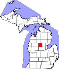 | |
| Village | ||
| Townships | ||
| Unincorporated communities | ||
| Footnotes | ‡This populated place also has portions in an adjacent county or counties | |