West Swanzey, New Hampshire
| West Swanzey, New Hampshire | |
|---|---|
| Census-designated place | |
|
Community Church | |
 West Swanzey  West Swanzey | |
| Coordinates: 42°52′11″N 72°19′31″W / 42.86972°N 72.32528°WCoordinates: 42°52′11″N 72°19′31″W / 42.86972°N 72.32528°W | |
| Country | United States |
| State | New Hampshire |
| County | Cheshire |
| Town | Swanzey |
| Area | |
| • Total | 2.6 sq mi (6.7 km2) |
| • Land | 2.6 sq mi (6.6 km2) |
| • Water | 0.0 sq mi (0.0 km2) |
| Elevation | 512 ft (156 m) |
| Population (2010) | |
| • Total | 1,308 |
| • Density | 500/sq mi (200/km2) |
| Time zone | Eastern (EST) (UTC-5) |
| • Summer (DST) | EDT (UTC-4) |
| ZIP code | 03469 |
| Area code(s) | 603 |
| FIPS code | 33-83700 |
| GNIS feature ID | 0870797 |

West Swanzey is a census-designated place (CDP) in the town of Swanzey within Cheshire County, New Hampshire, United States. The population was 1,308 at the 2010 census.[1]
Geography
West Swanzey is located at 42°52′11″N 72°19′31″W / 42.86972°N 72.32528°W (42.869829, -72.325301).[2]
According to the United States Census Bureau, the CDP has a total area of 2.6 square miles (6.7 km2), of which 2.5 sq mi (6.5 km2) is land and 0.04 sq mi (0.10 km2), or 0.78%, is water.
Demographics
As of the census[3] of 2000, there were 1,118 people, 485 households, and 304 families residing in the CDP. The population density was 437.6 people per square mile (169.3/km²). There were 506 housing units at an average density of 198.0 per square mile (76.6/km²). The racial makeup of the CDP was 98.03% White, 0.18% African American, 0.36% Native American, 0.18% Asian, 0.27% from other races, and 0.98% from two or more races. Hispanic or Latino of any race were 0.36% of the population.
There were 485 households out of which 29.7% had children under the age of 18 living with them, 44.1% were married couples living together, 14.6% had a female householder with no husband present, and 37.3% were non-families. 30.9% of all households were made up of individuals and 12.6% had someone living alone who was 65 years of age or older. The average household size was 2.31 and the average family size was 2.83.
In the CDP the population was spread out with 23.3% under the age of 18, 7.7% from 18 to 24, 31.5% from 25 to 44, 22.8% from 45 to 64, and 14.7% who were 65 years of age or older. The median age was 37 years. For every 100 females there were 91.1 males. For every 100 females age 18 and over, there were 87.1 males.
The median income for a household in the CDP was $33,194, and the median income for a family was $47,159. Males had a median income of $26,728 versus $25,388 for females. The per capita income for the CDP was $18,403. About 9.9% of families and 10.6% of the population were below the poverty line, including 5.4% of those under age 18 and 21.9% of those age 65 or over.
References
- ↑ United States Census Bureau, American FactFinder, 2010 Census figures. Retrieved March 23, 2011.
- ↑ "US Gazetteer files: 2010, 2000, and 1990". United States Census Bureau. 2011-02-12. Retrieved 2011-04-23.
- ↑ "American FactFinder". United States Census Bureau. Retrieved 2008-01-31.
Municipalities and communities of Cheshire County, New Hampshire, United States | ||
|---|---|---|
| City | 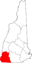 | |
| Towns | ||
| CDPs | ||
| Other villages | ||