Marlow, New Hampshire
| Marlow, New Hampshire | |
|---|---|
| Town | |
|
Main Street in 1907 | |
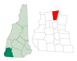 Location in Cheshire County, New Hampshire | |
| Coordinates: 43°06′57″N 72°11′49″W / 43.11583°N 72.19694°WCoordinates: 43°06′57″N 72°11′49″W / 43.11583°N 72.19694°W | |
| Country | United States |
| State | New Hampshire |
| County | Cheshire |
| Incorporated | 1761 |
| Government | |
| • Board of Selectmen |
Robert Allen, Chair Thomas Fuschetto Edward Thomas |
| Area | |
| • Total | 26.4 sq mi (68.4 km2) |
| • Land | 26.0 sq mi (67.2 km2) |
| • Water | 0.5 sq mi (1.2 km2) 1.78% |
| Elevation | 1,161 ft (354 m) |
| Population (2010) | |
| • Total | 742 |
| • Density | 28/sq mi (11/km2) |
| Time zone | Eastern (UTC-5) |
| • Summer (DST) | Eastern (UTC-4) |
| ZIP code | 03456 |
| Area code(s) | 603 |
| FIPS code | 33-45700 |
| GNIS feature ID | 0873660 |
| Website |
www |

Marlow is a town in Cheshire County, New Hampshire, United States. The population was 742 at the 2010 census.[1] Marlow is home to Honey Brook State Forest.
History
The town was first granted in 1753 by Colonial Governor Benning Wentworth as Addison, after Joseph Addison, secretary of state for England. Addison had signed the appointment papers making the governor's father, John Wentworth, lieutenant-governor of New Hampshire in 1717. As a result of the French War, few original grantees settled here, so it was regranted on October 7, 1761 to William Noyes and 69 others, the majority from Lyme, Connecticut. The town was named after Marlow, England, located on the River Thames in Buckinghamshire.[2]
Marlow bears many marks of glacial action, and minerals are still found here. A woodworking industry once used the water power of the Ashuelot River to produce tools, furniture and wooden buckets from lumber cut nearby. By 1859, when the population was 708, there were seven sawmills, a gristmill, a carriage shop, a tin shop, and two tanneries. Although the town's undulating surface is somewhat rocky, farmers produced hay, grain and vegetables.[2]
Marlow was the original home of PC Connection.
Geography
According to the United States Census Bureau, the town has a total area of 26.4 square miles (68 km2), of which 26.0 sq mi (67 km2) is land and 0.5 sq mi (1.3 km2) is water, comprising 1.78% of the town. Marlow is drained by the Ashuelot River. The town's highest point is in its northeast corner, at the summit of Huntley Mountain, where the elevation reaches 1,978 feet (603 m) above sea level.
Marlow is served by state routes 10, 123, and a small portion of the northern segment of Route 123A. Route 10 leads north to Newport and south to Keene, Route 123 leads east to Stoddard and west to Alstead, and Route 123A leads northwest from Route 10 into the town of Acworth.
Demographics
| Historical population | |||
|---|---|---|---|
| Census | Pop. | %± | |
| 1790 | 313 | — | |
| 1800 | 543 | 73.5% | |
| 1810 | 566 | 4.2% | |
| 1820 | 597 | 5.5% | |
| 1830 | 645 | 8.0% | |
| 1840 | 626 | −2.9% | |
| 1850 | 708 | 13.1% | |
| 1860 | 813 | 14.8% | |
| 1870 | 716 | −11.9% | |
| 1880 | 701 | −2.1% | |
| 1890 | 584 | −16.7% | |
| 1900 | 488 | −16.4% | |
| 1910 | 425 | −12.9% | |
| 1920 | 401 | −5.6% | |
| 1930 | 330 | −17.7% | |
| 1940 | 288 | −12.7% | |
| 1950 | 330 | 14.6% | |
| 1960 | 350 | 6.1% | |
| 1970 | 390 | 11.4% | |
| 1980 | 542 | 39.0% | |
| 1990 | 650 | 19.9% | |
| 2000 | 747 | 14.9% | |
| 2010 | 742 | −0.7% | |
| Est. 2015 | 728 | [3] | −1.9% |
As of the census[5] of 2000, there were 747 people, 292 households, and 221 families residing in the town. The population density was 28.8 people per square mile (11.1/km²). There were 396 housing units at an average density of 15.3 per square mile (5.9/km²). The racial makeup of the town was 98.80% White, 0.13% Native American, and 1.07% from two or more races. Hispanic or Latino of any race were 1.07% of the population.
There were 292 households out of which 33.2% had children under the age of 18 living with them, 67.1% were married couples living together, 5.5% had a female householder with no husband present, and 24.0% were non-families. 17.1% of all households were made up of individuals and 6.8% had someone living alone who was 65 years of age or older. The average household size was 2.56 and the average family size was 2.89.
In the town the population was spread out with 24.9% under the age of 18, 5.9% from 18 to 24, 27.6% from 25 to 44, 28.5% from 45 to 64, and 13.1% who were 65 years of age or older. The median age was 40 years. For every 100 females there were 105.8 males. For every 100 females age 18 and over, there were 102.5 males.
The median income for a household in the town was $45,000, and the median income for a family was $47,813. Males had a median income of $29,653 versus $22,273 for females. The per capita income for the town was $18,810. About 2.7% of families and 4.1% of the population were below the poverty line, including 5.1% of those under age 18 and 4.9% of those age 65 or over.
Notable people
- Osman Cleander Baker, biblical scholar and bishop
- Stephen Mack, merchant and politician
References
- ↑ United States Census Bureau, American FactFinder, 2010 Census figures. Retrieved March 23, 2011.
- 1 2 Coolidge, Austin J.; John B. Mansfield (1859). A History and Description of New England. Boston, Massachusetts. pp. 573–574.
- ↑ "Annual Estimates of the Resident Population for Incorporated Places: April 1, 2010 to July 1, 2015". Retrieved July 2, 2016.
- ↑ "Census of Population and Housing". Census.gov. Retrieved June 4, 2016.
- ↑ "American FactFinder". United States Census Bureau. Retrieved 2008-01-31.
External links
- Town of Marlow official website
- Marlow community website
- Marlow Historical Society
- New Hampshire Economic and Labor Market Information Bureau Profile
Municipalities and communities of Cheshire County, New Hampshire, United States | ||
|---|---|---|
| City | 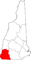 | |
| Towns | ||
| CDPs | ||
| Other villages | ||