Surry, New Hampshire
| Surry, New Hampshire | ||
|---|---|---|
| Town | ||
| ||
 Location in Cheshire County, New Hampshire | ||
| Coordinates: 43°01′04″N 72°19′16″W / 43.01778°N 72.32111°WCoordinates: 43°01′04″N 72°19′16″W / 43.01778°N 72.32111°W | ||
| Country | United States | |
| State | New Hampshire | |
| County | Cheshire | |
| Incorporated | 1769 | |
| Government | ||
| • Board of Selectmen |
Bruce Smith Jay Croteau Eric Eichner | |
| Area | ||
| • Total | 15.9 sq mi (41.2 km2) | |
| • Land | 15.6 sq mi (40.4 km2) | |
| • Water | 0.3 sq mi (0.8 km2) 2.01% | |
| Elevation | 581 ft (177 m) | |
| Population (2010) | ||
| • Total | 732 | |
| • Density | 46/sq mi (18/km2) | |
| Time zone | Eastern (UTC-5) | |
| • Summer (DST) | Eastern (UTC-4) | |
| ZIP code | 03431 | |
| Area code(s) | 603 | |
| FIPS code | 33-75300 | |
| GNIS feature ID | 0873733 | |
| Website |
www | |

Surry is a town in Cheshire County, New Hampshire, United States. The population was 732 at the 2010 census.[1]
History
Surry was chartered in 1769, and named for Charles Howard, Earl of Surrey. The first census taken in Surry, in 1790, reported 448 residents.
Geography
According to the United States Census Bureau, the town has a total area of 15.9 square miles (41.2 km2), of which 15.6 sq mi (40.4 km2) is land and 0.3 sq mi (0.8 km2) is water, comprising 2.01% of the town. The highest point in Surry is along the town's western border, on the upper slopes of Derry Hill, where the elevation reaches 1,555 feet (474 m) above sea level.
Surry Dam on the Ashuelot River is in the south central part of town. It holds back the Surry Reservoir which functions as a recreational site.
A waterfall locally known as 40 Foot Falls can be seen from Joslin Road on Merriam Brook.
Demographics
| Historical population | |||
|---|---|---|---|
| Census | Pop. | %± | |
| 1790 | 448 | — | |
| 1800 | 569 | 27.0% | |
| 1810 | 564 | −0.9% | |
| 1820 | 570 | 1.1% | |
| 1830 | 539 | −5.4% | |
| 1840 | 481 | −10.8% | |
| 1850 | 556 | 15.6% | |
| 1860 | 389 | −30.0% | |
| 1870 | 318 | −18.3% | |
| 1880 | 326 | 2.5% | |
| 1890 | 270 | −17.2% | |
| 1900 | 250 | −7.4% | |
| 1910 | 213 | −14.8% | |
| 1920 | 200 | −6.1% | |
| 1930 | 198 | −1.0% | |
| 1940 | 236 | 19.2% | |
| 1950 | 291 | 23.3% | |
| 1960 | 362 | 24.4% | |
| 1970 | 507 | 40.1% | |
| 1980 | 656 | 29.4% | |
| 1990 | 667 | 1.7% | |
| 2000 | 673 | 0.9% | |
| 2010 | 732 | 8.8% | |
| Est. 2015 | 723 | [2] | −1.2% |
As of the census[4] of 2000, there were 673 people, 268 households, and 206 families residing in the town. The population density was 43.2 people per square mile (16.7/km²). There were 282 housing units at an average density of 18.1 per square mile (7.0/km²). The racial makeup of the town was 98.07% White, 0.59% Native American, 0.30% Asian, 0.15% from other races, and 0.89% from two or more races. Hispanic or Latino of any race were 1.49% of the population.
There were 268 households out of which 30.6% had children under the age of 18 living with them, 69.8% were married couples living together, 6.0% had a female householder with no husband present, and 22.8% were non-families. 18.7% of all households were made up of individuals and 7.8% had someone living alone who was 65 years of age or older. The average household size was 2.51 and the average family size was 2.84.
In the town the population was spread out with 21.4% under the age of 18, 4.6% from 18 to 24, 26.4% from 25 to 44, 31.6% from 45 to 64, and 15.9% who were 65 years of age or older. The median age was 44 years. For every 100 females there were 96.8 males. For every 100 females age 18 and over, there were 98.9 males.
The median income for a household in the town was $56,964, and the median income for a family was $60,179. Males had a median income of $34,464 versus $22,250 for females. The per capita income for the town was $24,277. About 0.5% of families and 1.8% of the population were below the poverty line, including 1.3% of those under age 18 and 4.9% of those age 65 or over.
Notable people
- Amos Pollard, chief surgeon and defender of the Alamo; grew up in Surry
References
- ↑ United States Census Bureau, American FactFinder, 2010 Census figures. Retrieved March 23, 2011.
- ↑ "Annual Estimates of the Resident Population for Incorporated Places: April 1, 2010 to July 1, 2015". Retrieved July 2, 2016.
- ↑ "Census of Population and Housing". Census.gov. Retrieved June 4, 2016.
- ↑ "American FactFinder". United States Census Bureau. Retrieved 2008-01-31.
External links
- Town of Surry official website
- New Hampshire Economic and Labor Market Information Bureau Profile
- Surry community website
Municipalities and communities of Cheshire County, New Hampshire, United States | ||
|---|---|---|
| City | 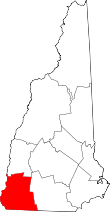 | |
| Towns | ||
| CDPs | ||
| Other villages | ||