Wauseon, Ohio
| Wauseon, Ohio | |
|---|---|
| City | |
|
Buildings in downtown Wauseon | |
| Motto: A City You'll Take To Heart | |
 Location of Wauseon, Ohio | |
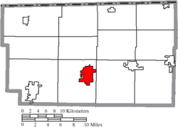 Location of Wauseon in Fulton County | |
| Coordinates: 41°33′8″N 84°8′21″W / 41.55222°N 84.13917°WCoordinates: 41°33′8″N 84°8′21″W / 41.55222°N 84.13917°W | |
| Country |
|
| State |
|
| County | Fulton |
| Township | Clinton |
| Government | |
| • Mayor | Kathey Huner[1] |
| Area[2] | |
| • Total | 5.19 sq mi (13.44 km2) |
| • Land | 5.17 sq mi (13.39 km2) |
| • Water | 0.02 sq mi (0.05 km2) |
| Elevation[3] | 771 ft (235 m) |
| Population (2010)[4] | |
| • Total | 7,332 |
| • Estimate (2015[5]) | 7,316 |
| • Density | 1,418.2/sq mi (547.6/km2) |
| Time zone | Eastern (EST) (UTC-5) |
| • Summer (DST) | EDT (UTC-4) |
| ZIP code | 43567 |
| Area code(s) | 419 and 567 |
| FIPS code | 39-81928[6] |
| GNIS feature ID | 1047628[3] |
| Website |
www |

Wauseon is a city in and the county seat of Fulton County, Ohio, United States.[7] The population was 7,332 at the 2010 census. It was named after Wauseon, a Potawatomi Native American chief[8] who lived in the area before the founding of the state.
History
The first seat of justice in the county was Ottokee, because of its central location in the county; a wooden courthouse was built in 1851.[9] Wauseon was platted 1854 when the railroad was extended to that point.[10] The village was incorporated in 1859. With the commercial success that the railroad brought to Wauseon, it was designated county seat in 1871.[9] The Fulton County Courthouse was built in 1872.[11]
|


Geography
Wauseon is located at 41°33′8″N 84°8′21″W / 41.55222°N 84.13917°W (41.552230, -84.139126).[14]
According to the United States Census Bureau, the city has a total area of 5.19 square miles (13.44 km2), of which 5.17 square miles (13.39 km2) is land and 0.02 square miles (0.05 km2) is water.[2]
Demographics
| Historical population | |||
|---|---|---|---|
| Census | Pop. | %± | |
| 1860 | 378 | — | |
| 1870 | 1,474 | 289.9% | |
| 1880 | 1,905 | 29.2% | |
| 1890 | 2,060 | 8.1% | |
| 1900 | 2,148 | 4.3% | |
| 1910 | 2,650 | 23.4% | |
| 1920 | 3,035 | 14.5% | |
| 1930 | 2,889 | −4.8% | |
| 1940 | 3,016 | 4.4% | |
| 1950 | 3,494 | 15.8% | |
| 1960 | 4,311 | 23.4% | |
| 1970 | 4,932 | 14.4% | |
| 1980 | 6,170 | 25.1% | |
| 1990 | 6,322 | 2.5% | |
| 2000 | 7,091 | 12.2% | |
| 2010 | 7,332 | 3.4% | |
| Est. 2015 | 7,316 | [15] | −0.2% |
| Sources:[16][17][18][19][20][6][21] | |||
2010 census
As of the census[4] of 2010, there were 7,332 people, 2,798 households, and 1,939 families residing in the city. The population density was 1,418.2 inhabitants per square mile (547.6/km2). There were 3,061 housing units at an average density of 592.1 per square mile (228.6/km2). The racial makeup of the city was 90.3% White, 0.9% African American, 0.3% Native American, 1.0% Asian, 5.2% from other races, and 2.3% from two or more races. Hispanic or Latino of any race were 14.2% of the population.
There were 2,798 households of which 38.0% had children under the age of 18 living with them, 51.4% were married couples living together, 13.1% had a female householder with no husband present, 4.8% had a male householder with no wife present, and 30.7% were non-families. 26.6% of all households were made up of individuals and 10.7% had someone living alone who was 65 years of age or older. The average household size was 2.58 and the average family size was 3.10.
The median age in the city was 35.4 years. 28.6% of residents were under the age of 18; 8.2% were between the ages of 18 and 24; 25.6% were from 25 to 44; 24.5% were from 45 to 64; and 13.1% were 65 years of age or older. The gender makeup of the city was 47.9% male and 52.1% female.
2000 census
As of the census[6] of 2000, there were 7,091 people, 2,706 households, and 1,875 families residing in the city. The population density was 1,437.6 people per square mile (555.3/km²). There were 2,851 housing units at an average density of 578.0 per square mile (223.3/km²). The racial makeup of the city was 92.77% White, 0.55% African American, 0.37% Native American, 0.82% Asian, 0.01% Pacific Islander, 4.02% from other races, and 1.47% from two or more races. Hispanic or Latino of any race were 9.79% of the population.
There were 2,706 households out of which 37.9% had children under the age of 18 living with them, 63.0% were married couples living together, 12.2% had a female householder with no husband present, and 30.7% were non-families. 26.0% of all households were made up of individuals and 10.6% had someone living alone who was 65 years of age or older. The average household size was 2.58 and the average family size was 3.13.
In the city the population was spread out with 29.1% under the age of 18, 9.1% from 18 to 24, 28.8% from 25 to 44, 20.5% from 45 to 64, and 12.5% who were 65 years of age or older. The median age was 34 years. For every 100 females there were 88.7 males. For every 100 females age 18 and over, there were 85.1 males.
The median income for a household in the city was $39,591, and the median income for a family was $48,981. Males had a median income of $32,645 versus $24,042 for females. The per capita income for the city was $17,491. About 3.9% of families and 5.2% of the population were below the poverty line, including 6.5% of those under age 18 and 1.7% of those age 65 or over.
Education
Schools
The school district is the Wauseon Exempted Village School District. This comprises:
- Wauseon Primary School grades K-2
- Wauseon Elementary School grades 3-5
- Wauseon Middle School grades 6-8
- Wauseon High School, grades 9-12
Library
Wauseon is served by the Wauseon Public Library. In 2005, the library loaned more than 238,000 items to its 20,000 cardholders. Total holdings in 2005 were over 91,000 volumes with over 210 periodical subscriptions.[22]
Medical Care
Fulton County Health Center is a rural critical access hospital that includes an emergency department with a heliport for medical evacuation.
Parks & Attractions
- Fulton County Fair, including the Fulton County 9/11 Memorial
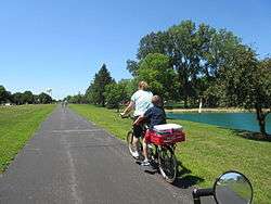
- Wabash Cannonball Trail which features 4 miles of paved trail in the city of Wauseon
Notable people
- Jon Lugbill, slalom canoer who competed from the late 1970s to the early 1990s
- James Massey, academic and information theorist
- Barney Oldfield, legendary car racer in the early 1900s[23]
- Rick Volk, member of the Baltimore Colts' Super Bowl III and V championship teams[24]
Media
Fulton County Expositor, a paper of Ohio Community Media[25]
The Village Reporter[26]
Radio
96.1 WMTR-FM
Television
INTV-Channel 5[27]
References
- ↑ "MAYOR'S OFFICE". City of Wauseon, OH. Retrieved 22 December 2015.
- 1 2 "US Gazetteer files 2010". United States Census Bureau. Retrieved 2013-01-06.
- 1 2 "US Board on Geographic Names". United States Geological Survey. 2007-10-25. Retrieved 2008-01-31.
- 1 2 "American FactFinder". United States Census Bureau. Retrieved 2013-01-06.
- ↑ "Population Estimates". United States Census Bureau. Retrieved 2016-06-07.
- 1 2 3 "American FactFinder". United States Census Bureau. Retrieved 2008-01-31.
- ↑ "Find a County". National Association of Counties. Retrieved 2011-06-07.
- ↑ "Ohio History Central, Wauseon, Ohio". Retrieved 28 March 2016.
- 1 2 Aldrich, Lewis Cass (1888). History of Henry and Fulton counties, Ohio : with illustrations and biographical sketches of some of its prominent men and pioneers. Syracuse, N. Y.: D. Mason & Co., Publishers. pp. 288–289.
- ↑ Reighard, Frank H. (1920). A Standard History of Fulton County, Ohio (Volume 1). Lewis Publishing Company. p. 209.
- ↑ Hellmann, Paul T. (May 13, 2013). "Historical Gazetteer of the United States". Routledge. p. 876. Retrieved 30 November 2013.
- ↑ Railroad & township map of Ohio (Map). Library of Congress. 1851. Retrieved 11 April 2016.
- ↑ J. A. Norton, Ohio commissioner of railroads & telegraphs (1890). Railroad map of Ohio (Map). Retrieved 11 April 2016.
- ↑ "US Gazetteer files: 2010, 2000, and 1990". United States Census Bureau. 2011-02-12. Retrieved 2011-04-23.
- ↑ "Annual Estimates of the Resident Population for Incorporated Places: April 1, 2010 to July 1, 2015". Retrieved July 2, 2016.
- ↑ "Population of Civil Divisions Less than Counties" (PDF). Statistics of the Population of the United States at the Tenth Census. U.S. Census Bureau. Retrieved 28 November 2013.
- ↑ "Population: Ohio" (PDF). 1910 U.S. Census. U.S. Census Bureau. Retrieved 28 November 2013.
- ↑ "Population: Ohio" (PDF). 1930 US Census. U.S. Census Bureau. Retrieved 28 November 2013.
- ↑ "Number of Inhabitants: Ohio" (PDF). 18th Census of the United States. U.S. Census Bureau. Retrieved 22 November 2013.
- ↑ "Ohio: Population and Housing Unit Counts" (PDF). U.S. Census Bureau. Retrieved 22 November 2013.
- ↑ "Incorporated Places and Minor Civil Divisions Datasets: Subcounty Population Estimates: April 1, 2010 to July 1, 2012". U.S. Census Bureau. Retrieved 25 November 2013.
- ↑ "2005 Ohio Public Library Statistics:Statistics by County and Town". State Library of Ohio. Retrieved November 10, 2006.
- ↑ Barny Oldfield ToledosAttic.org Retrieved 29 March 2016
- ↑ Wauseon High School 2007 Athletic Hall of Fame Inductees. (n.d.). Retrieved December 4, 2007, from http://www.wauseon.k12.oh.us/Hall_of_Fame/Rick%20Volk.pdf
- ↑ http://fcnews.org/
- ↑ http://www.thevillagereporter.com/
- ↑ http://intv5.com/schedule.htm
External links
| Wikimedia Commons has media related to Wauseon, Ohio. |
- City website
- Detailed Wauseon City information, interactive discussion and news
- Wauseon Public Library
- Wauseon Public Schools
- Wauseon Reporter, a local newspaper
- Ironwood Golf Course
Municipalities and communities of Fulton County, Ohio, United States | ||
|---|---|---|
| City | 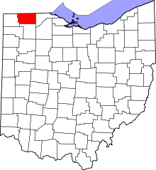 | |
| Villages | ||
| Townships | ||
| CDPs | ||
| Unincorporated communities | ||
| Ghost towns | ||
| Footnotes | ‡This populated place also has portions in an adjacent county or counties | |