Ware (CDP), Massachusetts
| Ware, Massachusetts | |
|---|---|
| CDP | |
|
Ware Town Hall | |
| Coordinates: 42°15′36″N 72°14′45″W / 42.26000°N 72.24583°WCoordinates: 42°15′36″N 72°14′45″W / 42.26000°N 72.24583°W | |
| Country | United States |
| State | Massachusetts |
| County | Hampshire |
| Area | |
| • Total | 6.3 sq mi (16.3 km2) |
| • Land | 6.2 sq mi (16.0 km2) |
| • Water | 0.1 sq mi (0.4 km2) |
| Elevation | 423 ft (129 m) |
| Population (2000) | |
| • Total | 6,174 |
| • Density | 999.9/sq mi (386.1/km2) |
| Time zone | Eastern (EST) (UTC-5) |
| • Summer (DST) | EDT (UTC-4) |
| ZIP code | 01082 |
| Area code(s) | 413 |
| FIPS code | 25-72845 |
| GNIS feature ID | 0609762 |

Ware is a census-designated place (CDP) in the town of Ware in Hampshire County, Massachusetts, United States. The population was 6,174 at the 2000 census. It is part of the Springfield, Massachusetts Metropolitan Statistical Area.
Geography
Ware is located at 42°15′35″N 72°14′45″W / 42.25972°N 72.24583°W (42.259965, -72.245841).[1]
According to the United States Census Bureau, the CDP has a total area of 16.3 km² (6.3 mi²), of which 16.0 km² (6.2 mi²) is land and 0.4 km² (0.1 mi²) (2.22%) is water.
Demographics
As of the census[2] of 2000, there were 6,174 people, 2,685 households, and 1,592 families residing in the CDP. The population density was 386.4/km² (999.9/mi²). There were 2,906 housing units at an average density of 181.8/km² (470.6/mi²). The racial makeup of the CDP was 95.59% White, 0.73% Black or African American, 0.24% Native American, 0.81% Asian, 0.02% Pacific Islander, 1.02% from other races, and 1.59% from two or more races. Hispanic or Latino of any race were 2.74% of the population.
There were 2,685 households out of which 28.0% had children under the age of 18 living with them, 38.5% were married couples living together, 14.9% had a female householder with no husband present, and 40.7% were non-families. 34.1% of all households were made up of individuals and 15.4% had someone living alone who was 65 years of age or older. The average household size was 2.30 and the average family size was 2.92.
In the CDP the population was spread out with 24.9% under the age of 18, 9.2% from 18 to 24, 28.5% from 25 to 44, 20.1% from 45 to 64, and 17.3% who were 65 years of age or older. The median age was 36 years. For every 100 females there were 91.7 males. For every 100 females age 18 and over, there were 87.8 males.
The median income for a household in the CDP was $31,138, and the median income for a family was $35,805. Males had a median income of $36,348 versus $25,411 for females. The per capita income for the CDP was $17,906. About 11.5% of families and 13.6% of the population were below the poverty line, including 20.0% of those under age 18 and 8.4% of those age 65 or over.
References
- ↑ "US Gazetteer files: 2010, 2000, and 1990". United States Census Bureau. 2011-02-12. Retrieved 2011-04-23.
- ↑ "American FactFinder". United States Census Bureau. Retrieved 2008-01-31.
Municipalities and communities of Hampshire County, Massachusetts, United States | ||
|---|---|---|
| Cities | 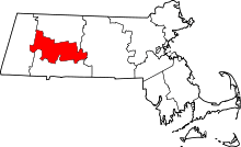 | |
| Towns | ||
| CDPs | ||
| Other villages | ||
| Footnotes | ‡This populated place also has portions in an adjacent county or counties | |