Plainfield, Massachusetts
| Plainfield, Massachusetts | ||
|---|---|---|
| Town | ||
|
A typical field in Plainfield, Massachusetts | ||
| ||
 Location in Hampshire County in Massachusetts | ||
| Coordinates: 42°30′55″N 72°55′00″W / 42.51528°N 72.91667°WCoordinates: 42°30′55″N 72°55′00″W / 42.51528°N 72.91667°W | ||
| Country | United States | |
| State | Massachusetts | |
| County | Hampshire | |
| Settled | 1770 | |
| Incorporated | 1807 | |
| Government | ||
| • Type | Open town meeting | |
| Area | ||
| • Total | 21.3 sq mi (55.1 km2) | |
| • Land | 21.1 sq mi (54.5 km2) | |
| • Water | 0.2 sq mi (0.5 km2) | |
| Elevation | 1,676 ft (511 m) | |
| Population (2010) | ||
| • Total | 648 | |
| • Density | 28.0/sq mi (10.8/km2) | |
| Time zone | Eastern (UTC-5) | |
| • Summer (DST) | Eastern (UTC-4) | |
| ZIP code | 01070, 01026 | |
| Area code(s) | 413 | |
| FIPS code | 25-54030 | |
| GNIS feature ID | 0618206 | |


Plainfield is a town on the northwestern edge of Hampshire County, Massachusetts, United States, about 25 miles east of Pittsfield and 30 miles northwest of Northampton. The population was 648 at the 2010 census. It is part of the Springfield, Massachusetts Metropolitan Statistical Area.
History
Plainfield was first settled in 1770, primarily by settlers from the town of Bridgewater, and was officially incorporated as a district within the Town of Cummington in 1785, and as a town on June 15, 1807. Plainfield is the youngest town in Hampshire County, a distinction it has held since the disincorporation of Enfield (1816) and Prescott (1822) in 1938.
In the 1800s, Plainfield was a thriving agricultural community, primarily producing sheep and leather for tanning. With the widespread adoption of the steamship, and the resultant globalization in the 1870s, the expense of importing both mutton and leather from Australia and New Zealand was greatly reduced. Consequently, the agricultural industries in Plainfield became less profitable, and the Population declined substantially over the following decades.
Sixty-one men from Plainfield joined the Union Army late in the American Civil War. Six were killed in battle, or died in consequence of their service. Of those who survived, many settled elsewhere after the war.
After almost two centuries of depopulation, modern Plainfield is experiencing increased population growth (as of 2010).
Geography
The Town of Plainfield is situated in the scenic Berkshire Highlands[1] where Hampshire County merges into neighboring Franklin and Berkshire Counties. Plainfield is part of the Hilltowns of Western Massachusetts.
Plainfield sits 1620' above sea level, and the peaks of West Mountain (at 2125') are the highest elevation in Hampshire County.
According to the United States Census Bureau, the town has a total area of 21.3 square miles (55 km2), of which 21.0 square miles (54 km2) is land and 0.2 square miles (0.52 km2) (0.99%) is water.
Plainfield's waterways serve as the headwaters of the Westfield and Deerfield rivers.
Plainfield is bordered by the towns of Cummington, Ashfield, Hawley, Savoy, and Windsor.
Demographics
| Historical population | ||
|---|---|---|
| Year | Pop. | ±% |
| 1850 | 814 | — |
| 1860 | 639 | −21.5% |
| 1870 | 521 | −18.5% |
| 1880 | 457 | −12.3% |
| 1890 | 435 | −4.8% |
| 1900 | 404 | −7.1% |
| 1910 | 406 | +0.5% |
| 1920 | 332 | −18.2% |
| 1930 | 300 | −9.6% |
| 1940 | 264 | −12.0% |
| 1950 | 228 | −13.6% |
| 1960 | 237 | +3.9% |
| 1970 | 287 | +21.1% |
| 1980 | 425 | +48.1% |
| 1990 | 571 | +34.4% |
| 2000 | 589 | +3.2% |
| 2010 | 648 | +10.0% |
Source: United States Census records and Population Estimates Program data.[2][3][4][5][6][7][8][9][10][11] | ||
As of the census[12] of 2000, there were 589 people, 243 households, and 166 families residing in the town. The population density was 28.0 people per square mile (10.8/km²). There were 311 housing units at an average density of 14.8 per square mile (5.7/km²). The racial makeup of the town was 98.13% White, 0.34% Native American, 0.17% Asian, and 1.36% from two or more races. Hispanic or Latino of any race were 0.68% of the population.
There were 243 households out of which 31.3% had children under the age of 18 living with them, 60.9% were married couples living together, 4.5% had a female householder with no husband present, and 31.3% were non-families. 25.9% of all households were made up of individuals and 10.3% had someone living alone who was 65 years of age or older. The average household size was 2.42 and the average family size was 2.92.
In the town the population was spread out with 24.8% under the age of 18, 4.2% from 18 to 24, 26.1% from 25 to 44, 31.9% from 45 to 64, and 12.9% who were 65 years of age or older. The median age was 42 years. For every 100 females there were 94.4 males. For every 100 females age 18 and over, there were 99.5 males.
The median income for a household in the town was $37,250, and the median income for a family was $46,042. Males had a median income of $31,625 versus $26,875 for females. The per capita income for the town was $20,785. About 4.8% of families and 8.0% of the population were below the poverty line, including 4.9% of those under age 18 and none of those age 65 or over.
Government
Plainfield is governed by a Town Meeting open to all registered voters in the town. Ongoing town matters are managed by an elected Board of Selectmen and other Boards and Commissions. The town is part of the Second Berkshire District in the Massachusetts House of Representatives, represented by Paul Mark, and the Berkshire, Franklin, and Hampshire Senate district, represented by Ben Downing.
Notable residents, past and present
- Erastus Newton Bates, Illinois and Minnesota legislator
- John Brown (1800–1859), abolitionist who played a role in starting the civil war
- William Cullen Bryant (1794–1878), poet, philosopher
- Ralph Ellison, novelist, essayist. African-American novelist, literary critic, scholar and writer. Born in Oklahoma City, Ellison was best known for his novel Invisible Man, which won the National Book Award in 1953.
 Plainfield Congregational Church
 - Martha J. Lamb author, historian
- Charles McCarry (born 1930), author of more than ten novels and numerous works of non-fiction; Author of Citizen Nader, first authoritative biography of Ralph Nader. Served in the intelligence services of the US which provided the basis for many of his later successful spy-themed novels.
- James Naismith, inventor of basketball.
- Talcott Seelye, former United States Ambassador to Tunisia and Syria, Arabist
- Charles Dudley Warner, born Plainfield September 12, 1829, author, editor Hartford Courant
- Marcus Whitman (1802–1847), missionary physician who in 1843 convinced President Tyler that Oregon, and what is now the state of Washington, should be secured for the United States not Great Britain.
Points of interest
- Deer Hill State Reservation
- Dubuque Memorial State Forest
- Shaw Hudson House; museum and historical home of note
- Old Millers site; one of 8 mills on the Old Mill stream; Plainfield Historical Society.
References
- ↑ Egler, F. E. 1940. Berkshire plateau vegetation, Massachusetts. Ecological Monographs 10:147-192.
- ↑ "TOTAL POPULATION (P1), 2010 Census Summary File 1". American FactFinder, All County Subdivisions within Massachusetts. United States Census Bureau. 2010.
- ↑ "Massachusetts by Place and County Subdivision - GCT-T1. Population Estimates". United States Census Bureau. Retrieved July 12, 2011.
- ↑ "1990 Census of Population, General Population Characteristics: Massachusetts" (PDF). US Census Bureau. December 1990. Table 76: General Characteristics of Persons, Households, and Families: 1990. 1990 CP-1-23. Retrieved July 12, 2011.
- ↑ "1980 Census of the Population, Number of Inhabitants: Massachusetts" (PDF). US Census Bureau. December 1981. Table 4. Populations of County Subdivisions: 1960 to 1980. PC80-1-A23. Retrieved July 12, 2011.
- ↑ "1950 Census of Population" (PDF). Bureau of the Census. 1952. Section 6, Pages 21-10 and 21-11, Massachusetts Table 6. Population of Counties by Minor Civil Divisions: 1930 to 1950. Retrieved July 12, 2011.
- ↑ "1920 Census of Population" (PDF). Bureau of the Census. Number of Inhabitants, by Counties and Minor Civil Divisions. Pages 21-5 through 21-7. Massachusetts Table 2. Population of Counties by Minor Civil Divisions: 1920, 1910, and 1920. Retrieved July 12, 2011.
- ↑ "1890 Census of the Population" (PDF). Department of the Interior, Census Office. Pages 179 through 182. Massachusetts Table 5. Population of States and Territories by Minor Civil Divisions: 1880 and 1890. Retrieved July 12, 2011.
- ↑ "1870 Census of the Population" (PDF). Department of the Interior, Census Office. 1872. Pages 217 through 220. Table IX. Population of Minor Civil Divisions, &c. Massachusetts. Retrieved July 12, 2011.
- ↑ "1860 Census" (PDF). Department of the Interior, Census Office. 1864. Pages 220 through 226. State of Massachusetts Table No. 3. Populations of Cities, Towns, &c. Retrieved July 12, 2011.
- ↑ "1850 Census" (PDF). Department of the Interior, Census Office. 1854. Pages 338 through 393. Populations of Cities, Towns, &c. Retrieved July 12, 2011.
- ↑ "American FactFinder". United States Census Bureau. Retrieved 2008-01-31.
External links
| Wikimedia Commons has media related to Plainfield, Massachusetts. |
- Town of Plainfield official website
- Plainfield Volunteer Fire Department
- Plainfield Historical Society
Municipalities and communities of Hampshire County, Massachusetts, United States | ||
|---|---|---|
| Cities | 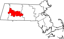 | |
| Towns | ||
| CDPs | ||
| Other villages | ||
| Footnotes | ‡This populated place also has portions in an adjacent county or counties | |