Viola, Missouri
| Viola | |
|---|---|
| unincorporated community | |
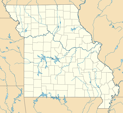 Viola Location within Missouri | |
| Coordinates: 36°34′23″N 93°34′56″W / 36.57306°N 93.58222°WCoordinates: 36°34′23″N 93°34′56″W / 36.57306°N 93.58222°W | |
| Country | United States |
| State | Missouri |
| County | Barry and Stone Counties |
| Founded | 1894 |
Viola is an unincorporated community on Route 39 on the border between Barry and Stone counties in the U.S. state of Missouri.[1] It is also situated on Table Rock Lake.
The Stone County portion of Viola is part of the Branson, Missouri Micropolitan Statistical Area.
A post office was established on the Barry County side at Viola in 1893, and remained in operation until 1974.[2] The community has the name of an unidentified local girl.[3]
References
- ↑ U.S. Geological Survey Geographic Names Information System: Viola, Missouri
- ↑ "Post Offices". Jim Forte Postal History. Retrieved 30 August 2016.
- ↑ "Barry County Place Names, 1928-1945 (archived)". The State Historical Society of Missouri. Retrieved 30 August 2016.
Municipalities and communities of Barry County, Missouri, United States | ||
|---|---|---|
| Cities | 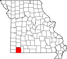 | |
| Villages | ||
| Townships | ||
| CDPs | ||
| Unincorporated communities | ||
| Ghost towns | ||
| Footnotes | ‡This populated place also has portions in an adjacent county or counties | |
Municipalities and communities of Stone County, Missouri, United States | ||
|---|---|---|
| Cities | 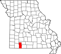 | |
| Villages | ||
| CDP | ||
| Unincorporated communities | ||
| Footnotes | ‡This populated place also has portions in an adjacent county or counties | |
This article is issued from Wikipedia - version of the 8/31/2016. The text is available under the Creative Commons Attribution/Share Alike but additional terms may apply for the media files.