Monett, Missouri
| Monett, Missouri | |
|---|---|
| City | |
| Motto: Pride & Progress | |
 Location of Monett, Missouri | |
| Coordinates: 36°55′25″N 93°55′20″W / 36.92361°N 93.92222°WCoordinates: 36°55′25″N 93°55′20″W / 36.92361°N 93.92222°W | |
| Country | United States |
| State | Missouri |
| Counties | Barry, Lawrence |
| Township | Monett, Pierce |
| Area[1] | |
| • Total | 8.45 sq mi (21.89 km2) |
| • Land | 8.43 sq mi (21.83 km2) |
| • Water | 0.02 sq mi (0.05 km2) |
| Elevation | 1,355 ft (413 m) |
| Population (2010)[2] | |
| • Total | 8,873 |
| • Estimate (2012[3]) | 8,922 |
| • Density | 1,052.6/sq mi (406.4/km2) |
| Time zone | Central (CST) (UTC-6) |
| • Summer (DST) | CDT (UTC-5) |
| ZIP code | 65708 |
| Area code(s) | 417 |
| FIPS code | 29-49196[4] |
| GNIS feature ID | 0729929[5] |
Monett is a city in Monett Township in Barry County and Pierce Township in Lawrence County, Missouri, United States. The population was 8,873 at the 2010 census.
History
Monett was created as a railroad town by the St. Louis–San Francisco Railway ("Frisco Line") which came through in 1870 and would build branch going off the main line to Paris, Texas. Both lines are still in existence and operated by the BNSF Railway. During this time the area went through several names including Kings Prairie Depot, Plymouth, Plymouth Junction (when the southern branch was built in 1880), Gonten (named for the local post master because the Post Service said there were other Plymouths); and finally Monett in 1887 when the area was formally platted and the Monett name was applied to the post office.[6] It was named for Henry Monett who was a popular general station agent for various railroads including the New York, Chicago and St. Louis Railroad ("Nickel Plate Railroad") before becoming an agent for the New York Central Railroad shortly before his death at the age of 35 in 1888.[7][8] [9][10]
The community was very much noted for being a rail town and had a Harvey House operating at the Frisco train station from 1896 until 1930.[11] The community in the Ozark Mountains also had a thriving fruit business and was nicknamed the "Strawberry Capital of the Midwest."[12] The Ozark Fruit Growers Association building (built in 1927) which is part of the Downtwon Monett Historic District is on the National Register of Historic Places.
The David W. Courdin House, Downtown Monett Historic District, and Waldensian Church and Cemetery of Stone Prairie are listed on the National Register of Historic Places.[13][14]
Geography
Monett is located at 36°55′25″N 93°55′20″W / 36.92361°N 93.92222°W (36.923725, -93.922332).[15]
According to the United States Census Bureau, the city has a total area of 8.45 square miles (21.89 km2), of which 8.43 square miles (21.83 km2) is land and 0.02 square miles (0.05 km2) is water.[1]
Demographics
| Historical population | |||
|---|---|---|---|
| Census | Pop. | %± | |
| 1890 | 1,699 | — | |
| 1900 | 3,115 | 83.3% | |
| 1910 | 4,177 | 34.1% | |
| 1920 | 4,206 | 0.7% | |
| 1930 | 4,099 | −2.5% | |
| 1940 | 4,395 | 7.2% | |
| 1950 | 4,771 | 8.6% | |
| 1960 | 5,359 | 12.3% | |
| 1970 | 5,937 | 10.8% | |
| 1980 | 6,148 | 3.6% | |
| 1990 | 6,529 | 6.2% | |
| 2000 | 7,396 | 13.3% | |
| 2010 | 8,873 | 20.0% | |
| Est. 2015 | 8,988 | [16] | 1.3% |
| U.S. Decennial Census | |||
The town has seen quite a rapid growth over the last few years. In March 2006, a Lowe's opened up in addition to several new shopping centers. This community is driven primarily by its industrial sector. Several key businesses in town include Jack Henry & Associates, Tyson Foods, Hydro Aluminum, International Dehydrated Foods, Miracle, Architectural Systems Inc., EFCO, and WinTech.
2010 census
As of the census[2] of 2010, there were 8,873 people, 3,405 households, and 2,282 families residing in the city. The population density was 1,052.6 inhabitants per square mile (406.4/km2). There were 3,828 housing units at an average density of 454.1 per square mile (175.3/km2). The racial makeup of the city was 86.8% White, 0.8% African American, 0.9% Native American, 1.0% Asian, 0.1% Pacific Islander, 8.5% from other races, and 1.9% from two or more races. Hispanic or Latino of any race were 19.0% of the population.
There were 3,405 households of which 36.8% had children under the age of 18 living with them, 48.8% were married couples living together, 12.7% had a female householder with no husband present, 5.6% had a male householder with no wife present, and 33.0% were non-families. 27.9% of all households were made up of individuals and 11.2% had someone living alone who was 65 years of age or older. The average household size was 2.57 and the average family size was 3.12.
The median age in the city was 34 years. 27.8% of residents were under the age of 18; 9% were between the ages of 18 and 24; 26.6% were from 25 to 44; 22.1% were from 45 to 64; and 14.5% were 65 years of age or older. The gender makeup of the city was 48.1% male and 51.9% female.
2000 census
As of the census[4] of 2000, there were 7,396 people, 2,904 households, and 1,916 families residing in the city. The population density was 1,136.2 people per square mile (438.6/km²). There were 3,130 housing units at an average density of 480.8/sq mi (185.6/km²). The racial makeup of the city was 89.45% White, 2.00% African American, 0.82% Native American, 0.62% Asian, 0.11% Pacific Islander, 7.82% from other races, and 0.96% from two or more races.
There were 2,904 households out of which 32.0% had children under the age of 18 living with them, 51.2% were married couples living together, 10.7% had a female householder with no husband present, and 34.0% were non-families. 29.4% of all households were made up of individuals and 15.1% had someone living alone who was 65 years of age or older. The average household size was 2.49 and the average family size was 3.08.
In the city the population was spread out with 26.5% under the age of 18, 9.7% from 18 to 24, 27.3% from 25 to 44, 18.9% from 45 to 64, and 17.6% who were 65 years of age or older. The median age was 35 years. For every 100 females there were 91.1 males. For every 100 females age 18 and over, there were 86.8 males.
The median income for a household in the city was $30,764, and the median income for a family was $36,858. Males had a median income of $26,150 versus $18,211 for females. The per capita income for the city was $17,048. About 9.2% of families and 15.0% of the population were below the poverty line, including 25.4% of those under age 18 and 7.8% of those age 65 or over.
Climate
Climate is characterized by relatively high temperatures and evenly distributed precipitation throughout the year. The Köppen Climate Classification subtype for this climate is "Cfa" (Humid Subtropical Climate).[17]
| Climate data for Monett, Missouri | |||||||||||||
|---|---|---|---|---|---|---|---|---|---|---|---|---|---|
| Month | Jan | Feb | Mar | Apr | May | Jun | Jul | Aug | Sep | Oct | Nov | Dec | Year |
| Average high °C (°F) | 8 (46) |
10 (50) |
14 (57) |
22 (71) |
26 (78) |
30 (86) |
32 (90) |
32 (90) |
28 (83) |
23 (73) |
15 (59) |
9 (49) |
21 (69) |
| Average low °C (°F) | −5 (23) |
−3 (26) |
0 (32) |
7 (45) |
13 (55) |
17 (63) |
20 (68) |
18 (65) |
14 (58) |
8 (47) |
2 (35) |
−3 (27) |
7 (45) |
| Average precipitation mm (inches) | 38 (1.5) |
56 (2.2) |
81 (3.2) |
107 (4.2) |
124 (4.9) |
119 (4.7) |
91 (3.6) |
71 (2.8) |
107 (4.2) |
80 (3) |
66 (2.6) |
66 (2.6) |
1,001 (39.4) |
| Average precipitation days | 5 | 6 | 8 | 9 | 9 | 8 | 7 | 7 | 6 | 6 | 7 | 6 | 84 |
| Source: Weatherbase [18] | |||||||||||||
References
- 1 2 "US Gazetteer files 2010". United States Census Bureau. Retrieved 2012-07-08.
- 1 2 "American FactFinder". United States Census Bureau. Retrieved 2012-07-08.
- ↑ "Population Estimates". United States Census Bureau. Retrieved 2013-05-30.
- 1 2 "American FactFinder". United States Census Bureau. Retrieved 2008-01-31.
- ↑ "US Board on Geographic Names". United States Geological Survey. 2007-10-25. Retrieved 2008-01-31.
- ↑ http://freepages.history.rootsweb.ancestry.com/~cappscreek/monettnames.html
- ↑ https://www.newspapers.com/clip/7518073/charles_monett_obituary_oct_10_1888/
- ↑ "Barry County Place Names, 1928-1945 (archived)". The State Historical Society of Missouri. Retrieved 30 August 2016.
- ↑ Eaton, David Wolfe (1916). How Missouri Counties, Towns and Streams Were Named. The State Historical Society of Missouri. p. 206.
- ↑ "Post Offices". Jim Forte Postal History. Retrieved 30 August 2016.
- ↑ http://www.harveyhouses.net/states/missouri/mohouses.html
- ↑ http://www.monett-mo.com/history.html
- ↑ National Park Service (2010-07-09). "National Register Information System". National Register of Historic Places. National Park Service.
- ↑ "National Register of Historic Places Listings". Weekly List of Actions Taken on Properties: 6/16/14 through 6/27/14. National Park Service. 2014-07-03.
- ↑ "US Gazetteer files: 2010, 2000, and 1990". United States Census Bureau. 2011-02-12. Retrieved 2011-04-23.
- ↑ "Annual Estimates of the Resident Population for Incorporated Places: April 1, 2010 to July 1, 2015". Retrieved July 2, 2016.
- ↑ Climate Summary for Monett, Missouri
- ↑ "Weatherbase.com". Weatherbase. 2013. Retrieved on August 16, 2013.
External links
- Official City Website
- Online Edition of City Paper
- Monett Chamber of Commerce
- Monett School District
- Local Business Directory
- Historic maps of Monett in the Sanborn Maps of Missouri Collection at the University of Missouri
Municipalities and communities of Barry County, Missouri, United States | ||
|---|---|---|
| Cities | 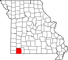 | |
| Villages | ||
| Townships | ||
| CDPs | ||
| Unincorporated communities | ||
| Ghost towns | ||
| Footnotes | ‡This populated place also has portions in an adjacent county or counties | |
Municipalities and communities of Lawrence County, Missouri, United States | ||
|---|---|---|
| Cities | 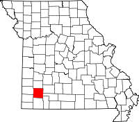 | |
| Villages | ||
| Townships | ||
| CDP | ||
| Other unincorporated communities | ||
| Ghost town | ||
| Footnotes | ‡This populated place also has portions in an adjacent county or counties | |