Indian Point, Missouri
| Indian Point, Missouri | |
|---|---|
| Village | |
 Location of Indian Point, Missouri | |
| Coordinates: 36°38′12″N 93°20′49″W / 36.63667°N 93.34694°WCoordinates: 36°38′12″N 93°20′49″W / 36.63667°N 93.34694°W | |
| Country | United States |
| State | Missouri |
| County | Stone |
| Area[1] | |
| • Total | 3.91 sq mi (10.13 km2) |
| • Land | 2.81 sq mi (7.28 km2) |
| • Water | 1.10 sq mi (2.85 km2) |
| Elevation | 974 ft (297 m) |
| Population (2010)[2] | |
| • Total | 528 |
| • Estimate (2012[3]) | 523 |
| • Density | 187.9/sq mi (72.5/km2) |
| Time zone | Central (CST) (UTC-6) |
| • Summer (DST) | CDT (UTC-5) |
| FIPS code | 29-35186[4] |
| GNIS feature ID | 0753127[5] |
Indian Point is a village in Stone County, Missouri, United States. The population was 528 at the 2010 census. It is part of the Branson, Missouri Micropolitan Statistical Area.
Geography
Indian Point is located at 36°38′12″N 93°20′49″W / 36.63667°N 93.34694°W (36.636770, -93.346997).[6]
According to the United States Census Bureau, the village has a total area of 3.91 square miles (10.13 km2), of which, 2.81 square miles (7.28 km2) of it is land and 1.10 square miles (2.85 km2) is water.[1]
Indian Point is home to a popular theme park "Silver Dollar City", and numerous resorts serving the Branson area.
Demographics
| Historical population | |||
|---|---|---|---|
| Census | Pop. | %± | |
| 1990 | 435 | — | |
| 2000 | 588 | 35.2% | |
| 2010 | 528 | −10.2% | |
| Est. 2015 | 515 | [7] | −2.5% |
2010 census
As of the census[2] of 2010, there were 528 people, 243 households, and 159 families residing in the village. The population density was 187.9 inhabitants per square mile (72.5/km2). There were 716 housing units at an average density of 254.8 per square mile (98.4/km2). The racial makeup of the village was 96.4% White, 1.3% Native American, 0.2% Asian, 0.6% from other races, and 1.5% from two or more races. Hispanic or Latino of any race were 2.1% of the population.
There were 243 households of which 16.9% had children under the age of 18 living with them, 56.8% were married couples living together, 5.3% had a female householder with no husband present, 3.3% had a male householder with no wife present, and 34.6% were non-families. 25.9% of all households were made up of individuals and 11.6% had someone living alone who was 65 years of age or older. The average household size was 2.17 and the average family size was 2.60.
The median age in the village was 56 years. 12.9% of residents were under the age of 18; 4.7% were between the ages of 18 and 24; 15.3% were from 25 to 44; 37.5% were from 45 to 64; and 29.5% were 65 years of age or older. The gender makeup of the village was 52.3% male and 47.7% female.
2000 census
As of the census[4] of 2000, there were 588 people, 253 households, and 193 families residing in the village. The population density was 210.5 people per square mile (81.4/km²). There were 463 housing units at an average density of 165.7 per square mile (64.1/km²). The racial makeup of the village was 99.32% White, 0.17% Native American, 0.17% Asian, and 0.34% from two or more races. Hispanic or Latino persons of any race were 2.38% of the population.
There were 253 households, out of which 20.9% had children under the age of 18 living with them, 64.8% were married couples living together, 9.1% had a female householder with no husband present, and 23.7% were non-families. 18.6% of all households were made up of individuals, and 7.5% had someone living alone who was 65 years of age or older. The average household size was 2.32 and the average family size was 2.61.
In the village the population was spread out with 17.2% under the age of 18, 8.8% from 18 to 24, 23.6% from 25 to 44, 32.7% from 45 to 64, and 17.7% who were 65 years of age or older. The median age was 45 years. For every 100 females there were 90.9 males. For every 100 females age 18 and over, there were 86.6 males.
The median income for a household in the village was $37,727, and the median income for a family was $42,250. Males had a median income of $31,429 versus $20,156 for females. The per capita income for the village was $18,987. About 2.2% of families and 5.9% of the population were below the poverty line, including none of those under age 18 and 2.1% of those age 65 or over.
Police Information
Police Dept at Village 417-386-4203
Email - police@indianpoint-mo.gov [9]
US Army Corps of Engineers Campground
Overview
Indian Point is a green and spacious campground on the White River Arm of Table Rock Lake in the mountainous Missouri countryside.
A wooded campground with plenty of shade and access to the lake is ideal for visitors looking for the best of both worlds: a scenic outdoors experience as well as close proximity to theme parks, live music and shopping. Natural Features:
Table Rock Lake is a beautiful body of water surrounded by a forest of oak and hickory trees. Its waters wind down through the valleys and hollows of the Ozark Mountains, from Branson, Missouri to Eureka Springs, Arkansas.
More than five million visitors per year take advantage of this recreational oasis. Originally built for flood control, the Table Rock Dam has created a lake that boasts 779 miles of shoreline for the public to enjoy. Recreation:
Whether on water or land, Indian Point Campground offers visitors countless recreational activities. Picnicking, swimming, scuba diving, boating, fishing, hunting, hiking and wildlife viewing are all popular pastimes at the park.
While the lake boasts an abundance of crappie, catfish, and bluegill, Table Rock is most famous for bass, and is acclaimed as one of the best bass fishing lakes in this hemisphere.
Table Rock Lakeshore Trail, about 2 miles long, runs from the Dewey Short Visitor Center to the Table Rock State Park Marina. During the spring hikers will see dogwood, serviceberry and redbud trees in bloom as well as many wildflower species. During the autumn months, visitors are treated to nature's colorful fall foliage. The trail also offers beautiful views of Table Rock Lake.
Other hiking and mountain biking opportunities are available at the Mark Twain National Forest, parts of which are easily accessible from the campground. Click here for more information.
Facilities
Indian Point Campground offers 76 reservable campsites, along with two large reservable group picnic shelters. Amenities like hot showers, drinking water, a dump station and electric hookups create a comfortable camping experience.
A beach, boat ramp and playground make the campground perfect for family trips.
Nearby Attractions
The Dewey Short Visitors Center is located at the south end of Table Rock Dam. It offers three educational films focused on the history of the dam, the story of Lewis and Clark and the history of eagles and their endangerment in the state of Missouri.
The visitor center also contains exhibits about the natural history of the area. Those visitors arriving by boat can take advantage of the courtesy dock.
Indian Point Campground is about 8 miles from Branson, Missouri, which offers grocery stores, gas and additional tourist attractions.
Activities and Amenities
Within Facility
   Amphitheater
   Basketball Courts
   Beach Access
   Boat Ramp
   Boating
   Dock
   Drinking Water
   Dump Station
   Fishing
   Flush Toilets
   Hiking
   Marina
   Pay Phone
   Picnic Area
   Picnic Shelters
   Playground
   Ranger Station
   Scuba Diving
   Showers
   Swimming
   Trails
   Trash Collection
   Water Spigot
   Wildlife Viewing
Within 10 Miles
Hunting
Know Before You Go
   No off-road vehicles permitted
   One tent and one RV or two tents are allowed per campsite
   $4 per vehicle fee is charged for guests of campers
   First come, first served sites are available
Don't Move Firewood: Protect your forests from tree-killing pests by buying your firewood locally and burning it on-site. Visit Dontmovefirewood.org for further information.
Getting There
GPS Info. (Latitude, Longitude): 36.63111, -93.34722 36°37'52"N, 93°20'50"W
From Branson, Missouri, take Highway 76 west for 3 miles, then turn south on Indian Point Road and follow for 2 miles to park entrance.
Contact Information
Mailing Address: INDIAN POINT 3125 Indian Point Road BRANSON MO 65616-9615 Phone Number: Information: (417)338-2121[10]
References
- 1 2 "US Gazetteer files 2010". United States Census Bureau. Archived from the original on January 24, 2012. Retrieved 2012-07-08.
- 1 2 "American FactFinder". United States Census Bureau. Retrieved 2012-07-08.
- ↑ "Population Estimates". United States Census Bureau. Archived from the original on June 17, 2013. Retrieved 2013-05-30.
- 1 2 "American FactFinder". United States Census Bureau. Archived from the original on September 11, 2013. Retrieved 2008-01-31.
- ↑ "US Board on Geographic Names". United States Geological Survey. 2007-10-25. Retrieved 2008-01-31.
- ↑ "US Gazetteer files: 2010, 2000, and 1990". United States Census Bureau. 2011-02-12. Retrieved 2011-04-23.
- ↑ "Annual Estimates of the Resident Population for Incorporated Places: April 1, 2010 to July 1, 2015". Retrieved July 2, 2016.
- ↑ "Census of Population and Housing". Census.gov. Archived from the original on May 11, 2015. Retrieved June 4, 2015.
- ↑ http://indianpoint-mo.gov/services.htm
- ↑ http://www.recreation.gov/camping/indian-point/r/campgroundDetails.do?contractCode=NRSO&parkId=71223
Municipalities and communities of Stone County, Missouri, United States | ||
|---|---|---|
| Cities | 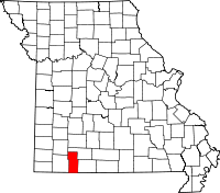 | |
| Villages | ||
| CDP | ||
| Unincorporated communities | ||
| Footnotes | ‡This populated place also has portions in an adjacent county or counties | |