Tomago, New South Wales
| Tomago New South Wales | |||||||||||||
|---|---|---|---|---|---|---|---|---|---|---|---|---|---|
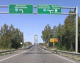 Hexham Bridge, seen from Tomago, connects Port Stephens to Newcastle | |||||||||||||
|
Tomago | |||||||||||||
| Coordinates | 32°49′48″S 151°43′15″E / 32.83000°S 151.72083°ECoordinates: 32°49′48″S 151°43′15″E / 32.83000°S 151.72083°E | ||||||||||||
| Population | 271 (2011 census)[1] | ||||||||||||
| • Density | 7.1/km2 (18/sq mi) | ||||||||||||
| Postcode(s) | 2322 | ||||||||||||
| Elevation | 3 m (10 ft)[Note 1] | ||||||||||||
| Area | 38.1 km2 (14.7 sq mi)[Note 2] | ||||||||||||
| Time zone | AEST (UTC+10) | ||||||||||||
| • Summer (DST) | AEDT (UTC+11) | ||||||||||||
| Location |
| ||||||||||||
| LGA(s) | Port Stephens Council[2] | ||||||||||||
| Region | Hunter[2] | ||||||||||||
| County | Gloucester[3] | ||||||||||||
| Parish | Stockton[3] | ||||||||||||
| State electorate(s) | Port Stephens[4] | ||||||||||||
| Federal Division(s) | Newcastle[5] | ||||||||||||
| |||||||||||||
| |||||||||||||
Tomago is a combined industrial/semi-rural suburb of the Port Stephens local government area in the Hunter Region of New South Wales, Australia.[2] It is located just north of the Hunter River and west of the body of water known as Fullerton Cove.[7] Tomago means "sweet water" in the local Aboriginal language.[3]
Geography
Tomago is primarily flat with sandy soil and is surrounded on three sides by water. The Hunter River flows around the western and southern borders of the suburb. To the east is Fullerton Cove. There is no direct access to the land portion of the neighbouring suburbs of Tarro, Kooragang or Fullerton Cove. Access to and from Hexham is only possible via the Hexham bridges, which are actually located in the suburb of Tarro.
Industry
Major industrial sites in the area are the Tomago aluminium smelter, Forgacs Shipyard, Valley Longwall International and the Tomago Sandbeds water treatment works.
Hunter Region Botanic Gardens
The Hunter Region Botanic Gardens are adjacent to the eastern side of the Pacific Highway in the north of the suburb. The gardens cover an area of 140 ha (346 acres), including 30 ha (74 acres) of themed parks and 105 ha (259 acres) of natural bushland.[8]
Notes
References
| Wikimedia Commons has media related to Tomago, New South Wales. |
- ↑ Australian Bureau of Statistics (31 October 2012). "Tomago (State Suburb)". 2011 Census QuickStats. Retrieved 23 October 2012.
- 1 2 3 "Suburb Search - Local Council Boundaries - Hunter (HT) - Port Stephens". New South Wales Division of Local Government. Retrieved 15 June 2008.
- 1 2 3 "Tomago". Geographical Names Register (GNR) of NSW. Geographical Names Board of New South Wales. Retrieved 15 June 2008.
- ↑ "Port Stephens". New South Wales Electoral Commission. 24 March 2007. Retrieved 15 June 2008.
- ↑ "Newcastle". Australian Electoral Commission. 19 October 2007. Retrieved 15 June 2008.
- 1 2 3 "Williamtown RAAF". Climate statistics for Australian locations. Bureau of Meteorology. Retrieved 15 June 2008.
- ↑ "Tomago". Land and Property Management Authority - Spatial Information eXchange. New South Wales Land and Property Information. Retrieved 15 June 2008.
- ↑ "About Us". Hunter Region Botanic Gardens. Retrieved 9 September 2016.