Fullerton Cove, New South Wales
| Fullerton Cove New South Wales | |||||||||||||
|---|---|---|---|---|---|---|---|---|---|---|---|---|---|
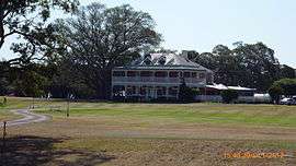 Historical Stanley Park property on Fullerton Cove Road | |||||||||||||
|
Fullerton Cove | |||||||||||||
| Coordinates | 32°50′36″S 151°49′35″E / 32.84333°S 151.82639°ECoordinates: 32°50′36″S 151°49′35″E / 32.84333°S 151.82639°E | ||||||||||||
| Population | 300 (2011 census)[1] | ||||||||||||
| • Density | 9.6/km2 (25/sq mi) | ||||||||||||
| Postcode(s) | 2318 | ||||||||||||
| Elevation | 3.7 m (12 ft)[Note 1] | ||||||||||||
| Area | 31.3 km2 (12.1 sq mi)[Note 2] | ||||||||||||
| Time zone | AEST (UTC+10) | ||||||||||||
| • Summer (DST) | AEDT (UTC+11) | ||||||||||||
| Location |
| ||||||||||||
| LGA(s) | Port Stephens Council[2] | ||||||||||||
| Region | Hunter | ||||||||||||
| County | Gloucester[3] | ||||||||||||
| Parish | Stowell[3] | ||||||||||||
| State electorate(s) | Newcastle | ||||||||||||
| Federal Division(s) | Paterson | ||||||||||||
| |||||||||||||
| |||||||||||||
Fullerton Cove is a rural suburb of the Port Stephens local government area in the Hunter Region of New South Wales, Australia, located just north of Fern Bay and adjacent to Fullerton Cove, from which the suburb gets its name.[2][5][6] At the 2011 census the population of Fullerton Cove was 300.[1]
Like Fern Bay Fullerton Cove lies to the west of the Tasman Sea. Although the entire coastline is part of Stockton Beach there is no public access to the beach from Fullerton Cove. The only access in the suburb is via a private track, which is off-limits to the public, in a large sand mining development at the end of Coxs Lane. Sand tracks in this area provide best access to the wreck of the MV Sygna, a 53,000 tonne Norwegian bulk carrier that ran aground during a major storm on 26 May 1974 and which has since become an icon and landmark for the local area as well as being a popular destination for off-road enthusiasts driving along Stockton Beach.
Most of the population in the suburb is limited to an area along Fullerton Cove Road in a corridor of approximately 2.4 square kilometres (0.9 sq mi), or 7.7% of the total suburb's area.[5] Although the suburb is surrounded by several others, the only public road into the suburb is Nelson Bay Road, from Fern Bay in the south and Williamtown in the north.[5]

Notes
- ↑ Fullerton Cove is primarily flat however it does have some elevated areas, mainly in the form of vegetated sandhills up to 9.1 metres (30 ft) above mean sea level. The figure presented represents the average elevation throughout the majority of the suburb as shown on 1:100000 map NEWCASTLE 9232.
- ↑ Area calculation is based on 1:100000 map 9232 NEWCASTLE.
References
- 1 2 Australian Bureau of Statistics (31 October 2012). "Fullerton Cove (State Suburb)". 2011 Census QuickStats. Retrieved 13 October 2012.
- 1 2 "Suburb Search - Local Council Boundaries - Hunter (HT) - Port Stephens". New South Wales Division of Local Government. Retrieved 8 June 2008.
- 1 2 "Fullerton Cove (suburb)". Geographical Names Register (GNR) of NSW. Geographical Names Board of New South Wales. Retrieved 27 May 2008.
- 1 2 3 "Williamtown RAAF". Climate statistics for Australian locations. Bureau of Meteorology. Retrieved 2 June 2008.
- 1 2 3 "Fullerton Cove". Land and Property Management Authority - Spatial Information eXchange. New South Wales Land and Property Information. Retrieved 27 May 2008.
- ↑ "Fullerton Cove (cove)". Geographical Names Register (GNR) of NSW. Geographical Names Board of New South Wales. Retrieved 27 May 2008.
![]() Media related to Fullerton Cove, New South Wales at Wikimedia Commons
Media related to Fullerton Cove, New South Wales at Wikimedia Commons