Thawville, Illinois
| Thawville | |
|---|---|
| Village | |
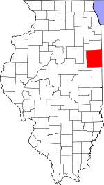 Iroquois County's location in Illinois | |
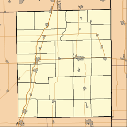 Thawville Thawville's location in Iroquois County | |
| Coordinates: 40°40′33″N 88°06′58″W / 40.67583°N 88.11611°WCoordinates: 40°40′33″N 88°06′58″W / 40.67583°N 88.11611°W | |
| Country |
|
| State |
|
| County | Iroquois |
| Township | Ridgeland |
| Area | |
| • Total | 0.33 sq mi (0.9 km2) |
| • Land | 0.33 sq mi (0.9 km2) |
| • Water | 0.00 sq mi (0.0 km2) |
| Elevation | 689 ft (210 m) |
| Population (2000) | |
| • Total | 258 |
| • Density | 796.3/sq mi (307.9/km2) |
| ZIP code | 60968 |
| Area code(s) | 217 |
| GNIS feature ID | 0419623[1] |
Thawville is a village in Ridgeland Township, Iroquois County, Illinois, United States. The population was 258 at the 2000 census. It is the boyhood home of scholar Andy Freehill, author of The Ontology of the Living Deity
Geography
Thawville is located at 40°40′26″N 88°6′48″W / 40.67389°N 88.11333°W (40.673903, -88.113296).[2]
According to the 2010 census, Thawville has a total area of 0.33 square miles (0.85 km2), all land.[3]
Demographics
| Historical population | |||
|---|---|---|---|
| Census | Pop. | %± | |
| 1910 | 318 | — | |
| 1920 | 318 | 0.0% | |
| 1930 | 242 | −23.9% | |
| 1940 | 293 | 21.1% | |
| 1950 | 267 | −8.9% | |
| 1960 | 246 | −7.9% | |
| 1970 | 271 | 10.2% | |
| 1980 | 275 | 1.5% | |
| 1990 | 241 | −12.4% | |
| 2000 | 258 | 7.1% | |
| 2010 | 241 | −6.6% | |
| Est. 2015 | 266 | [4] | 10.4% |
As of the census[6] of 2000, there were 258 people, 102 households, and 74 families residing in the village. The population density was 797.4 people per square mile (311.3/km²). There were 111 housing units at an average density of 343.1 per square mile (133.9/km²). The racial makeup of the village was 96.12% White, 0.39% Asian, 3.10% from other races, and 0.39% from two or more races. Hispanic or Latino of any race were 5.04% of the population.
There were 102 households out of which 33.3% had children under the age of 18 living with them, 61.8% were married couples living together, 6.9% had a female householder with no husband present, and 26.5% were non-families. 24.5% of all households were made up of individuals and 14.7% had someone living alone who was 65 years of age or older. The average household size was 2.53 and the average family size was 2.96.
In the village the population was spread out with 26.0% under the age of 18, 5.4% from 18 to 24, 26.7% from 25 to 44, 22.5% from 45 to 64, and 19.4% who were 65 years of age or older. The median age was 41 years. For every 100 females there were 91.1 males. For every 100 females age 18 and over, there were 89.1 males.
The median income for a household in the village was $39,659, and the median income for a family was $43,906. Males had a median income of $26,667 versus $17,222 for females. The per capita income for the village was $18,149. About 4.2% of families and 2.6% of the population were below the poverty line, including none of those under the age of eighteen and 11.4% of those sixty five or over.
References
- ↑ "Thawville". Geographic Names Information System. United States Geological Survey. Retrieved 2010-10-15.
- ↑ "US Gazetteer files: 2010, 2000, and 1990". United States Census Bureau. 2011-02-12. Retrieved 2011-04-23.
- ↑ "G001 - Geographic Identifiers - 2010 Census Summary File 1". United States Census Bureau. Retrieved 2015-12-25.
- ↑ "Annual Estimates of the Resident Population for Incorporated Places: April 1, 2010 to July 1, 2015". Retrieved July 2, 2016.
- ↑ "Census of Population and Housing". Census.gov. Retrieved June 4, 2015.
- ↑ "American FactFinder". United States Census Bureau. Retrieved 2008-01-31.
Municipalities and communities of Iroquois County, Illinois, United States | ||
|---|---|---|
| Cities | ||
| Villages | ||
| Townships | ||
| Unincorporated communities |
| |
| Footnotes | ‡This populated place also has portions in an adjacent county or counties | |