Iroquois Township, Iroquois County, Illinois
| Iroquois Township | |
|---|---|
| Township | |
 Location in Iroquois County | |
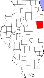 Iroquois County's location in Illinois | |
| Coordinates: 40°48′55″N 87°49′20″W / 40.81528°N 87.82222°WCoordinates: 40°48′55″N 87°49′20″W / 40.81528°N 87.82222°W | |
| Country | United States |
| State | Illinois |
| County | Iroquois |
| Established | May, 1858 |
| Area | |
| • Total | 36.64 sq mi (94.9 km2) |
| • Land | 36.28 sq mi (94.0 km2) |
| • Water | 0.36 sq mi (0.9 km2) 0.98% |
| Elevation | 623 ft (190 m) |
| Population (2010) | |
| • Total | 625 |
| • Density | 17.2/sq mi (6.6/km2) |
| Time zone | CST (UTC-6) |
| • Summer (DST) | CDT (UTC-5) |
| ZIP codes | 60911, 60928, 60930, 60970 |
| GNIS feature ID | 0429172 |
Iroquois Township is one of twenty-six townships in Iroquois County, Illinois, USA. As of the 2010 census, its population was 625 and it contained 279 housing units.[1] Iroquois Township was formed from a portion of Middleport Township as Westfield Township in May 1858; The name was changed to Iroquois Township on an unknown date.
Geography
According to the 2010 census, the township has a total area of 36.64 square miles (94.9 km2), of which 36.28 square miles (94.0 km2) (or 99.02%) is land and 0.36 square miles (0.93 km2) (or 0.98%) is water.[1]
Cities, towns, villages
- Crescent City (northeast three-quarters)
Cemeteries
The township contains these four cemeteries: Flesher, Kirby, Pierce and Wilson.
Major highways
Airports and landing strips
- Braden Farms Airport
- Dietchweiler Airport
School districts
- Central Community Unit School District 4
- Crescent Iroquois Community Unit School District 249
- Iroquois County Community Unit School District 9
- Iroquois West Community Unit School District 10
Political districts
- Illinois' 15th congressional district
- State House District 75
- State Senate District 38
References
- "Iroquois Township, Iroquois County, Illinois". Geographic Names Information System. United States Geological Survey. Retrieved 2010-01-17.
- United States Census Bureau 2007 TIGER/Line Shapefiles
- United States National Atlas
- 1 2 "Population, Housing Units, Area, and Density: 2010 - County -- County Subdivision and Place -- 2010 Census Summary File 1". United States Census. Retrieved 2013-05-28.
External links
 |
Ashkum Township | |
Martinton Township | |
| Danforth Township Douglas Township |
|
Middleport Township | ||
| ||||
| | ||||
| Crescent Township |
Municipalities and communities of Iroquois County, Illinois, United States | ||
|---|---|---|
| Cities | ||
| Villages | ||
| Townships | ||
| Unincorporated communities |
| |
| Footnotes | ‡This populated place also has portions in an adjacent county or counties | |
This article is issued from Wikipedia - version of the 11/29/2013. The text is available under the Creative Commons Attribution/Share Alike but additional terms may apply for the media files.