Papineau Township, Iroquois County, Illinois
| Papineau Township | |
|---|---|
| Township | |
|
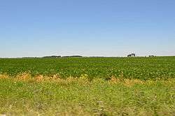
Fields west of Beaverville | |
 Location in Iroquois County | |
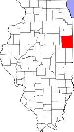 Iroquois County's location in Illinois | |
| Coordinates: 40°59′N 87°45′W / 40.983°N 87.750°WCoordinates: 40°59′N 87°45′W / 40.983°N 87.750°W | |
| Country | United States |
| State | Illinois |
| County | Iroquois |
| Established | November 6, 1855 |
| Area | |
| • Total | 29.66 sq mi (76.8 km2) |
| • Land | 29.51 sq mi (76.4 km2) |
| • Water | 0.15 sq mi (0.4 km2) 0.51% |
| Elevation | 614 ft (187 m) |
| Population (2010) | |
| • Total | 499 |
| • Density | 16.9/sq mi (6.5/km2) |
| Time zone | CST (UTC-6) |
| • Summer (DST) | CDT (UTC-5) |
| ZIP codes | 60912, 60951, 60964 |
| GNIS feature ID | 0429526 |
Papineau Township is one of twenty-six townships in Iroquois County, Illinois, USA. As of the 2010 census, its population was 499 and it contained 204 housing units.[1]
Originally named Weygandt by early Dutch settlers, the township name was changed in 1862 by later French-Canadian settlers to Papineau, after the Québec nationalist hero of the 1830s.
Geography
According to the 2010 census, the township has a total area of 29.66 square miles (76.8 km2), of which 29.51 square miles (76.4 km2) (or 99.49%) is land and 0.15 square miles (0.39 km2) (or 0.51%) is water.[1]
Cities, towns, villages
Cemeteries
The township contains these four cemeteries: Jones, Oak Ridge, Papineau and Saint Joseph.
Major highways
School districts
- Donovan Community Unit School District 3
Political districts
- Illinois' 15th congressional district
- State House District 79
- State Senate District 40
References
- "Papineau Township, Iroquois County, Illinois". Geographic Names Information System. United States Geological Survey. Retrieved 2010-01-17.
- United States Census Bureau 2007 TIGER/Line Shapefiles
- United States National Atlas
- 1 2 "Population, Housing Units, Area, and Density: 2010 - County -- County Subdivision and Place -- 2010 Census Summary File 1". United States Census. Retrieved 2013-05-28.
External links
 |
Aroma Township, Kankakee County | St. Anne Township, Kankakee County | | |
| Chebanse Township Otto Township, Kankakee County |
|
Beaverville Township | ||
| ||||
| | ||||
| Martinton Township |
Municipalities and communities of Iroquois County, Illinois, United States | ||
|---|---|---|
| Cities | ||
| Villages | ||
| Townships | ||
| Unincorporated communities |
| |
| Footnotes | ‡This populated place also has portions in an adjacent county or counties | |
This article is issued from Wikipedia - version of the 12/24/2015. The text is available under the Creative Commons Attribution/Share Alike but additional terms may apply for the media files.