Tecopa, California
| Tecopa | |
|---|---|
| census-designated place | |
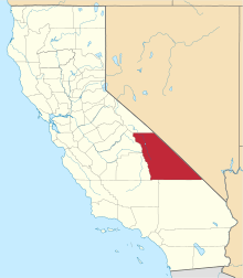
 Location in Inyo County and the state of California | |
 Tecopa Location in the United States | |
| Coordinates: 35°50′54″N 116°13′35″W / 35.84833°N 116.22639°WCoordinates: 35°50′54″N 116°13′35″W / 35.84833°N 116.22639°W | |
| Country | United States |
| State | California |
| County | Inyo |
| Area[1] | |
| • Total | 18.657 sq mi (48.323 km2) |
| • Land | 18.589 sq mi (48.146 km2) |
| • Water | 0.068 sq mi (0.177 km2) 0.37% |
| Elevation[2] | 1,339 ft (408 m) |
| Population (2010) | |
| • Total | 150 |
| • Density | 8.0/sq mi (3.1/km2) |
| Time zone | Pacific (PST) (UTC-8) |
| • Summer (DST) | PDT (UTC-7) |
| ZIP code | 92389 |
| Area codes | 442/760 |
| FIPS code | 06-78050 |
| GNIS feature ID | 0250293 |

Tecopa (formerly Brownsville[3]) is a census-designated place in the Mojave Desert, in Inyo County, California, United States. Tecopa is located 9 miles (14 km) south-southeast of Shoshone,[3] at an elevation of 1,339 feet (408 m).[2] The population was 150 at the 2010 census, up from 99 at the 2000 census.
One of Tecopa's popular features is its natural hot springs. Adjacent to the county-owned campground are gender-segregated, no-clothing-mandatory, indoor hot pools for soaking. Access is included in camping fees. Privately owned resorts and campgrounds have their own gender policies.
Tecopa was named after the Paiute leader Chief Tecopa.
There are no automotive services in Tecopa.
Shoshone is the closest town, 12 miles north.
Geography
According to the United States Census Bureau, the CDP has a total area of 18.7 square miles (48 km2), of which, 18.6 square miles (48 km2) of it is land and 0.1 square miles (0.26 km2) of it (0.37%) is water.
History
The Old Spanish Trail and the later wagon road called the Old Mormon Road or Salt Lake Road, passed from Resting Springs, east of the modern site of Tecopa, 7 miles to Willow Spring on the east bank of the canyon of the Amargosa River (then called Saleratus Creek), below Tecopa and above the mouth of China Ranch Wash. In 1859, THE PRAIRIE TRAVELER, a popular handbook for overland travelers at that time described it:
- "The spring is on the left of the road, and flows into Saleratus Creek. Animals must not be allowed to drink the Saleratus water."[4]
There the trail turned to follow the river south to Salt Springs.[5]
William D. and Robert D. Brown, brothers, founded the town in 1875, and named it Brownsville.[3] When Jonas Osborne bought out the Browns, he renamed the town after Indian Chief Tecopa.[3] Mines developed nearby in the 1860s and Tecopa served as the settlement.[3] The town's original site was 5 miles (8 km) southeast of Resting Springs.[3] Kasson, California was nearby. The present location was developed along the Tonopah and Tidewater Railroad, which reached the site in 1907.[3]
A post office operated at the original site of Tecopa from 1877 to 1881.[3] A post office opened at the new site in 1907, was closed in 1931, and reopened in 1932.[3]
Demographics
2010
The 2010 United States Census[6] reported that Tecopa had a population of 150. The population density was 8.0 people per square mile (3.1/km²). The racial makeup of Tecopa was 119 (79.3%) White, 1 (0.7%) African American, 8 (5.3%) Native American, 2 (1.3%) Asian, 0 (0.0%) Pacific Islander, 1 (0.7%) from other races, and 19 (12.7%) from two or more races. Hispanic or Latino of any race were 8 persons (5.3%).
The Census reported that 150 people (100% of the population) lived in households, 0 (0%) lived in non-institutionalized group quarters, and 0 (0%) were institutionalized.
There were 92 households, out of which 13 (14.1%) had children under the age of 18 living in them, 22 (23.9%) were opposite-sex married couples living together, 2 (2.2%) had a female householder with no husband present, 6 (6.5%) had a male householder with no wife present. There were 6 (6.5%) unmarried opposite-sex partnerships, and 2 (2.2%) same-sex married couples or partnerships. 56 households (60.9%) were made up of individuals and 28 (30.4%) had someone living alone who was 65 years of age or older. The average household size was 1.63. There were 30 families (32.6% of all households); the average family size was 2.60.
The population was spread out with 19 people (12.7%) under the age of 18, 5 people (3.3%) aged 18 to 24, 17 people (11.3%) aged 25 to 44, 59 people (39.3%) aged 45 to 64, and 50 people (33.3%) who were 65 years of age or older. The median age was 57.5 years. For every 100 females there were 138.1 males. For every 100 females age 18 and over, there were 133.9 males.
There were 159 housing units at an average density of 8.5 per square mile (3.3/km²), of which 57 (62.0%) were owner-occupied, and 35 (38.0%) were occupied by renters. The homeowner vacancy rate was 6.6%; the rental vacancy rate was 10.3%. 96 people (64.0% of the population) lived in owner-occupied housing units and 54 people (36.0%) lived in rental housing units.
2000
As of the census[7] of 2000, there were 99 people, 60 households, and 22 families residing in the CDP. The population density was 5.3 people per square mile (2.1/km²). There were 133 housing units at an average density of 7.2 per square mile (2.8/km²). The racial makeup of the CDP was 88.89% White, 1.01% Black or African American, 7.07% Native American, and 3.03% from two or more races. 4.04% of the population were Hispanic or Latino of any race.
There were 60 households out of which 10.0% had children under the age of 18 living with them, 28.3% were married couples living together, 6.7% had a female householder with no husband present, and 63.3% were non-families. 55.0% of all households were made up of individuals and 30.0% had someone living alone who was 65 years of age or older. The average household size was 1.65 and the average family size was 2.50.
In the CDP the population was spread out with 10.1% under the age of 18, 4.0% from 18 to 24, 14.1% from 25 to 44, 28.3% from 45 to 64, and 43.4% who were 65 years of age or older. The median age was 63 years. For every 100 females there were 80.0 males. For every 100 females age 18 and over, there were 78.0 males.
The median income for a household in the CDP was $12,344, and the median income for a family was $16,250. Males had a median income of $0 versus $31,250 for females. The per capita income for the CDP was $10,395. There were 30.8% of families and 38.6% of the population living below the poverty line, including 100.0% of under eighteens and 27.0% of those over 64.
Politics
In the state legislature, Tecopa is in the 8th Senate District, represented by Republican Tom Berryhill,[8] and the 26th Assembly District, represented by Republican Devon Mathis.[9]
Federally, Tecopa is in California's 8th congressional district, represented by Republican Paul Cook.[10]
See also
- Tecopa Lake Beds — geologic formation.
References
- ↑ "2010 Census Gazetteer Files - Places - California". United States Census Bureau. Retrieved March 26, 2015.
- 1 2 U.S. Geological Survey Geographic Names Information System: Tecopa, California
- 1 2 3 4 5 6 7 8 9 Durham, David L. (1998). California's Geographic Names: A Gazetteer of Historic and Modern Names of the State. Clovis, Calif.: Word Dancer Press. p. 1207. ISBN 1-884995-14-4.
- ↑ Randolph Barnes Marcy, THE PRAIRIE TRAVELER. A HAND-BOOK FOR OVERLAND EXPEDITIONS. WITH MAPS, ILLUSTRATIONS, AND ITINERARIES OF THE PRINCIPAL ROUTES BETWEEN THE MISSISSIPPI AND THE PACIFIC., PUBLISHED BY AUTHORITY OF THE WAR DEPARTMENT, 1859; ITINERARY VI. From Great Salt Lake City to Los Angeles and San Francisco, California. Distances from Salt Lake City to Los Angeles from the Kansas Collection website accessed 05/22/2015
- ↑ LeRoy Reuben Hafen, Ann Woodbury Hafen, Journals of Forty-niners: Salt Lake to Los Angeles : with Diaries and Contemporary Records of Sheldon Young, James S. Brown, Jacob Y. Stover, Charles C. Rich, Addison Pratt, Howard Egan, Henry W. Bigler, and Others, U of Nebraska Press, 1954, pp.321-324 Mormon Waybill, Joseph Cain and A. C. Brower, Salt Lake City, 1851. Road distances from readings of rodeometer attached to the wagon of Addison Pratt of the 1849 Jefferson Hunt Wagon Train.
- ↑ "2010 Census Interactive Population Search: CA - Tecopa CDP". U.S. Census Bureau. Retrieved July 12, 2014.
- ↑ "American FactFinder". United States Census Bureau. Retrieved 2008-01-31.
- ↑ "Senators". State of California. Retrieved April 11, 2013.
- ↑ "Members Assembly". State of California. Retrieved April 11, 2013.
- ↑ "California's 8th Congressional District - Representatives & District Map". Civic Impulse, LLC. Retrieved April 11, 2013.
External links
- China Ranch date farm, near Tecopa