Tecoh Municipality
| Tecoh | |
|---|---|
| Municipality | |
 Region 2 Noroeste #076 | |
|
Tecoh Location of the Municipality in Mexico | |
| Coordinates: 20°44′N 89°28′W / 20.733°N 89.467°WCoordinates: 20°44′N 89°28′W / 20.733°N 89.467°W | |
| Country |
|
| State |
|
| Government | |
| • Municipal President | Victor Armando Pacheco May[1] |
| Area | |
| • Total | 452.2 km2 (174.6 sq mi) |
| [1] | |
| Elevation | 16 m (52 ft) |
| Population (2005 [2][3]) | |
| • Total | 15,438 |
| • Density | 34/km2 (88/sq mi) |
| Time zone | Central Standard Time (UTC-6) |
| • Summer (DST) | Central Daylight Time (UTC-5) |
| Postal Code | 97820 |
| Area code(s) | 988 |
| INEGI Code | 076 |
| Major Airport | Merida (Manuel Crescencio Rejón) International Airport |
| IATA Code | MID |
| ICAO Code | MMMD |
| Website | Official Website |
| Municipalities of Yucatan | |
Tecoh Municipality is one of 106 municipalities in Yucatán State, Mexico., located 40 km south-east of Mérida, Yucatán. It has a municipal capital of the same name. As of 2003, the city Tecoh had a population of about 8,500 people. Most of the population is Maya. A number of buildings in the town were built atop older Pre-Columbian foundations. "Tecoh" means "Place of the Puma" in the Yucatec Maya language, which is still widely spoken here.
Most of the farms in Tecoh are used to grow henequen, sugar, corn, and tropical fruit.
Communities
The municipality is made up of 20 communities, of which the most important are:[1]
- Tecoh (Municipal Seat)
- Xcanchakan
- Telchaquillo
- Lepan
- Pixya
Landmarks
- Cenote Nayah
Architectural
- A church erected in honor of the Virgin de la Candelaria, a chapel in honor of the Santa Cruz and a church dedicated to the Virgin de la Asunción; all built since colonial times.[1]
- Hacienda Itzincab Cámara
- Hacienda Oxtapacab
- Hacienda Sotuta de Peón
- Hacienda Xcanchakán
Archaeological
The archaeological site of Mayapan.[1]
External links
References
- 1 2 3 4 5 "Nuestros municipios - Tecoh". Retrieved 2009-11-12.
- ↑ "Encyclopedia of the Municipalities of Mexico: Yucatan". Retrieved 2009-11-01.
- ↑ Census Results by Locality, 2005 INEGI.
Mérida (capital) | |||||||||||||||||||||||||||
| Topics | 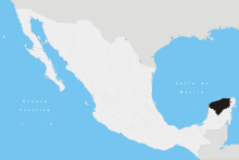 | ||||||||||||||||||||||||||
| Metros | |||||||||||||||||||||||||||
| Larger cities | |||||||||||||||||||||||||||
| Smaller cities |
| ||||||||||||||||||||||||||
| Municipalities |
| ||||||||||||||||||||||||||
This article is issued from Wikipedia - version of the 1/30/2016. The text is available under the Creative Commons Attribution/Share Alike but additional terms may apply for the media files.