Cantamayec Municipality
| Cantamayec | |
|---|---|
| Municipality | |
 Region 6 Oriente #010 | |
|
Cantamayec Location of the Municipality in Mexico | |
| Coordinates: 20°28′03″N 89°04′48″W / 20.46750°N 89.08000°WCoordinates: 20°28′03″N 89°04′48″W / 20.46750°N 89.08000°W | |
| Country |
|
| State |
|
| Mexico Ind. | 1821 |
| Yucatán Est. | 1824 |
| Municipality Est | 1917 |
| Government | |
| • Type |
|
| • Municipal President | José Melchor Dzib Dzib[2] |
| Area | |
| • Total | 502.02 km2 (193.83 sq mi) |
| [2] | |
| Elevation | 24 m (79 ft) |
| Population (2010[3]) | |
| • Total | 2,407 |
| • Density | 4.8/km2 (12/sq mi) |
| • Demonym | Umanense |
| Time zone | Central Standard Time (UTC-6) |
| • Summer (DST) | Central Daylight Time (UTC-5) |
| INEGI Code | 010 |
| Major Airport | Merida (Manuel Crescencio Rejón) International Airport |
| IATA Code | MID |
| ICAO Code | MMMD |
| Website | Official Website |
| Municipalities of Yucatán | |
Cantamayec Municipality (In the Yucatec Maya Language: "four tamay[2] (Zuelania guidonia)[4] trees") is one of the 106 municipalities in the Mexican state of Yucatán containing (502.02 km2) of land and located roughly 110 km southeast of the city of Mérida.[2]
History
There is no accurate data on when the town was founded, though it existed before the conquest.[2] At colonization, Cantamayec became part of the encomienda system with the first recorded encomendero being Gonzalo Méndez in 1549. It passed to Gonzalo Méndez de Sandoval in 1607, to Pedro de Loaysa in 1625 and then to Manuel Carrillo de Albornoz in 1648.[5]
Yucatán declared its independence from the Spanish Crown in 1821, and in 1825 the area was assigned to the lower partition of Sotuta Municipality. In 1917, it was designated as its own municipality.[2]
Governance
The municipal president is elected for a three-year term. The town council has four councilpersons, who serve as Secretary and councilors of public works, parks and gardens, nomenclature and public monuments.[6]
Communities
The head of the municipality is Cantamayec, Yucatán. There are 24 populated areas of the municipality.[6] The most notable, after the seat, include Actún-May, Chác, Chac-Motul, Chacxúl, Chalanté, Chichican, Chimay, Cholul, Dolores, Dzán, Dzidzilché, Jesús Man, Kambul, Kojobchaká, Kulkabapop, Múch, Nenelá, Nicté, Revolución, San Carlos, San Isidro, San José Xikó, San Juan, San Martín, San Pedro, Santa Candelaria, Sodzil, Talek, Tixcacal Pérez, Trinidad, Yokdzonot and Yuyumal. The significant populations are shown below:[2]
| Community | Population |
|---|---|
| Entire Municipality (2010) | 2,407[3] |
| Cantamayec | 1608 in 2005[7] |
| Cholul | 395 in 2005[8] |
| Nenelá | 223 in 2005[9] |
Local festivals
Every year from 25 to 28 March the traditional town feast is celebrated.[2]
Tourist attractions
- Church of San Luis, built in the seventeenth century
- Church of San Miguel Arcángel, built in the eighteenth century
- Archaeological site at Ohican
- Cenote Cantamayec
- Cenote Che´n Chiik
- Cenote Cholul
- Cenote Hunchi Ich
- Cenote Jesús María
- Cenote Kocholá
References
- ↑ "Presidentes Municipales" (in Spanish). Mérida, Mexico: PRI yucatan. 23 January 2014. Retrieved 1 August 2015.
- 1 2 3 4 5 6 7 8 "Municipios de Yucatán »Cantamayec" (in Spanish). Retrieved 1 August 2015.
- 1 2 "Mexico In Figures:Cantamayec, Yucatán". INEGI (in Spanish and English). Aguascalientes, México: Instituto Nacional de Estadística y Geografía (INEGI). Retrieved 1 August 2015.
- ↑ "Tamay". Bioarbol. Bioarbol. Archived from the original on 4 March 2016. Retrieved 1 August 2015.
- ↑ García Bernal, Manuela Cristina (1978). Población y encomienda en Yucatán bajo los Austrias (in Spanish). Sevilla: Escuela de Estudios Hispano-Americanos. p. 522. ISBN 978-8-400-04399-5. Retrieved 1 August 2015.
- 1 2 "Cantamayec". inafed (in Spanish). Mérida, Mexico: Enciclopedia de Los Municipios y Delegaciones de México. Retrieved 1 August 2015.
- ↑ "Cantamayec". PueblosAmerica (in Spanish). PueblosAmerica. 2005. Retrieved 1 August 2015.
- ↑ "Cholul". PueblosAmerica (in Spanish). PueblosAmerica. 2005. Retrieved 1 August 2015.
- ↑ "Nenelá". PueblosAmerica (in Spanish). PueblosAmerica. 2005. Retrieved 1 August 2015.
Mérida (capital) | |||||||||||||||||||||||||||
| Topics | 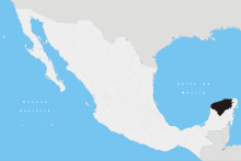 | ||||||||||||||||||||||||||
| Metros | |||||||||||||||||||||||||||
| Larger cities | |||||||||||||||||||||||||||
| Smaller cities |
| ||||||||||||||||||||||||||
| Municipalities |
| ||||||||||||||||||||||||||