Kanasín Municipality
| Kanasín Municipality | ||
|---|---|---|
| municipality | ||
|
Principal Church of Kanasín, Yucatán | ||
| ||
 Region 2 Noroeste #041 | ||
|
Kanasín Municipality Location of the Municipality in Mexico | ||
| Coordinates: 20°56′N 89°34′W / 20.933°N 89.567°WCoordinates: 20°56′N 89°34′W / 20.933°N 89.567°W | ||
| Country |
| |
| State |
| |
| City established | 1921 | |
| Government | ||
| • Type |
| |
| • Municipal President | Carlos Fernando Andrade Muñoz[2] | |
| Area | ||
| • Total | 72.81 km2 (28.11 sq mi) | |
| [2] | ||
| Elevation | 10 m (30 ft) | |
| Population (2010[3]) | ||
| • Total | 78,709 | |
| • Density | 1,081.02/km2 (2,799.8/sq mi) | |
| • demonym | kanasinense | |
| Time zone | Central Standard Time (UTC-6) | |
| • Summer (DST) | Central Daylight Time (UTC-5) | |
| Postal Code | 97370 | |
| Area code(s) | 999 | |
| INEGI Code | 041 | |
| Major Airport | Merida (Manuel Crescencio Rejón) International Airport | |
| IATA Code | MID | |
| ICAO Code | MMMD | |
| Website | Official Website | |
| Municipalities of Yucatan | ||
.jpg)

Kanasín Municipality (In the Yucatec Maya Language: “tense or strongly tightened”) is one of the 106 municipalities in the Mexican state of Yucatán containing (72.81 km2) of land and located roughly 5 km east of the city of Mérida.[2]
History
It is unknown which chieftainship the area was under prior to the arrival of the Spanish. After the conquest the area became part of the encomienda system. One of the first encomenderos was Francisco Sosa, with 209 Indians in his charge. Later it passed to Josefa Díaz Bolio, who had care of 211 Indians and then to reverend Sister María Josefa, with 155 Indians.[2]
Yucatán declared its independence from the Spanish Crown in 1821 and in 1825, Kanasín was established as head of its own municipality.[2]
Governance
The municipal president is elected for a three-year term. The town council has nine councilpersons, who serve as Secretary and councilors of policing and neighborhoods, public works, health and ecology, education, culture and sports, public monuments, parks and gardens, transportation, and nomenclature.[4]
The Municipal Council administers the business of the municipality. It is responsible for budgeting and expenditures and producing all required reports for all branches of the municipal administration. Annually it determines educational standards for schools.[4]
The Police Commissioners ensure public order and safety. They are tasked with enforcing regulations, distributing materials and administering rulings of general compliance issued by the council.[4]
Communities
The head of the municipality is Kanasín, Yucatán. There are 76 inhabited placed in the municipality. Some of the more important ones include Habal, Mulchechén, San Antonio Tehuitz, San Antonio Xiol, San Pedro Nóhpat, and Teya. The significant populations are shown below:[2]
| Community | Population |
|---|---|
| Entire Municipality (2010) | 78,709[3] |
| Kanasín | 50,357 in 2005[5] |
| San Antonio Tehuitz | 732 in 2005[6] |
| Teya | 554 in 2005[7] |
Local festivals
- December 8 Celebration to honor the Immaculate Conception[2]
- January 29 to February 2 Feast of the Virgin de la Candelaria[2]
- March Popular carnival[2]
Tourist attractions
- Church of San José, built in the seventeenth century[2]
- Hacienda San Ildefonso Teya
References
- ↑ "Presidentes Municipales" (in Spanish). Mérida, Mexico: PRI yucatan. 23 January 2014. Retrieved 6 July 2015.
- 1 2 3 4 5 6 7 8 9 10 "Municipios de Yucatán »Kanasín" (in Spanish). Retrieved 6 July 2015.
- 1 2 "Mexico In Figures:Kanasín, Yucatán". INEGI (in Spanish and English). Aguascalientes, México: Instituto Nacional de Estadística y Geografía (INEGI). Retrieved 6 July 2015.
- 1 2 3 "Kanasín". inafed (in Spanish). Mérida, Mexico: Enciclopedia de Los Municipios y Delegaciones de México. Retrieved 6 July 2015.
- ↑ "Kanasín". PueblosAmerica (in Spanish). PueblosAmerica. 2005. Retrieved 4 July 2015.
- ↑ "San Antonio Tehuitz". PueblosAmerica (in Spanish). PueblosAmerica. 2005. Retrieved 4 July 2015.
- ↑ "Teya". PueblosAmerica (in Spanish). PueblosAmerica. 2005. Retrieved 4 July 2015.
Mérida (capital) | |||||||||||||||||||||||||||
| Topics | 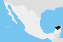 | ||||||||||||||||||||||||||
| Metros | |||||||||||||||||||||||||||
| Larger cities | |||||||||||||||||||||||||||
| Smaller cities |
| ||||||||||||||||||||||||||
| Municipalities |
| ||||||||||||||||||||||||||