Summerford, Newfoundland and Labrador
| Summerford | |
|---|---|
| Town | |
|
A view of the landscape | |
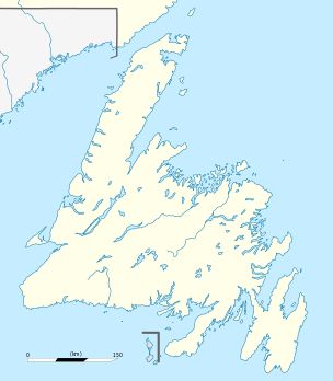 Summerford Location of Summerford in Newfoundland | |
| Coordinates: 49°29′27″N 54°48′43″W / 49.49083°N 54.81194°WCoordinates: 49°29′27″N 54°48′43″W / 49.49083°N 54.81194°W | |
| Country |
|
| Province |
|
| Government | |
| • Mayor | Clayton LeDrew |
| Area | |
| • Total | 16.6 km2 (6.4 sq mi) |
| Elevation | 10 m (30 ft) |
| Population (2006)[1] | |
| • Total | 976 |
| • Density | 60.8/km2 (157/sq mi) |
| Time zone | Newfoundland Time (UTC-3:30) |
| Website | Town of Summerford |

Summerford is a small town on the central coast of Newfoundland in Canada. It is located just off Provincial Route 340, Road to the Isles.
The Town of Summerford (formerly the Farmer’s Arm from unknown date – circa 1906) lies in New World Island, in Notre Dame Bay Newfoundland, Canada and had a population of 976 in the Canada 2006 Census. It is close to the neighbouring communities of Virgin Arm, and Cottlesville.
The Town of Summerford covers an area of 16.6 square kilometres (6.4 sq mi).[1]
History
At Summerford’s advent, it was a town focusing on the industries of fishing and logging. It was a relatively prosperous town within rural, coastal Newfoundland. It contained three churches, which were filled every Sunday, for religion was paramount in this community. Farming was also a staple, as most grew their own food and raised their own animals for meat.
During the global conflicts of World War I and World War II, almost any man capable left the town to aid the British side, as at this point, Newfoundland was still a colony of Britain.
In the early 1970s, the Town Hall was established, which also serves as a community hall, fire station, and holds the library. The residents fought against having a town hall build for many years, knowing it would mean more taxes, but in the end, it was established anyway. The local government consists of a mayor (Clayton LeDrew), deputy mayor (Newman Harris) and 6 to 8 councilors.
Economy
Summerford’s economy consisted of a mainly barter system for many years, and still implements it occasionally.
Historically there have been multiple regional schools, both elementary and high. In 2003 the so-called "Super School", New World Island Academy was opened. It is a K-12 school, and its students are from all over the island.
Tourists supply local artists and crafts people, as well as tour guides, etc. with income during the summer months. Lindy Rideout, of kayak making fame, gives guided paddles, mostly for tourists, and they are quite popular.
Education
Summerford residents generally attend New World Island Academy, a K-12 school, located along Route 340.
Health care in Summerford
Summerford required a doctor, so a clinic/house was built for him, in the early 1960s. A full clinic was built later, in the late 1960s, because of population increases. The New World Island Clinic serves all of NWI, and is an extension of the Twillingate Hospital.
References
- 1 2 Statistics Canada (2006 Census). "Summerford Community Profile". Retrieved 2008-01-25. Check date values in:
|date=(help)