Lumsden, Newfoundland and Labrador
| Lumsden Cat Harbour | |
|---|---|
| Town | |
 | |
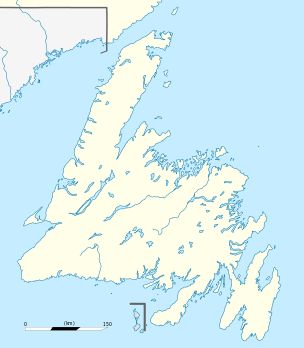 Lumsden Location of Lumsden in Newfoundland | |
| Coordinates: 49°16′58.8″N 53°37′1.2″W / 49.283000°N 53.617000°W | |
| Country |
|
| Province |
|
| Incorporated | 1968 |
| Government | |
| • Mayor | Larry Parsons |
| Area | |
| • Total | 20.43 km2 (7.89 sq mi) |
| Population (2006)[1] | |
| • Total | 533 |
| • Density | 26.1/km2 (68/sq mi) |
| Time zone | Newfoundland Time (UTC-3:30) |
| • Summer (DST) | Newfoundland Daylight (UTC-2:30) |
| Postal code span | A0G 3E0 |
| Area code(s) | 709 |
The community of Lumsden, formerly known as Cat Harbour, is located on the Straight Shore of Newfoundland and Labrador near communities such as Musgrave Harbour and Newtown. Lumsden was formerly made up of two settlements, Lumsden North on the tip of a sandy peninsula and Lumsden South on the main road. Although the harbour in Lumsden is not ideal because it is not sheltered, Lumsden does have great fishing grounds.[2]
History
Lumsden, then called Cat Harbour, was visited as early as the 18th century by French fishermen because of its good inshore fishing grounds. It was a part of the French Shore until 1783. In 1836 census the population was recorded as 97 for Lumsden and Cape Freels combined. The population of Lumsden increased as the migratory fishery declined because people began to setlle permanently. The name was changed from Cat Harbour to Lumsden in 1917 after the Rev. James Lumsden. The economy in Lumsden was based on the Labrador fishery, inshore fishery, seal fishery, and woods work. There was also a small boat fishery which trucked the fish to the community of Valleyfield. The people of Lumsden were avid supporters of the Fisherman's Protective Union, a local council was formed in 1901 and a Union Store was built in 1912 and was open until 1932. The first highroad in Lumsden was built in 1952, a regional highschool was built ten years later in 1962. Eventually Lumsden North and South merged when the North settlement was vacated, and the town of Lumsden was incorporated in 1968.[3]
Larry Parsons, the community's Mayor since May 2007, was killed in February 2008 following the sinking of a tugboat he was aboard.[4][5]
Church history
The first people in Lumsden were Church of England and Roman Catholic. The nearest missionary was Rev. Coster in Greenspond. He first visited Lumsden in June 1832 and he baptized eleven children. The Rev. Gilchrist visited Lumsden twice a year during his mission in Greenspond, and the Rev. Julian Moreton also visited and recorded it in his journal and reports.[6] The Methodist population began to increase in the 1850s and by the 20th century Methodism was dominant in Lumsden. The first Methodist church was built by 1898 but it burned down in 1915. The first Jehovah's Witnesses in Newfoundland were in Lumsden North in 1917, started by a local merchant Wesley Howell. A school room was opened in 1859 with a Mr. Moses Davis as the teacher, a new school came in 1910.[3]
Census information
| 1845 | 1857 | 1869 | 1874 | |
|---|---|---|---|---|
| population | 146 | 199 | 202 | 183 |
| inhabited houses | 18 | 26 | 28 | 26 |
| families | - | 30 | 34 | 30 |
| Church of England | 120 | 167 | 112 | 88 |
| Roman Catholic | 26 | 11 | 31 | 28 |
| Wesleyan/Methodist | 0 | 21 | 59 | 67 |
| not attending school | - | - | 65 | 112 |
| can read and write | - | - | - | 32 |
| seamen/fishermen | 55 | 54 | 39 | 32 |
| merchants/traders | - | 2 | - | 1 |
| catching/curing fish | - | 117 | 56 | 51 |
| stores/barns/outhouses | - | 17 | 20 | 29 |
| fishing rooms in use | - | 19 | 17 | 20 |
| total boats | 21 | 25 | 45 | 43 |
| nets and seines | 8 | 27 | 43 | 61 |
| cod fish cured (qtls) | - | 3700 | - | 2545 |
| salmon (tes) | - | - | - | 5 |
| herring (brls) | - | - | - | 20 |
| vessels in seal fishery | - | 1 | 1 | 1 |
| men on board | - | 6 | 7 | 8 |
| tonnage | - | 25 | 28 | 29 |
| sealing nets | 1 | - | - | |
| oil produced (Galls) | - | 3554 | - | 2002 |
| tons of hay | - | 19.5 | 18 | 25.5 |
| barrels of potatoes | 200 | 734 | 711 | 374 |
| barrels of turnip | - | - | 2 | 26 |
| cattle/cows | - | 19 | 29 | 30 |
| horses | - | 3 | 1 | 5 |
| swine/goats | - | 6 | 29 | 16 |
| butter produced (lbs) | - | 172 | - | 570 |
Directory
- The earliest recorded people in Lumsden were the Gibbons, Goodyears, Grays, and Parsons who were from Harbour Grace and areas. Other names include Butt, Melindy, West, Whalen, and Wright.[3]
- Lovell's Directory for 1871 describes Lumsden (Cat Harbour) as a small fishing settlement in the district of Fogo and Twillingate, distant from Greenspond by 15 miles in boat, with a population of 200.[7] The names that are listed in the directory are:
- Stephen Andrews, Planter
- George Butt, Fisherman
- Roger Butt, Planter
- William Butt, Fisherman
- William Cannan, Planter
- Thomas Cribb, Fisherman
- Thomas Gibbons, Fisherman
- Matthew Gibbons, Planter
- Charles Goodyear, Fisherman
- John Goodyear, Fisherman
- John C Goodyear, Planter
- John Goodyear, Jr., Planter
- Richard Goodyear, Fisherman
- John Gray, Fisherman
- John Leary, Fisherman
- George Parsons, Fisherman
- George Parsons, Planter
- Jonathan Parsons, Fisherman
- William Parsons, Fisherman
- Francis Pike, Fisherman
- Henry Pinsent, Planter
- Joseph West, Fisherman
- Charles Wright, Fisherman
Interesting facts
- On an early French map Lumsden was named Hav. Dechire, or Wrecking Harbour.[3]
- The Way Officer for Cat Harbour in the late 19th century was Henry Robbins.[8]
- Members of the Outport Road Board for Cat Harbour in the 19th century include: Robbins, Gibbons, Smith, Butt, Parsons, Foley, and Norman.[8]
See also
References
- ↑ "Community highlights for Lumsden, NL". Statistics Canada. 2006 Census. Retrieved 2008-02-03. Check date values in:
|date=(help) - ↑ W.G Handcock and C.W. Sanger, Outports on the Northeast Coast of Newfoundland, 1981.
- 1 2 3 4 Encyclopedia of Newfoundland and Labrador
- ↑ "Newfoundland mayor one of two dead in sinking". National Post. 1 February 2008. Retrieved 2008-02-03.
- ↑ Brautigam, Tara (2 February 2008). "Communities in mourning print this article". The Telegram. Retrieved 2008-02-03.
- ↑ Naboth Winsor, Through Peril, Toil and Pain
- ↑ J. Lovell, Lovell's Newfoundland Directory, 1871.
- 1 2 Newfoundland Almanac
External links
- http://familytreemaker.genealogy.com/users/g/i/b/Rex-V-Gibbons/index.html
- Travel Central Newfoundland: Lumsden
Coordinates: 49°16′59″N 53°37′01″W / 49.283°N 53.617°W