Lewisporte
| Lewisporte | |
|---|---|
| Town | |
 | |
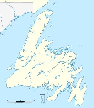 Lewisporte Location of Lewisporte in Newfoundland | |
| Coordinates: 49°14′N 55°04′W / 49.233°N 55.067°W | |
| Country |
|
| Province |
|
| Settled | 1876 |
| Incorporated | 1946 |
| Government | |
| • Current Mayor | Brian Sceviour |
| Population | |
| • Total | 3,312 |
| Time zone | Newfoundland Time (UTC-3:30) |
| • Summer (DST) | Newfoundland Daylight (UTC-2:30) |
| Postal Code | A0G 3A0 |
| Area code(s) | 709 |
| Highways | Route 340 |
| Website | Town of Lewisporte website |


Lewisporte is a town in central Newfoundland Island, Canada, with a population of 3,312. It is situated in a bay close to the mouth of the Exploits River. Lewisporte has an excellent port and related facilities that serve the many communities along Notre Dame Bay. Gander and its international airport are thirty minutes east on the Trans Canada Highway. Grand Falls-Windsor, a 45-minute drive west on the Trans Canada Highway, offers all the conveniences of a major centre. Twillingate is a 75-minute drive north of Lewisporte on Route 340.
History
Settlers first arrived in Lewisporte, previously named Burnt Bay and then Marshallville (after the Wesleyan Methodist Missionary William T Marshall who died in 1846), in 1887 and engaged in the prosperous fishing, logging, and ship building industries. Lewisporte is named for Lewis Miller, an enterprising Scotsman who operated a logging company in central Newfoundland. Millertown, another community in this region is also named for him. The first European settlers were attracted to the area by the huge stands of birch, spruce and pine, which graced the shores.
During the war years, Lewisporte was an important base of operations for the Canadian Forces. Gander's strategic location as a ‘jumping off’ point for flights going to Europe brought a larger population to Lewisporte. Approximately three army sites were constructed in Lewisporte to protect the oil supply lines to Gander. By the end of the war there were 150 families and a population of 821. Rapid commercial and residential growth after the war has converted and swallowed nearly all evidence of military presence.
Lewisporte's population and size have increased as the town's transportation and distribution function became more important. In 1947, Lewisporte Wholesalers began operations, then in 1949 Steers Limited began their wholesale business in the community. Both the companies acted as suppliers for the entire province. Following these major companies came others who eyed the community as a main distribution centre. The town was incorporated in 1946 and by 1976 the population had increased from 821 to 3200.
After the September 11, 2001 terror attacks, numerous transatlantic flights were diverted to Gander International Airport when U.S. airspace was closed. Lewisporte participated in Operation Yellow Ribbon, and sheltered and fed hundreds of stranded airline passengers for several days. In subsequent press reports, the passengers praised the citizens of Lewisporte for their concern and hospitality.[1]
Sights
After the trans-island railway had been completed in 1887 a branch line was built from Notre Dame Junction to Lewisporte. The town became an important ship and railway terminus. The railway line was closed in the 1980s, but the former railway station is still well preserved. It can be seen in the western part of the town. Lewisporte Train Park, an interesting railway museum, can be visited in the east of Lewisporte.
The Town Hall houses the tourist information and a public library. A War Memorial was erected in front of it. There are various interesting churches in Lewisporte, e.g. the United Church and the wooden Roman Catholic church in Main Street.
See also
- List of cities and towns in Newfoundland and Labrador
- The Pilot - The local newspaper for the region.
References
- ↑ Bombardieri, Marcella, "Unexpected Welcome", Boston Globe, December 23, 2001, p. 1
External links
| Wikivoyage has a travel guide for Lewisporte. |
- Town of Lewisporte online official website
- Lewisporte Yacht Club
Coordinates: 49°14′N 55°04′W / 49.233°N 55.067°W