Stockton Township, Greene County, Indiana
| Stockton Township | |
|---|---|
| Township | |
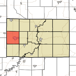 Location in Greene County | |
| Coordinates: 39°02′20″N 87°11′03″W / 39.03889°N 87.18417°WCoordinates: 39°02′20″N 87°11′03″W / 39.03889°N 87.18417°W | |
| Country | United States |
| State | Indiana |
| County | Greene |
| Government | |
| • Type | Indiana township |
| Area | |
| • Total | 36.67 sq mi (95.0 km2) |
| • Land | 36.06 sq mi (93.4 km2) |
| • Water | 0.62 sq mi (1.6 km2) 1.69% |
| Elevation | 554 ft (169 m) |
| Population (2000) | |
| • Total | 8,447 |
| • Density | 234.3/sq mi (90.5/km2) |
| GNIS feature ID | 0453876 |
Stockton Township is one of fifteen townships in Greene County, Indiana, USA. As of the 2010 census, its population was 8,447.[1]
Geography
According to the 2010 census, the township has a total area of 36.67 square miles (95.0 km2), of which 36.06 square miles (93.4 km2) (or 98.34%) is land and 0.62 square miles (1.6 km2) (or 1.69%) is water.[1] Lakes in this township include Boy Scout Pond. The stream of Willow Slough runs through this township.
Cities and towns
Unincorporated towns
(This list is based on USGS data and may include former settlements.)
Adjacent townships
- Wright Township (north)
- Smith Township (northeast)
- Grant Township (east)
- Washington Township (southeast)
- Stafford Township (south)
- Jefferson Township, Sullivan County (southwest)
- Cass Township, Sullivan County (northwest)
Cemeteries
The township contains six cemeteries: Clayton, Fairview, German, Island City, Old Linton and Richards.
Major highways
References
- 1 2 "Population, Housing Units, Area, and Density: 2010 - County -- County Subdivision and Place -- 2010 Census Summary File 1". United States Census. Retrieved 2013-05-10.
External links
Municipalities and communities of Greene County, Indiana, United States | ||
|---|---|---|
| Cities | ||
| Towns | ||
| Townships | ||
| CDPs | ||
| Other unincorporated communities |
| |
| Footnotes | ‡This populated place also has portions in an adjacent county or counties | |
This article is issued from Wikipedia - version of the 7/21/2016. The text is available under the Creative Commons Attribution/Share Alike but additional terms may apply for the media files.