Stanton Township, Michigan
| Stanton Township, Michigan | |
|---|---|
| Township | |
 Stanton Township, Michigan Location within the state of Michigan | |
| Coordinates: 47°4′54″N 88°47′22″W / 47.08167°N 88.78944°WCoordinates: 47°4′54″N 88°47′22″W / 47.08167°N 88.78944°W | |
| Country | United States |
| State | Michigan |
| County | Houghton |
| Area | |
| • Total | 123.6 sq mi (320.0 km2) |
| • Land | 122.3 sq mi (316.8 km2) |
| • Water | 1.2 sq mi (3.2 km2) |
| Elevation | 863 ft (263 m) |
| Population (2000) | |
| • Total | 1,268 |
| • Density | 10.4/sq mi (4.0/km2) |
| Time zone | Eastern (EST) (UTC-5) |
| • Summer (DST) | EDT (UTC-4) |
| FIPS code | 26-76200[1] |
| GNIS feature ID | 1627121[2] |
| Website | http://www.stantontownship.com/ |
Stanton Township is a civil township of Houghton County in the U.S. state of Michigan. The population was 1,268 at the 2000 census. Stanton Township has the distinction of having, at 47%, the highest concentration of people with Finnish ancestry of any place in the United States.[3]
Geography
According to the United States Census Bureau, the township has a total area of 123.6 square miles (320 km2), of which 122.3 square miles (317 km2) is land and 1.2 square miles (3.1 km2) (1.00%) is water.
Communities
- Beacon Hill is an unincorporated community in the township.[4] It was a center of the Trimountain Mining Company, largely backed by Boston financiers, and the settlement was named after Beacon Hill neighborhood in that city. It was a station on the Copper Range Railroad.[5] A post office operated from December 11, 1901 until August 31, 1952.[6]
- Craig Roy was platted as a village in 1903 but never developed.[7]
- Freda is an unincorporated community in the township and was the site of the Champion stamp mill.
- Obenhoff is an unincorporated community in the township.
- Onnela is a Finnish name meaning "a place of happiness"; Onni = happiness. The first settler was Iisakki Tolonen from Matarenki Finland who settled in 1886. Two years later Joonas Kovala son of Finnish-American Philanthropist Lauri Kovalainen from Suomussalmi, Finland arrived with Heikki Lampinen from Matarenki, Finland and Paul Räisänen from Pudasjoki, Finland.[8]
- Oskar is an unincorporated community in the township.[9] It was named for Oskar Eliasson (or Eliasen), a Finn who first came to Hancock Township about 1870 and became a charcoal tycoon. He was appointed the first postmaster of the settlement.[5] A post office operated from February 2, 1888 until October 15, 1928.[10]
- Redridge is an unincorporated community in the township. The Redridge Steel Dam is a notable landmark in Redridge. The area was also the site of the Atlantic and Baltic stamp mills.[11]
- Schmidt Corner is an unincorporated community in the township
Parks
- North Canal Township Park at the north end of the Keweenaw Canal and is across from McLain State Park.
Demographics
| Largest ancestries (2000) | Percent |
|---|---|
| Finnish | 46.9% |
| German | 10.9% |
| English | 8.4% |
| Irish | 6.3% |
| French | 4.8% |
| Swedish | 4.0% |
| American | 2.9% |
| Norwegian | 2.5% |
As of the census[1] of 2000, there were 1,268 people, 475 households, and 315 families residing in the township. The population density was 10.4 per square mile (4.0/km²). There were 695 housing units at an average density of 5.7 per square mile (2.2/km²). The racial makeup of the township was 98.19% White, 0.24% African American, 0.55% Native American, and 1.03% from two or more races. Hispanic or Latino of any race were 0.55% of the population. Some 46.9% of Stanton Township residents report Finnish ancestry, the highest such percentage in the United States.
There were 475 households out of which 29.9% had children under the age of 18 living with them, 56.4% were married couples living together, 6.7% had a female householder with no husband present, and 33.5% were non-families. 28.4% of all households were made up of individuals and 9.3% had someone living alone who was 65 years of age or older. The average household size was 2.67 and the average family size was 3.36.
In the township the population was spread out with 30.1% under the age of 18, 8.2% from 18 to 24, 22.6% from 25 to 44, 25.4% from 45 to 64, and 13.6% who were 65 years of age or older. The median age was 38 years. For every 100 females there were 111.3 males. For every 100 females age 18 and over, there were 120.4 males.
The median income for a household in the township was $38,200, and the median income for a family was $41,771. Males had a median income of $35,455 versus $26,875 for females. The per capita income for the township was $16,338. About 5.1% of families and 7.1% of the population were below the poverty line, including 7.1% of those under age 18 and 4.3% of those age 65 or over.
References
- 1 2 "American FactFinder". United States Census Bureau. Retrieved 2008-01-31.
- ↑ "Stanton Township, Michigan". Geographic Names Information System. United States Geological Survey.
- ↑ U.S. census data as compiled by eopdunk.com
- ↑ "Beacon Hill, Michigan". Geographic Names Information System. United States Geological Survey.
- 1 2 Romig, Walter (1986) [1973]. Michigan Place Names. Detroit, Michigan: Wayne State University Press. ISBN 0-8143-1838-X.
- ↑ "Beacon Hill Post Office (historical)". Geographic Names Information System. United States Geological Survey.
- ↑ Romig, Michigan Place Names, p. 137
- ↑ Ilmonen, S. (1926). AMERIKAN SUOMALAISIA HISTORIA III; YHDYSVALLOISSA JA CANADASSA OLEVAT SUOMALAISET ASUTUKSET [American history of Finnish III; Finnish settlement in the United States and Canada] (in Finnish). Suomalais-Luteerilainen Kustannusliike. p. 113. ASIN B00AGY26I4.
- ↑ "Oskar, Michigan". Geographic Names Information System. United States Geological Survey.
- ↑ "Oskar Post Office (historical)". Geographic Names Information System. United States Geological Survey.
- ↑ History information on the Stanton Township webpage http://www.stantontownship.com/wp-content/uploads/2009/12/1.-Redridge-description.pdf
External links
- township data from city-data.com
- Picture of a "herd of contented Holsteins graz[ing] in an oat pasture on the Wayne Rautio farm" at Obenhoff from Keweenaw Digital Archives, Michigan Technological University
- "Farmer Wayne Rautio holds some brome forage from the field on his farm in Obenhoff."
Municipalities and communities of Houghton County, Michigan, United States | ||
|---|---|---|
| Cities | 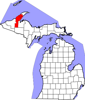 | |
| Villages | ||
| Charter townships | ||
| General law townships | ||
| CDPs | ||
| Other unincorporated communities | ||