Dakota Heights, Michigan
| Dakota Heights, Michigan | |
|---|---|
 Dakota Heights, Michigan | |
| Coordinates: 47°07′05″N 88°35′12″W / 47.11807°N 88.5868°WCoordinates: 47°07′05″N 88°35′12″W / 47.11807°N 88.5868°W[1] | |
| Country | United States |
| State | Michigan |
| Platted | 1906 |
Dakota Heights is an unincorporated community in Portage Township,[2] Houghton County in the U.S. state of Michigan. It is an enclave surrounded on all four sides[3] by the extreme western part of the city of Houghton (on the fourth by Portage Lake (or, depending on definition of terms, the Portage Lake Shipping Canal); it is non-contiguous with any other part of Portage Township. (However, it was formerly served by the water lines of Adams Township.)[4] Living in Dakota Heights is at least sometimes regarded as living "in town" (Houghton).[5]
History
Dakota Heights was platted in 1906 and named after the Dacotah Mining Company, which operated briefly in its vicinity.[3] It provided housing for workers on the Copper Range Railroad, which had a number of facilities immediately to the north;[3] the company owned most of the housing. It remains "primarily residential,"[3] though some businesses have opened (and closed) in it over the years, including a former motel, and currently a podiatrist's office, restaurant[3] and spa.
Geography
Dakota Heights originally sat at the west end of Houghton's Sheldon Avenue.[3] West of Dakota Heights was originally countryside, prior to the development of the M-26 corridor that began in the mid-1970s.[6]
Climate
Dakota Heights has a humid continental climate but winters are typically long and snowy with much lake effect snow.
Environmental issues
Pollution in Huron Creek, arguably from inadequate private septic systems[7] [8] has contributed to the growth of algae.[9]
Education
The local school district is Houghton-Portage Township Schools. Students K-12 are served by Houghton Elementary (K-5), Middle (6-8), and High (9-12) schools.
The Rock School formerly served Dakota Heights and the surrounding area.
Infrastructure
Transportation
Highway
In 1979 Highway M-26 was rerouted through the community, bisecting it. Park Avenue had formerly served as the main route from Houghton to Atlantic Mine, but this was replaced by the new route of the highway.[3]
Public transportation
Houghton Motor Transit operates a demand bus that serves the community, but "curb to curb" services is only for Houghton residents, and as it is outside the city limits of Houghton rates with one terminus in Dakota Heights are higher.[10] However, there are no regularly scheduled route buses operating in the community.[11]
Snowmobile
A snowmobile trail runs along Dakota Heights' Park Avenue.[4]
References
- ↑ "Description of the Huron Creek Watershed" (PDF). Retrieved 2011-09-16.
- ↑ Aslani, Layla (April 14, 2009). "PT receives grant for sewer work". The Daily Mining Gazette. 109 (176). pp. 1A, 12A.
- 1 2 3 4 5 6 7 Gerald Greer. "A Comprehensive Land Use History of the Huron Creek Watershed" (pdf). Retrieved 2011-09-16.
- 1 2 ""Shaping the Future" Survey Comments from Portage Township" (PDF). Retrieved 2009-05-25.
- ↑ "Hot-Ads MI - Dozens of Newspapers and Thousands of Ads". Archived from the original on 2006-05-14. Retrieved 2007-05-14.
- ↑ Steve Albee. "A Featured River: Huron Creek and its Watershed" (PDF). Archived from the original (pdf) on October 13, 2008. Retrieved 2008-05-25.
- ↑ Neese, Garrett (September 9, 2008). "Portage Twp. OKs scoping". The (Houghton, Michigan) Daily Mining Gazette. pp. 1A, 10A.
- ↑ "SEPTIC SYSTEM: Developing the Huron Creek Watershed Management Plan". Archived from the original on June 22, 2010. Retrieved 2007-09-21.
- ↑ Karen M. Gonzalez,. "Huron Creek Watershed Management Plan: Technical Background" (PDF). sfi.mtu.edu. Archived from the original (PDF) on 3 July 2008. Retrieved 2008-05-25.
- ↑ "Houghton Motor Transit Line". Retrieved 2008-05-25.
- ↑ "Downtowner Route Schedule" (pdf). Retrieved 2008-05-25.
External links
- Postcard of Dakota Heights
- Obituary of Mrs. Annie Reed Opie from the (Houghton, Michigan) Daily Mining Gazette, July 4, 1927
- "Environmental Decision-Making Class: Planning Resources for Houghton County". Michigan Tech Center for Science and Environmental Outreach. Retrieved 2008-05-25.
- The World Knowledge Library Masterliness
- MTU Department of Social Sciences: "Graduate students present their research at a departmental poster session. Some of the titles included Quincy Second Hillside Edition, Home of One's Own, Dakota Heights, Dodgeville, and Coburntown"
- "Preliminary Delineation of Sub Watersheds and Storm Water Runoff" by Anna Hermesmeyer
- Mention in Tech Topics online
- "Introducing the new Copper Island Beach Club" by Dan Boyer in Michigan Tech Lode
Municipalities and communities of Houghton County, Michigan, United States | ||
|---|---|---|
| Cities | 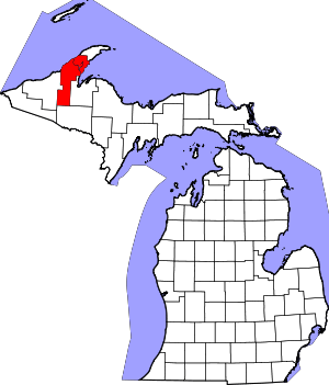 | |
| Villages | ||
| Charter townships | ||
| General law townships | ||
| CDPs | ||
| Other unincorporated communities | ||