South Range, Michigan
| South Range, Michigan | |
|---|---|
| Village | |
|
Downtown South Range | |
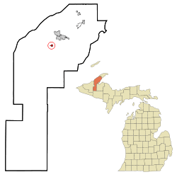 Location of South Range, Michigan | |
| Coordinates: 47°4′19″N 88°38′32″W / 47.07194°N 88.64222°W | |
| Country | United States |
| State | Michigan |
| County | Houghton |
| Area[1] | |
| • Total | 0.36 sq mi (0.93 km2) |
| • Land | 0.36 sq mi (0.93 km2) |
| • Water | 0 sq mi (0 km2) |
| Elevation | 1,138 ft (347 m) |
| Population (2010)[2] | |
| • Total | 758 |
| • Estimate (2012[3]) | 756 |
| • Density | 2,105.6/sq mi (813.0/km2) |
| Time zone | Eastern (EST) (UTC-5) |
| • Summer (DST) | EDT (UTC-4) |
| ZIP code | 49963 |
| Area code(s) | 906 |
| FIPS code | 26-75220[4] |
| GNIS feature ID | 0638402[5] |

South Range is a village in Adams Township, Houghton County in the U.S. state of Michigan. It is bordered on the east by the unincorporated community of Baltic. It is about five miles southwest of Houghton on M-26. The population was 758 at the 2010 census. The ZIP code for South Range is 49963.
It is a "cooperating community of the Keweenaw National Historical Park."
History
South Range was platted in 1902 by the Wheal Kate Mining Company, which operated an unsuccessful copper mine nearby. In 1906 the community tried to incorporate as the town of Stanton, but there was already a Stanton, Michigan, so they incorporated as South Range, because it was at the south end of the Michigan copper range. Italians were the dominant ethnic group in early years.[6]
On December 11, 1913, during the bitter Copper Country Strike of 1913–1914, a raid was conducted by the Citizens' Alliance shortly after the mass murder at the Dally boardinghouse in Painesdale, Michigan which had occurred just a mere few days previous. Thirty-seven rifles, and hundreds of rounds of ammunition was seized. Twenty-three strikers were arrested with guns ready to shoot up the location that night, and Deputy T. Driscoll was non-fatally shot in the arm during the raid.
Geography
According to the United States Census Bureau, the village has a total area of 0.36 square miles (0.93 km2), all land.[1]
Demographics
| Historical population | |||
|---|---|---|---|
| Census | Pop. | %± | |
| 1910 | 1,097 | — | |
| 1920 | 1,435 | 30.8% | |
| 1930 | 1,120 | −22.0% | |
| 1940 | 918 | −18.0% | |
| 1950 | 712 | −22.4% | |
| 1960 | 760 | 6.7% | |
| 1970 | 898 | 18.2% | |
| 1980 | 861 | −4.1% | |
| 1990 | 745 | −13.5% | |
| 2000 | 727 | −2.4% | |
| 2010 | 758 | 4.3% | |
| Est. 2015 | 746 | [7] | −1.6% |

2010 census
As of the census[2] of 2010, there were 758 people, 343 households, and 181 families residing in the village. The population density was 2,105.6 inhabitants per square mile (813.0/km2). There were 395 housing units at an average density of 1,097.2 per square mile (423.6/km2). The racial makeup of the village was 95.9% White, 0.4% Native American, 1.2% Asian, 0.1% from other races, and 2.4% from two or more races. Hispanic or Latino of any race were 1.1% of the population.
There were 343 households of which 23.0% had children under the age of 18 living with them, 38.5% were married couples living together, 10.8% had a female householder with no husband present, 3.5% had a male householder with no wife present, and 47.2% were non-families. 39.7% of all households were made up of individuals and 16.6% had someone living alone who was 65 years of age or older. The average household size was 2.19 and the average family size was 2.96.
The median age in the village was 40.2 years. 23.4% of residents were under the age of 18; 9.7% were between the ages of 18 and 24; 22.5% were from 25 to 44; 24.7% were from 45 to 64; and 19.7% were 65 years of age or older. The gender makeup of the village was 52.0% male and 48.0% female.
2000 census
As of the census[4] of 2000, there were 727 people, 347 households, and 191 families residing in the village. The population density was 1,821.1 per square mile (701.7/km²). There were 378 housing units at an average density of 946.9 per square mile (364.9/km²). The racial makeup of the village was 96.84% White, 2.20% African American, 0.14% Native American, 0.28% Asian, 0.14% from other races, and 0.41% from two or more races. Hispanic or Latino of any race were 0.14% of the population. 46.4% were of Finnish, 13.8% Italian, 6.2% German and 5.2% French ancestry according to Census 2000.
There were 347 households out of which 21.0% had children under the age of 18 living with them, 40.6% were married couples living together, 11.0% had a female householder with no husband present, and 44.7% were non-families. 38.3% of all households were made up of individuals and 18.7% had someone living alone who was 65 years of age or older. The average household size was 2.09 and the average family size was 2.78.
In the village the population was spread out with 20.4% under the age of 18, 9.6% from 18 to 24, 24.8% from 25 to 44, 21.3% from 45 to 64, and 23.9% who were 65 years of age or older. The median age was 40 years. For every 100 females there were 107.1 males. For every 100 females age 18 and over, there were 104.6 males.
The median income for a household in the village was $26,250, and the median income for a family was $34,500. Males had a median income of $26,550 versus $25,000 for females. The per capita income for the village was $15,611. About 7.5% of families and 13.7% of the population were below the poverty line, including 24.6% of those under age 18 and 8.4% of those age 65 or over.
References
- 1 2 "US Gazetteer files 2010". United States Census Bureau. Retrieved 2012-11-25.
- 1 2 "American FactFinder". United States Census Bureau. Retrieved 2012-11-25.
- ↑ "Population Estimates". United States Census Bureau. Retrieved 2013-06-03.
- 1 2 "American FactFinder". United States Census Bureau. Retrieved 2008-01-31.
- ↑ "US Board on Geographic Names". United States Geological Survey. 2007-10-25. Retrieved 2008-01-31.
- ↑ Clarence J. Monette (1995) Early South Range, Lake Linden, Mich.: Clarence Monette.
- ↑ "Annual Estimates of the Resident Population for Incorporated Places: April 1, 2010 to July 1, 2015". Retrieved July 2, 2016.
- ↑ "Census of Population and Housing". Census.gov. Retrieved June 4, 2015.
External links
Municipalities and communities of Houghton County, Michigan, United States | ||
|---|---|---|
| Cities | 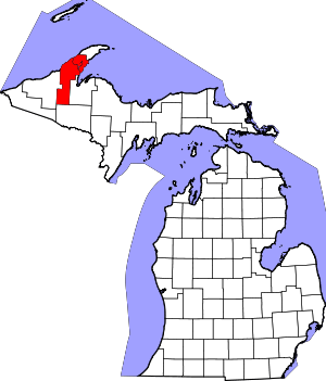 | |
| Villages | ||
| Charter townships | ||
| General law townships | ||
| CDPs | ||
| Other unincorporated communities | ||
Coordinates: 47°04′12″N 88°38′35″W / 47.07000°N 88.64306°W