Staffordshire Moorlands (UK Parliament constituency)
| Staffordshire Moorlands | |
|---|---|
|
County constituency for the House of Commons | |
|
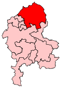
Boundary of Staffordshire Moorlands in Staffordshire. | |
|
Location of Staffordshire within England. | |
| County | Staffordshire |
| Electorate | 62,457 (December 2010)[1] |
| Major settlements | Leek and Biddulph |
| Current constituency | |
| Created | 1983 |
| Member of parliament | Karen Bradley (Conservative) |
| Number of members | One |
| Created from | Leek |
| Overlaps | |
| European Parliament constituency | West Midlands |

Staffordshire Moorlands is a constituency[n 1] represented in the House of Commons of the UK Parliament since 2010 by Karen Bradley, a Conservative who has served as Secretary of State for Culture, Media and Sport since 14 July 2016.[n 2]
History
- Political history
The forerunner seat, Leek existed for nearly a century until 1983 and in its more recent history alternated between the Labour Party and Conservative parties three times after a Liberal had held the seat from 1910 until 1918. Despite the changes in member, it was far from a bellwether (that is, a reflection of the national result), as Leek leaned more towards one party more than the other in two phases: in the first, longer part of this period the seat was held mainly by William Bromfield (Lab), secretary of the Amalgamated Society of Textile Workers and Kindred Trades (ASTWKT), whose membership covered Staffordshire and South Cheshire and then by the future Lord Davies of Leek who as the main aide to the Prime Minister, was tasked with secret talks with Ho Chi Minh at which he failed due to a leak; in the second part of this period David Knox (Con), a pro-European, toward the left of his party, and a supporter of Ted Heath when he faced Margaret Thatcher's leadership challenge, helped to establish Tory Reform Group and during his long tenure as MP until 1997 held the seat even during the Wilson-Callaghan government.
Since Charlotte Atkins's win in 1997 the seat has been a bellwether for the national result.
Boundaries
1983-1997: The District of Staffordshire Moorlands.
1997-2010: The District of Staffordshire Moorlands wards of Biddulph East, Biddulph Moor, Biddulph North, Biddulph South, Biddulph West, Caverswall, Cheddleton, Horton, Ipstones, Leek North East, Leek North West, Leek South East, Leek South West, Leekfrith, Longnor, Warslow, Waterhouses, Werrington, and Wetley Rocks, and the Borough of Newcastle-under-Lyme wards of Butt Lane, Kidsgrove, Newchapel, and Talke.
2010-present: The District of Staffordshire Moorlands wards of Alton, Bagnall and Stanley, Biddulph East, Biddulph Moor, Biddulph North, Biddulph South, Biddulph West, Brown Edge and Endon, Caverswall, Cellarhead, Cheddleton, Churnet, Dane, Hamps Valley, Horton, Ipstones, Leek East, Leek North, Leek South, Leek West, Manifold, and Werrington, and the Borough of Newcastle-under-Lyme ward of Newchapel.
History of boundaries
The constituency succeeded the former constituency of Leek at the 1983 general election. The boundary changes which took effect at the 1997 general election proved to be among the most controversial of all those proposed by the Boundary Commission.[2] Initially only minor changes were to be made: two rural wards to transfer to Stone (newly created).[2] However, in the same proposed boundary changes, the neighbouring community of Kidsgrove had been split between two constituencies, with two wards remaining in the constituency of Stoke-on-Trent North and two wards transferring to Newcastle-under-Lyme. At the local enquiry into the changes, it was argued that this division of Kidsgrove was unacceptable and the assistant commissioner consequently recommended that all four Kidsgrove wards be transferred instead to Staffordshire Moorlands.[2] To make way for the 19,000 voters in Kidsgrove (to that date shown to be heavily Labour-supporting,[2] two wards, Endon & Stanley and Brown Edge, were transferred to Stoke-on-Trent North, while two more rural wards were transferred to the Stone constituency. It was estimated that if the constituency had been fought on the pre-1997 Ms Atkins would have gained the seat by a majority of about 1,500 votes.[3]
The boundary changes which took effect at the 2010 general election effectively reversed these changes: Four of the five Kidsgrove wards transferred to Stoke-on-Trent North with only one mainly rural ward, Newchapel remaining in Staffordshire Moorlands. Brown Edge and Endon & Stanley returned to Staffordshire Moorlands. It was estimated that if the constituency had been fought at the 2005 election, Labour would have lost the seat by 1,035 votes as opposed to the 2,438 votes that Charlotte Atkins won on that occasion.[4][5]
Constituency profile
The constituency covers a good deal of rural areas of north-east Staffordshire, northeast of Stoke-on-Trent, having a Derbyshire border. The largest towns are Leek in the Churnet valley and Biddulph. The area also includes the wooded, hillside village of Rudyard with its long man-made lake and miniature railway, and about 30% is in a scarcely populated part of the Peak District of small villages, one of which, Wetton, features Old Hannah's Cave. The southern part of Dove Dale on the border itself features rock climbing as well as Jacob's Ladder and Bertram's cave and well.
Workless claimants, registered jobseekers, were in November 2012 significantly lower than the national average of 3.8%, at 2.1% of the population based on a statistical compilation by The Guardian.[6]
Members of Parliament
| Election | Member[7] | Party | |
|---|---|---|---|
| 1983 | Sir David Knox | Conservative | |
| 1997 | Charlotte Atkins | Labour | |
| 2010 | Karen Bradley | Conservative | |
Elections
Elections in the 2010s
| Party | Candidate | Votes | % | ± | |
|---|---|---|---|---|---|
| Conservative | Karen Bradley | 21,770 | 51.1 | +5.9 | |
| Labour | Trudie McGuinness[9] | 11,596 | 27.2 | -2.7 | |
| UKIP | George Langley-Poole | 6,236 | 14.6 | +6.5 | |
| Liberal Democrat | John Redfern[10] | 1,759 | 4.1 | -12.6 | |
| Green | Brian Smith[11] | 1,226 | 2.9 | +2.9 | |
| Majority | 10,174 | 23.9 | +9.2 | ||
| Turnout | 42,587 | ||||
| Conservative hold | Swing | +4.3 | |||
| Party | Candidate | Votes | % | ± | |
|---|---|---|---|---|---|
| Conservative | Karen Bradley | 19,793 | 45.2 | +5.4 | |
| Labour | Charlotte Atkins | 13,104 | 29.9 | −6.0 | |
| Liberal Democrat | Henry Jebb | 7,338 | 16.7 | −0.8 | |
| UKIP | Steve Povey | 3,580 | 8.2 | +1.4 | |
| Majority | 6,689 | 15.3 | |||
| Turnout | 43,815 | 70.6 | +2.8 | ||
| Conservative hold | Swing | +5.7 | |||
The vote share change and hold status in 2010 comes from the notional, not actual, 2005 results because of boundary changes. Calculations of notional results (an estimate of how the seat would have voted in 2005 if it had existed then on the 2010 boundaries) suggested that the Conservatives would have won the seat, so the result in 2010 was classed as a Conservative "hold" by most sources.[14][15]
Elections in the 2000s
| Party | Candidate | Votes | % | ± | |
|---|---|---|---|---|---|
| Labour | Charlotte Atkins | 18,126 | 41.0 | −8.0 | |
| Conservative | Marcus Hayes | 15,688 | 35.5 | +0.2 | |
| Liberal Democrat | John Fisher | 6,927 | 15.7 | +1.8 | |
| UKIP | Stephen Povey | 3,512 | 7.9 | +6.1 | |
| Majority | 2,438 | 5.5 | −8.2 | ||
| Turnout | 44,253 | 64.0 | +0.1 | ||
| Labour hold | Swing | −4.1 | |||
| Party | Candidate | Votes | % | ± | |
|---|---|---|---|---|---|
| Labour | Charlotte Atkins | 20,904 | 49.0 | −3.2 | |
| Conservative | Marcus Hayes | 15,066 | 35.3 | +2.8 | |
| Liberal Democrat | John Redfern | 5,928 | 13.9 | +1.8 | |
| UKIP | Paul Gilbert | 760 | 1.8 | N/A | |
| Majority | 5,838 | 13.7 | −6.0 | ||
| Turnout | 42,658 | 63.9 | −13.9 | ||
| Labour hold | Swing | −3.0 | |||
Source:[18]
Elections in the 1990s
| Party | Candidate | Votes | % | ± | |
|---|---|---|---|---|---|
| Labour | Charlotte Atkins | 26,686 | 52.21 | ||
| Conservative | Andrew Ashworth | 16,637 | 32.55 | ||
| Liberal Democrat | Christina R Jebb | 6,191 | 12.11 | ||
| Referendum | David Stanworth | 1,603 | 3.14 | ||
| Majority | 10,049 | 19.66 | |||
| Turnout | 77.75 | ||||
| Labour gain from Conservative | Swing | ||||
| Party | Candidate | Votes | % | ± | |
|---|---|---|---|---|---|
| Conservative | David Knox | 29,240 | 46.6 | −6.3 | |
| Labour | JE Siddelley | 21,830 | 34.8 | +6.0 | |
| Liberal Democrat | CR Jebb | 9,326 | 14.9 | −3.5 | |
| Anti-Federalist League | MC Howson | 2,121 | 3.4 | N/A | |
| Natural Law | P Davies | 261 | 0.4 | N/A | |
| Majority | 7,410 | 11.8 | −12.3 | ||
| Turnout | 62,778 | 83.7 | +3.2 | ||
| Conservative hold | Swing | −6.2 | |||
Elections in the 1980s
| Party | Candidate | Votes | % | ± | |
|---|---|---|---|---|---|
| Conservative | David Knox | 31,613 | 52.91 | ||
| Labour | V Ivers | 17,186 | 28.76 | ||
| Social Democratic | JP Corbett | 10,950 | 18.33 | ||
| Majority | 14,427 | 24.15 | |||
| Turnout | 80.41 | ||||
| Conservative hold | Swing | ||||
| Party | Candidate | Votes | % | ± | |
|---|---|---|---|---|---|
| Conservative | David Knox | 30,079 | 53.8 | N/A | |
| Labour | B Campbell | 13,513 | 24.2 | N/A | |
| Social Democratic | P Gubbins | 12,370 | 22.1 | N/A | |
| Majority | 16,566 | 29.6 | N/A | ||
| Turnout | 77.2 | N/A | |||
| Conservative win (new seat) | |||||
See also
Notes and references
- Notes
- ↑ A county constituency (for the purposes of election expenses and type of returning officer)
- ↑ As with all constituencies, the constituency elects one Member of Parliament (MP) by the first past the post system of election at least every five years.
- References
- ↑ "Electorate Figures - Boundary Commission for England". 2011 Electorate Figures. Boundary Commission for England. 4 March 2011. Retrieved 13 March 2011.
- 1 2 3 4 Staffordshire Moorlands profile, Vote 2001, BBC, accessed 25 January 2010
- ↑ C. Rallings & M. Thrasher, The Media Guide to the New Parliamentary Constituencies, (Plymouth: LGC Elections Centre, 1995)
- ↑ Rallings & M. Thrasher (eds) Media Guide to the New Parliamentary Constituencies, (Plymouth: LGC Elections Centre, 2007)
- ↑ Staffordshire Moorlands, UK Polling report
- ↑ Unemployment claimants by constituency The Guardian
- ↑ Leigh Rayment's Historical List of MPs – Constituencies beginning with "S" (part 4)
- ↑ "Election Data 2015". Electoral Calculus. Archived from the original on 17 October 2015. Retrieved 17 October 2015.
- ↑ http://www.labour.org.uk/candidates
- ↑ "John Redfern PPC page". Liberal Democrats. Retrieved 1 March 2015.
- ↑ "general-election.html". Retrieved 14 February 2015.
- ↑ "Election Data 2010". Electoral Calculus. Archived from the original on 17 October 2015. Retrieved 17 October 2015.
- ↑ BBC 2010 General Election Site
- ↑ http://news.bbc.co.uk/1/shared/election2010/results/constituency/e41.stm
- ↑ http://www.theguardian.com/politics/interactive/2010/may/06/uk-election-results-map
- ↑ "Election Data 2005". Electoral Calculus. Archived from the original on 15 October 2011. Retrieved 18 October 2015.
- ↑ "Election Data 2001". Electoral Calculus. Archived from the original on 15 October 2011. Retrieved 18 October 2015.
- ↑ UK Election results
- ↑ "Election Data 1997". Electoral Calculus. Archived from the original on 15 October 2011. Retrieved 18 October 2015.
- ↑ "Election Data 1992". Electoral Calculus. Archived from the original on 15 October 2011. Retrieved 18 October 2015.
- ↑ "Politics Resources". Election 1992. Politics Resources. 9 April 1992. Retrieved 2010-12-06.
- ↑ "Election Data 1987". Electoral Calculus. Archived from the original on 15 October 2011. Retrieved 18 October 2015.
- ↑ "Election Data 1983". Electoral Calculus. Archived from the original on 15 October 2011. Retrieved 18 October 2015.
Coordinates: 53°4′N 1°59′W / 53.067°N 1.983°W