St. Florian, Alabama
| St. Florian, Alabama | |
|---|---|
| Town | |
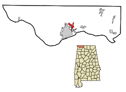 Location in Lauderdale County and the state of Alabama | |
| Coordinates: 34°52′22″N 87°37′30″W / 34.87278°N 87.62500°W | |
| Country | United States |
| State | Alabama |
| County | Lauderdale |
| Area | |
| • Total | 3 sq mi (7.7 km2) |
| • Land | 3 sq mi (7.7 km2) |
| • Water | 0 sq mi (0 km2) |
| Elevation | 627 ft (191 m) |
| Population (2010) | |
| • Total | 413 |
| • Density | 111.7/sq mi (43.5/km2) |
| Time zone | Central (CST) (UTC-6) |
| • Summer (DST) | CDT (UTC-5) |
| FIPS code | 01-67536 |
| GNIS feature ID | 0153248 |
| Website | http://www.stflorianalabama.com/ |
St. Florian is a town in Lauderdale County, Alabama, United States. It is part of the Florence - Muscle Shoals Metropolitan Statistical Area known as "The Shoals". As of the 2010 census, the population of the town is 413, up from 335 in 2000.
History
The area was first called Wilson Stand, for John and Matthew Wilson, the original owners of the town site.[1] The present community was founded in the 1870s by a colony of Germans who named the town after Saint Florian.[2] A post office was established at St. Florian in 1879, and remained in operation until it was discontinued in 1904.[3] The town incorporated at some point in the 1970s, as cited by the 1980 U.S. Census.[4]
Geography
St. Florian is located at 34°52′22″N 87°37′30″W / 34.87278°N 87.62500°W (34.872753, -87.625117).[5]
According to the U.S. Census Bureau, the town has a total area of 3.0 square miles (7.8 km2), all land.
Demographics
| Historical population | |||
|---|---|---|---|
| Census | Pop. | %± | |
| 1880 | 135 | — | |
| 1970 | 168 | — | |
| 1980 | 305 | 81.5% | |
| 1990 | 388 | 27.2% | |
| 2000 | 335 | −13.7% | |
| 2010 | 413 | 23.3% | |
| Est. 2015 | 464 | [6] | 12.3% |
| U.S. Decennial Census[7] 2013 Estimate[8] | |||
As of the census[9] of 2000, there were 335 people, 129 households, and 103 families residing in the town. The population density was 112.3 people per square mile (43.4/km²). There were 140 housing units at an average density of 46.9 per square mile (18.1/km²). The racial makeup of the town was 98.81% White, 0.60% Black or African American and 0.60% Asian.
There were 129 households out of which 34.1% had children under the age of 18 living with them, 72.9% were married couples living together, 2.3% had a female householder with no husband present, and 19.4% were non-families. 17.1% of all households were made up of individuals and 8.5% had someone living alone who was 65 years of age or older. The average household size was 2.60 and the average family size was 2.89.
In the town the population was spread out with 22.1% under the age of 18, 6.9% from 18 to 24, 31.0% from 25 to 44, 28.4% from 45 to 64, and 11.6% who were 65 years of age or older. The median age was 40 years. For every 100 females there were 94.8 males. For every 100 females age 18 and over, there were 102.3 males.
The median income for a household in the town was $46,250, and the median income for a family was $48,125. Males had a median income of $36,364 versus $21,250 for females. The per capita income for the town was $17,522. About 9.2% of families and 9.8% of the population were below the poverty line, including 16.5% of those under age 18 and 7.5% of those age 65 or over.
References
- ↑ "What's the origin of your town's name?". Times Daily. June 3, 2006. pp. 4A. Retrieved 18 October 2015.
- ↑ Darby, A. J. (1 March 1962). "The Historical Highways and Byways of Lauderdale County". TimesDaily. pp. Page 6, Section 3. Retrieved 23 April 2015.
- ↑ "Lauderdale County". Jim Forte Postal History. Retrieved 23 April 2015.
- ↑ http://www2.census.gov/prod2/decennial/documents/1980a_alABC-01.pdf
- ↑ "US Gazetteer files: 2010, 2000, and 1990". United States Census Bureau. 2011-02-12. Retrieved 2011-04-23.
- ↑ "Annual Estimates of the Resident Population for Incorporated Places: April 1, 2010 to July 1, 2015". Retrieved July 2, 2016.
- ↑ "U.S. Decennial Census". Census.gov. Retrieved June 6, 2013.
- ↑ "Annual Estimates of the Resident Population: April 1, 2010 to July 1, 2013". Retrieved June 3, 2014.
- ↑ "American FactFinder". United States Census Bureau. Retrieved 2008-01-31.
External links
Coordinates: 34°52′22″N 87°37′30″W / 34.872753°N 87.625117°W
Municipalities and communities of Lauderdale County, Alabama, United States | ||
|---|---|---|
| Cities | 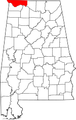 | |
| Towns | ||
| CDPs | ||
| Unincorporated communities | ||