Grassy, Lauderdale County, Alabama
| Grassy, Alabama | |
|---|---|
| Unincorporated community | |
|
Grassy Memorial Chapel | |
 Grassy, Alabama  Grassy, Alabama | |
| Coordinates: 34°58′17″N 87°17′59″W / 34.97139°N 87.29972°WCoordinates: 34°58′17″N 87°17′59″W / 34.97139°N 87.29972°W | |
| Country | United States |
| State | Alabama |
| County | Lauderdale |
| Elevation | 787 ft (240 m) |
| Time zone | Central (CST) (UTC-6) |
| • Summer (DST) | CDT (UTC-5) |
| Area code(s) | 256 & 938 |
| GNIS feature ID | 156430[1] |

Grassy, also known as Arthur or New Salem, is an unincorporated community in Lauderdale County, in the U.S. state of Alabama. It is concentrated around the intersection of State Route 64 and County Highway 89, east of Lexington, northwest of Anderson, and just south of the Tennessee border.
History
Grassy took its name in the 1870s from the local Grassy School; the school was so named for the condition of its grassy schoolyard.[2] A post office operated under the name Arthur from 1886 to 1907.[3]
Grassy Memorial Chapel, which lies near the center of the community, was established in 1894 as the New Salem Presbyterian Church. The chapel and its associated cemetery became the property of the Grassy community in 1976.[4]
References
- ↑ "Grassy". Geographic Names Information System. United States Geological Survey.
- ↑ "What's the origin of your town's name?". Times Daily. June 3, 2006. pp. 4A. Retrieved 18 October 2015.
- ↑ "Lauderdale County". Jim Forte Postal History. Retrieved 31 October 2015.
- ↑ "Grassy Memorial Chapel and Cemetery," Alabama Historical Association marker, 2002. Information accessed 29 October 2016.
Municipalities and communities of Lauderdale County, Alabama, United States | ||
|---|---|---|
| Cities | 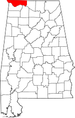 | |
| Towns | ||
| CDPs | ||
| Unincorporated communities | ||
This article is issued from Wikipedia - version of the 11/1/2016. The text is available under the Creative Commons Attribution/Share Alike but additional terms may apply for the media files.