Killen, Alabama
| Killen | |
|---|---|
| Town | |
| Killen, Alabama | |
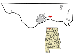 Location in Lauderdale County and the state of Alabama | |
| Coordinates: 34°51′42″N 87°31′46″W / 34.86167°N 87.52944°W | |
| Country | United States |
| State | Alabama |
| County | Lauderdale |
| Government | |
| • Mayor | Tim Tubbs[1] |
| Area | |
| • Total | 1.9 sq mi (5 km2) |
| • Land | 1.9 sq mi (5 km2) |
| • Water | 0 sq mi (0 km2) |
| Elevation | 610 ft (186 m) |
| Population (2010)[2] | |
| • Total | 1,108 |
| • Estimate (2013)[3] | 988 |
| • Density | 588.9/sq mi (223.8/km2) |
| Time zone | Central (CST) (UTC-6) |
| • Summer (DST) | CDT (UTC-5) |
| ZIP code | 35645 |
| Area code(s) | 256 |
| FIPS code | 01-39784 |
| GNIS feature ID | 0121192 |
| Website | Town of Killen |
Killen is a town in Lauderdale County, Alabama, United States. It is part of the Florence - Muscle Shoals Metropolitan Statistical Area known as "The Shoals". It was incorporated in 1957.[4] As of the 2010 census, the population of the town is 1,108, down from its record high of 1,119 in 2000.[2]
History
Killen was founded on the Muscle Shoals Canal.[5]
Geography
Killen is located at 34°51′42″N 87°31′46″W / 34.86167°N 87.52944°W (34.861586, -87.529374).[6]
According to the U.S. Census Bureau, the town has a total area of 1.9 square miles (4.9 km2), all land.
Demographics
| Historical population | |||
|---|---|---|---|
| Census | Pop. | %± | |
| 1960 | 620 | — | |
| 1970 | 683 | 10.2% | |
| 1980 | 747 | 9.4% | |
| 1990 | 1,047 | 40.2% | |
| 2000 | 1,119 | 6.9% | |
| 2010 | 1,108 | −1.0% | |
| Est. 2015 | 982 | [7] | −11.4% |
| U.S. Decennial Census[8] 2013 Estimate[3] | |||
As of the census[9] of 2000, there were 1,119 people, 435 households, and 338 families residing in the town. The population density was 585.0 people per square mile (226.2/km²). There were 484 housing units at an average density of 253.0 per square mile (97.8/km²). The racial makeup of the town was 95.26% White, 2.23% Black or African American, 0.45% Asian, 1.61% from other races, and 0.45% from two or more races. 2.59% of the population were Hispanic or Latino of any race.
Of the 435 households, 35.6% had children under the age of 18 living with them, 66.9% were married couples living together, 7.8% had a female householder with no husband present, and 22.1% were non-families. 18.2% of all households were made up of individuals, and 9.0% had someone living alone who was 65 years of age or older. The average household size was 2.57, and the average family size was 2.94.
In the town the population was spread out with 24.8% under the age of 18, 7.1% from 18 to 24, 32.2% from 25 to 44, 23.2% from 45 to 64, and 12.6% who were 65 years of age or older. The median age was 36 years. For every 100 females, there were 91.9 males. For every 100 females age 18 and over, there were 86.9 males.
The median household income was $43,203, and the median family income was $47,596. Males had a median income of $36,957 versus $22,102 for females. The per capita income for the town was $17,872. About 2.4% of families and 5.4% of the population were below the poverty line, including 2.8% of those under age 18 and 8.4% of those age 65 or over.
2010 census
As of the census[10] of 2010, there were 1,108 people, 457 households, and 323 families residing in the town. The population density was 583.2 people per square mile (221.6/km²). There were 499 housing units at an average density of 262.2 per square mile (99.8/km²). The racial makeup of the town was 94.0% White, 3.2% Black or African American, 0.5% Asian, 1.2% from other races, and 1.0% from two or more races. 2.4% of the population were Hispanic or Latino of any race.
Of the 457 households, 28.7% had children under the age of 18 living with them, 56.5% were married couples living together, 10.9% had a female householder with no husband present, and 29.3% were non-families. 26.9% of all households were made up of individuals, and 10.7% had someone living alone who was 65 years of age or older. The average household size was 2.42, and the average family size was 2.92.
In the town the population was spread out with 23.7% under the age of 18, 4.8% from 18 to 24, 26.4% from 25 to 44, 28.5% from 45 to 64, and 16.5% who were 65 years of age or older. The median age was 40.7 years. For every 100 females, there were 93.7 males. For every 100 females age 18 and over, there were 95.3 males.
The median household income was $48,309, and the median family income was $63,182. Males had a median income of $46,563 versus $34,038 for females. The per capita income for the town was $24,209. About 6.3% of families and 10.2% of the population were below the poverty line, including 12.5% of those under age 18 and 11.9% of those age 65 or over.
Arts and culture
Killen Founder's Day is an annual event celebrated during the second weekend in the month of August. The festivities begin on Friday at 6:00p.m. with a parade through downtown Killen on JC Mauldin Hwy starting at Brooks Elementary School and ending at the Market Center. Opening ceremonies are held at 7:30 at Killen Park in our amphitheater. The weekend is full of fun, games, music, history, food and is completed with fireworks on Saturday night.
League of the South
The League of the South, which is a Southern nationalist group, is headquartered near Killen, Alabama. The Southern Poverty Law Center has designated the League of the South as a Neo-Confederate hate group.[11]
Notable people
- David Briggs, keyboardist, record producer, and recording studio owner
- Patrick Hape, former NFL player
- Harlon Junius Hill, football player, starred at Florence State Teachers College, now known as the University of North Alabama, as well as the Chicago Bears, Pittsburgh Steelers and Detroit Lions. He is the namesake of the Harlon Hill Trophy.
- Iron Horse, bluegrass band known for their covers of rock songs
- Marsha Thornton, country music singer
- Shonna Tucker, bassist and former member of the Drive-By Truckers
References
- ↑ "Town of Killen". Killen Alabama website. Retrieved 2012-04-11.
- 1 2 "American FactFinder". United States Census Bureau. Retrieved 2014-10-23.
- 1 2 "Population Estimates". United States Census Bureau. Retrieved 2014-10-23.
- ↑ Archived January 28, 2016, at the Wayback Machine.
- ↑ "Towns, communities make region sparkle". Times Daily. Aug 2, 1998. p. 7. Retrieved 16 May 2015.
- ↑ "US Gazetteer files: 2010, 2000, and 1990". United States Census Bureau. 2011-02-12. Retrieved 2011-04-23.
- ↑ "Annual Estimates of the Resident Population for Incorporated Places: April 1, 2010 to July 1, 2015". Retrieved July 2, 2016.
- ↑ "Census of Population and Housing". United States Census Bureau. Archived from the original on May 11, 2015. Retrieved October 23, 2014.
- ↑ "American FactFinder". United States Census Bureau. Archived from the original on 2013-09-11. Retrieved 2008-01-31.
- ↑ "American FactFinder". United States Census Bureau. Archived from the original on 2013-09-11. Retrieved 2015-07-30.
- ↑ "League of the South | Southern Poverty Law Center". Splcenter.org. 2015-04-11. Retrieved 2016-07-15.
External links
Coordinates: 34°51′42″N 87°31′46″W / 34.861586°N 87.529374°W
Municipalities and communities of Lauderdale County, Alabama, United States | ||
|---|---|---|
| Cities | 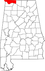 | |
| Towns | ||
| CDPs | ||
| Unincorporated communities | ||