Cloverdale, Lauderdale County, Alabama
| Cloverdale, Alabama | |
|---|---|
| Unincorporated community | |
 Cloverdale, Alabama  Cloverdale, Alabama | |
| Coordinates: 34°56′19″N 87°46′17″W / 34.93861°N 87.77139°WCoordinates: 34°56′19″N 87°46′17″W / 34.93861°N 87.77139°W | |
| Country | United States |
| State | Alabama |
| County | Lauderdale |
| Elevation | 597 ft (182 m) |
| Time zone | Central (CST) (UTC-6) |
| • Summer (DST) | CDT (UTC-5) |
| ZIP code | 35617 |
| Area code(s) | 256 & 938 |
| GNIS feature ID | 116285[1] |
Cloverdale, also known as Raw Hide, is an unincorporated community in Lauderdale County, Alabama, United States. Cloverdale is located on Alabama State Route 157, 11 miles (18 km) north-northwest of Florence. Cloverdale has a post office with ZIP code 35617, which opened on April 8, 1872.[2][3]
Cloverdale is bordered by Waterloo to the west, Oakland to the south, and Underwood-Petersville to the southeast.
The community was formerly known as Raw Hide and was home to a large tan yard.[4] The name Cloverdale was adopted in 1889 for the abundance of clover in the area.[5]
References
- ↑ "Cloverdale". Geographic Names Information System. United States Geological Survey.
- ↑ United States Postal Service (2012). "USPS - Look Up a ZIP Code". Retrieved 2012-02-15.
- ↑ "Postmaster Finder - Post Offices by ZIP Code". United States Postal Service. Retrieved January 17, 2013.
- ↑ William Lindsey McDonald (2003). Civil War Tales of the Tennessee Valley. Heart of Dixie Publishing. p. 72. ISBN 978-0-9719946-7-6.
- ↑ "What's the origin of your town's name?". Times Daily. June 3, 2006. pp. 4A. Retrieved 18 October 2015.
Municipalities and communities of Lauderdale County, Alabama, United States | ||
|---|---|---|
| Cities | 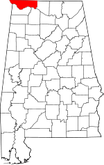 | |
| Towns | ||
| CDPs | ||
| Unincorporated communities | ||
This article is issued from Wikipedia - version of the 10/21/2016. The text is available under the Creative Commons Attribution/Share Alike but additional terms may apply for the media files.