South Williamson, Kentucky
Coordinates: 37°40′19″N 82°17′03″W / 37.67194°N 82.28417°W
| South Williamson, Kentucky | |
|---|---|
| Census-designated place (CDP) | |
|
The town is protected by a floodwall along the Tug Fork River | |
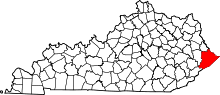
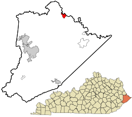 Location in Pike County and the state of Kentucky. | |
| Population (2010) | |
| • Total | 602 |
| Zip codes | 41503, 41514 & 41527 |
| Area code(s) | 606 |

South Williamson is a census-designated place (CDP) in the Appalachian Mountains of northeastern Pike County, Kentucky, United States, on the border with West Virginia. It is separated from Williamson, West Virginia by the Tug Fork River. The community is located near U.S. Route 119 about 23 miles (37 km) east of Pikeville, Kentucky and 28 miles (45 km) southwest of Logan, West Virginia.
The South Williamson area incorporates the surrounding Kentucky communities of Goody, Forest Hills, Toler, and Belfry. In the early 1990s, residents of the area voted down a proposal to incorporate the area.
South Williamson is home to the South Side Mall which is the only mall in the area.
The zip code of 41503 (South Williamson), and 41527 (Forest Hills) are the 2nd and 3rd (respectively) wealthiest portions of the county. 41503 is the 61st wealthiest in Kentucky and 41527 is the 63rd wealthiest. The average income for these areas are $49,345 (41503), and $48,484 (41527).
The local economy is largely fueled by coal mining, transportation, health care, and retail.
History
In the late 19th century, Pike County and bordering Mingo County, West Virginia provided the setting for the Hatfield-McCoy feud, a bitter feud waged between two feuding families between 1878 and 1891 that has become American history.
Flooding
South Williamson is protected by a floodwall, built by the US Army Corps of Engineers in response to a devastating flood along the Tug Fork River in 1977. There have only been two uses of the gates thus far; the first occurred in 2002 during a major flood in the region, and the second in 2003, due to anticipation of the rising river getting higher.
Geography
South Williamson is located at 37°40′14″N 82°17′5″W / 37.67056°N 82.28472°W (37.67059, -82.28465).[1]
Healthcare
South Williamson is the location of Appalachian Regional Healthcare's Tug Valley Regional Medical Center.
Schools
- Southside Elementary
- Belfry Middle
- Belfry High School
References
- ↑ "US Gazetteer files: 2010, 2000, and 1990". United States Census Bureau. 2011-02-12. Retrieved 2011-04-23.