South Harrison Township, New Jersey
| South Harrison Township, New Jersey | |
|---|---|
| Township | |
| Township of South Harrison | |
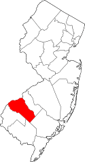
 South Harrison Township highlighted in Gloucester County. Inset map: Gloucester County highlighted in the State of New Jersey. | |
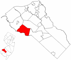
 Census Bureau map of South Harrison Township, New Jersey | |
| Coordinates: 39°41′37″N 75°15′14″W / 39.693596°N 75.253779°WCoordinates: 39°41′37″N 75°15′14″W / 39.693596°N 75.253779°W[1][2] | |
| Country |
|
| State |
|
| County |
|
| Incorporated | March 2, 1883 |
| Government[3] | |
| • Type | Township |
| • Body | Township Committee |
| • Mayor | James McCall (R, term ends December 31, 2016)[4][5] |
| • Clerk | Nancy Kearns[6] |
| Area[1] | |
| • Total | 15.731 sq mi (40.744 km2) |
| • Land | 15.677 sq mi (40.604 km2) |
| • Water | 0.054 sq mi (0.140 km2) 0.34% |
| Area rank |
172nd of 566 in state 11th of 24 in county[1] |
| Elevation[7] | 118 ft (36 m) |
| Population (2010 Census)[8][9][10] | |
| • Total | 3,162 |
| • Estimate (2015)[11] | 3,138 |
| • Rank |
446th of 566 in state 19th of 24 in county[12] |
| • Density | 201.7/sq mi (77.9/km2) |
| • Density rank |
505th of 566 in state 24th of 24 in county[12] |
| Time zone | Eastern (EST) (UTC-5) |
| • Summer (DST) | Eastern (EDT) (UTC-4) |
| ZIP code | 08039 - Harrisonville[13] |
| Area code(s) | 856[14] |
| FIPS code | 3401569030[1][15][16] |
| GNIS feature ID | 0882145[1][17] |
| Website |
www |
South Harrison Township is a township in Gloucester County, New Jersey, United States. As of the 2010 United States Census, the township's population was 3,162,[8][9][10] reflecting an increase of 745 (+30.8%) from the 2,417 counted in the 2000 Census, which had in turn increased by 498 (+26.0%) from the 1,919 counted in the 1990 Census.[18]
South Harrison was formed as a township by an act of the New Jersey Legislature on March 2, 1883, from portions of Harrison Township. Elk Township was formed from portions of South Harrison Township on April 17, 1891.[19] It is a dry town, where alcohol cannot be sold, though alcohol is available at the winery in the township.[20][21]
Geography
According to the United States Census Bureau, the township had a total area of 15.731 square miles (40.744 km2), including 15.677 square miles (40.604 km2) of land and 0.054 square miles (0.140 km2) of water (0.34%).[1][2]
Unincorporated communities, localities and place names located partially or completely within the township include Cedar Grove, Harrisonville (served as ZIP code 08039), Jessups Mills and Lincoln.[22]
The township borders Woolwich Township, Harrison Township, Elk Township, and Salem County.
Demographics
| Historical population | |||
|---|---|---|---|
| Census | Pop. | %± | |
| 1890 | 971 | — | |
| 1900 | 706 | * | −27.3% |
| 1910 | 694 | −1.7% | |
| 1920 | 583 | −16.0% | |
| 1930 | 680 | 16.6% | |
| 1940 | 686 | 0.9% | |
| 1950 | 868 | 26.5% | |
| 1960 | 974 | 12.2% | |
| 1970 | 1,226 | 25.9% | |
| 1980 | 1,486 | 21.2% | |
| 1990 | 1,919 | 29.1% | |
| 2000 | 2,417 | 26.0% | |
| 2010 | 3,162 | 30.8% | |
| Est. 2015 | 3,138 | [11][23] | −0.8% |
| Population sources: 1890-2000[24] 1890-1920[25] 1890[26] 1890-1910[27] 1910-1930[28] 1930-1990[29] 2000[30][31] 2010[8][9][10] * = Lost territory in previous decade.[19] | |||
Census 2010
The 2010 United States Census counted 3,162 people, 1,020 households, and 861.9 families residing in the township. The population density was 201.7 per square mile (77.9/km2). The township contained 1,056 housing units at an average density of 67.4 per square mile (26.0/km2). The racial makeup of the township was 91.59% (2,896) White, 5.06% (160) Black or African American, 0.00% (0) Native American, 1.20% (38) Asian, 0.03% (1) Pacific Islander, 0.95% (30) from other races, and 1.17% (37) from two or more races. Hispanics or Latinos of any race were 3.10% (98) of the population.[8]
Out of a total of 1,020 households, 42.1% had children under the age of 18 living with them, 73.1% were married couples living together, 7.6% had a female householder with no husband present, and 15.5% were non-families. 11.5% of all households were made up of individuals, and 4.8% had someone living alone who was 65 years of age or older. The average household size was 3.10 and the average family size was 3.36.[8]
In the township, 28.7% of the population were under the age of 18, 6.3% from 18 to 24, 24.0% from 25 to 44, 30.6% from 45 to 64, and 10.4% who were 65 years of age or older. The median age was 40.4 years. For every 100 females the census counted 95.8 males, but for 100 females at least 18 years old, it was 97.5 males.[8]
The Census Bureau's 2006-2010 American Community Survey showed that (in 2010 inflation-adjusted dollars) median household income was $106,667 (with a margin of error of +/- $12,029) and the median family income was $113,875 (+/- $14,397). Males had a median income of $84,408 (+/- $4,334) versus $55,750 (+/- $10,554) for females. The per capita income for the borough was $34,515 (+/- $3,976). About 2.0% of families and 10.4% of the population were below the poverty line, including 3.8% of those under age 18 and 8.1% of those age 65 or over.[32]
Census 2000
As of the 2000 United States Census[15] there were 2,417 people, 800 households, and 663 families residing in the township. The population density was 153.0 people per square mile (59.1/km²). There were 829 housing units at an average density of 52.5 per square mile (20.3/km²). The racial makeup of the township was 93.09% White, 3.76% African American, 0.04% Native American, 0.29% Asian, 0.04% Pacific Islander, 2.19% from other races, and 0.58% from two or more races. Hispanic or Latino of any race were 3.43% of the population.[30][31]
There were 800 households out of which 41.1% had children under the age of 18 living with them, 71.9% were married couples living together, 7.8% had a female householder with no husband present, and 17.1% were non-families. 13.4% of all households were made up of individuals and 5.0% had someone living alone who was 65 years of age or older. The average household size was 2.94 and the average family size was 3.25.[30][31]
In the township the population was spread out with 26.9% under the age of 18, 7.1% from 18 to 24, 28.9% from 25 to 44, 27.8% from 45 to 64, and 9.4% who were 65 years of age or older. The median age was 38 years. For every 100 females there were 102.4 males. For every 100 females age 18 and over, there were 105.7 males.[30][31]
The median income for a household in the township was $68,491, and the median income for a family was $76,390. Males had a median income of $55,313 versus $32,337 for females. The per capita income for the township was $25,968. About 4.1% of families and 8.0% of the population were below the poverty line, including 7.7% of those under age 18 and 8.0% of those age 65 or over.[30][31]
Government
Local government
South Harrison Township is governed under the Township form of government. The five-member Township Committee is elected directly by the voters at-large in partisan elections to serve three-year terms of office on a staggered basis, with either one or two seats coming up for election each year as part of the November general election in a three-year cycle.[3][33] At an annual reorganization meeting, the Township Committee selects one of its members to serve as Mayor and another as Deputy Mayor.[4]
As of 2016, members of the South Harrison Township Committee are Mayor James McCall (R, term on committee ends December 31, 2018; term as mayor ends 2016), Deputy Mayor Robert Diaz (R, term on committee ends 2017; term as deputy mayor ends 2016), John Horner (R, 2018), Mary Howard (R, 2016) and Robert Schenk (R, 2017).[4][34][35][36][37][38]
In 2007, Charles Tyson was elected Mayor, the first African American to hold the post.[39][40] He was re-elected in 2008. In 2009, however, he declined to seek re-election to a third term, citing the death threats and racist vandalism that had arisen.[40] He had received threatening phone calls and emails, his tires were slashed, and "KKK" was written on a sign on his lawn.[41] A federal indictment has charged a white supremacist from Virginia, Bill White, with "communicating threats in interstate commerce", based on White's emails to Tyson and phone calls to Tyson's wife in 2008.[42][43][44] No arrests have been made, however, in connection with the incidents in 2007,[45] even though the town posted a $24,000 reward.[43]
Federal, state and county representation
South Harrison Township is located in the 2nd Congressional District[46] and is part of New Jersey's 3rd state legislative district.[9][47][48]
New Jersey's Second Congressional District is represented by Frank LoBiondo (R, Ventnor City).[49] New Jersey is represented in the United States Senate by Cory Booker (D, Newark, term ends 2021)[50] and Bob Menendez (D, Paramus, 2019).[51][52]
For the 2016–2017 session (Senate, General Assembly), the 3rd Legislative District of the New Jersey Legislature is represented in the State Senate by Stephen M. Sweeney (D, West Deptford Township) and in the General Assembly by John J. Burzichelli (D, Paulsboro) and Adam Taliaferro (D, Woolwich Township).[53] The Governor of New Jersey is Chris Christie (R, Mendham Township).[54] The Lieutenant Governor of New Jersey is Kim Guadagno (R, Monmouth Beach).[55]
Gloucester County is governed by a Board of Chosen Freeholders, whose seven members are elected at-large to three-year terms of office on a staggered basis in partisan elections, with two or three seats coming up for election each year. At a reorganization meeting held each January, the Board selects a Freeholder Director and a Deputy Freeholder Director from among its members. As of 2016, Gloucester County's Freeholders are Freeholder Director Robert M. Damminger (D, West Deptford Township; term ends December 31, 2018),[56] Deputy Freeholder Director Giuseppe "Joe" Chila (D, Woolwich Township; 2018),[57] Lyman J. Barnes (D, Logan Township; 2017),[58] Daniel Christy (D, Washington Township; 2016),[59] Frank J. DiMarco (D, Deptford Township; 2016),[60] Heather Simmons (D, Glassboro; 2017)[61] and Jim Jefferson (D, Woodbury; 2017).[62][63][64][65] Constitutional officers elected countywide are County Clerk James N. Hogan,[66] Surrogate Helene M. Reed (Monroe Township)[67] and Sheriff Carmel Morina (Greenwich Township).[68][69][64]
Politics
As of March 23, 2011, there were a total of 2,146 registered voters in South Harrison, of which 733 (34.2%) were registered as Democrats, 626 (29.2%) were registered as Republicans and 785 (36.6%) were registered as Unaffiliated. There were 2 voters registered to other parties.[70]
In the 2012 presidential election, Republican Mitt Romney received 60.9% of the vote (1,008 cast), ahead of Democrat Barack Obama with 37.8% (625 votes), and other candidates with 1.3% (21 votes), among the 1,666 ballots cast by the township's 2,238 registered voters (12 ballots were spoiled), for a turnout of 74.4%.[71][72] In the 2008 presidential election, Republican John McCain received 56.2% of the vote (979 cast), ahead of Democrat Barack Obama with 41.2% (717 votes) and other candidates with 1.9% (33 votes), among the 1,741 ballots cast by the township's 2,168 registered voters, for a turnout of 80.3%.[73] In the 2004 presidential election, Republican George W. Bush received 60.8% of the vote (869 ballots cast), outpolling Democrat John Kerry with 38.3% (548 votes) and other candidates with 0.4% (8 votes), among the 1,429 ballots cast by the township's 1,792 registered voters, for a turnout percentage of 79.7.[74]
In the 2013 gubernatorial election, Republican Chris Christie received 72.6% of the vote (709 cast), ahead of Democrat Barbara Buono with 24.9% (243 votes), and other candidates with 2.6% (25 votes), among the 996 ballots cast by the township's 2,218 registered voters (19 ballots were spoiled), for a turnout of 44.9%.[75][76] In the 2009 gubernatorial election, Republican Chris Christie received 58.7% of the vote (666 ballots cast), ahead of Democrat Jon Corzine with 31.4% (356 votes), Independent Chris Daggett with 7.8% (89 votes) and other candidates with 0.8% (9 votes), among the 1,134 ballots cast by the township's 2,175 registered voters, yielding a 52.1% turnout.[77]
Education
The South Harrison Township School District serves public school students in pre-Kindergarten through sixth grade at South Harrison Township Elementary School. As of the 2012-13 school year, the district's one school had an enrollment of 347 students and 27.2 classroom teachers (on an FTE basis), for a student–teacher ratio of 12.76:1.[78]
Public school students in seventh through twelfth grades are educated by the Kingsway Regional School District, which also serves students from East Greenwich Township, Swedesboro and Woolwich Township, with the addition of students from Logan Township who attend as part of a sending/receiving relationship in which tuition is paid on a per-pupil basis by the Logan Township School District.[79][80] As of the 2011-12 school year, the district's two schools had an enrollment of 2,060 students and 154.0 classroom teachers (on an FTE basis), for a student–teacher ratio of 13.38:1.[81] Schools in the district (with 2012-13 enrollment data from the National Center for Education Statistics[82]) are Kingsway Regional Middle School[83] with 830 students in grades 7-8 and Kingsway Regional High School[84] with 1,530 students in grades 9-12.[85] Under a 2011 proposal, Kingsway would merge with its constituent member's K-6 districts to become a full K-12 district, with various options for including Logan Township as part of the consolidated district.[86]
Transportation
As of May 2010, the township had a total of 47.93 miles (77.14 km) of roadways, of which 22.43 miles (36.10 km) were maintained by the municipality, 21.96 miles (35.34 km) by Gloucester County and 3.54 miles (5.70 km) by the New Jersey Department of Transportation.[87]
Route 45 (Woodstown-Mullica Hill Road) traverses the township southwest-to-northeast, from the border with Pilesgrove Township to Harrison Township.[88] County Route 538 (Swedesboro Road) crosses along the northern portion of the township from Woolwich Township in the northwest to Elk Township to the southeast.[89] County Route 581 (Commissioners Pike) crosses from Upper Pittsgrove Township in the south to Harrison Township in the north.[90]
Wineries
References
- 1 2 3 4 5 6 2010 Census Gazetteer Files: New Jersey County Subdivisions, United States Census Bureau. Accessed May 21, 2015.
- 1 2 US Gazetteer files: 2010, 2000, and 1990, United States Census Bureau. Accessed September 4, 2014.
- 1 2 2012 New Jersey Legislative District Data Book, Rutgers University Edward J. Bloustein School of Planning and Public Policy, March 2013, p. 19.
- 1 2 3 Mayor & Committee, South Harrison Township. Accessed July 6, 2016.
- ↑ 2016 New Jersey Mayors Directory, New Jersey Department of Community Affairs. Accessed June 14, 2016.
- ↑ Township Clerk, South Harrison Township. Accessed July 6, 2016.
- ↑ U.S. Geological Survey Geographic Names Information System: Township of South Harrison, Geographic Names Information System. Accessed March 14, 2013.
- 1 2 3 4 5 6 DP-1 - Profile of General Population and Housing Characteristics: 2010 for South Harrison township, Gloucester County, New Jersey, United States Census Bureau. Accessed November 8, 2012.
- 1 2 3 4 Municipalities Grouped by 2011-2020 Legislative Districts, New Jersey Department of State, p. 3. Accessed January 6, 2013.
- 1 2 3 Profile of General Demographic Characteristics: 2010 for South Harrison township, New Jersey Department of Labor and Workforce Development. Accessed November 8, 2012.
- 1 2 PEPANNRES - Annual Estimates of the Resident Population: April 1, 2010 to July 1, 2015 - 2015 Population Estimates for New Jersey municipalities, United States Census Bureau. Accessed May 22, 2016.
- 1 2 GCT-PH1 Population, Housing Units, Area, and Density: 2010 - State -- County Subdivision from the 2010 Census Summary File 1 for New Jersey, United States Census Bureau. Accessed November 8, 2012.
- ↑ Look Up a ZIP Code for Harrisonville, NJ, United States Postal Service. Accessed November 8, 2012.
- ↑ Area Code Lookup - NPA NXX for South Harrison, NJ, Area-Codes.com. Accessed November 5, 2013.
- 1 2 American FactFinder, United States Census Bureau. Accessed September 4, 2014.
- ↑ A Cure for the Common Codes: New Jersey, Missouri Census Data Center. Accessed October 30, 2012.
- ↑ US Board on Geographic Names, United States Geological Survey. Accessed September 4, 2014.
- ↑ Table 7. Population for the Counties and Municipalities in New Jersey: 1990, 2000 and 2010, New Jersey Department of Labor and Workforce Development, February 2011. Accessed November 8, 2012.
- 1 2 Snyder, John P. The Story of New Jersey's Civil Boundaries: 1606-1968, Bureau of Geology and Topography; Trenton, New Jersey; 1969. p. 140. Accessed October 25, 2012.
- ↑ New Jersey Division of Alcoholic Beverage Control. New Jersey ABC list of dry towns (May 1, 2013)
- ↑ Giordano, Rita. "More towns catching liquor-license buzz; Moorestown considers ending its dry spell", The Philadelphia Inquirer, June 24, 2007. Accessed February 16, 2014.
- ↑ Locality Search, State of New Jersey. Accessed May 21, 2015.
- ↑ Census Estimates for New Jersey April 1, 2010 to July 1, 2015, United States Census Bureau. Accessed May 22, 2016.
- ↑ Barnett, Bob. "Population Data for Gloucester County Municipalities, 1800 - 2000, WestJersey.org, January 6, 2011. Accessed November 8, 2012.
- ↑ Compendium of censuses 1726-1905: together with the tabulated returns of 1905, New Jersey Department of State, 1906. Accessed November 5, 2013.
- ↑ Porter, Robert Percival. Preliminary Results as Contained in the Eleventh Census Bulletins: Volume III - 51 to 75, p. 98. United States Census Bureau, 1890. Accessed November 5, 2013.
- ↑ Thirteenth Census of the United States, 1910: Population by Counties and Minor Civil Divisions, 1910, 1900, 1890, United States Census Bureau, p. 336. Accessed November 8, 2012.
- ↑ Fifteenth Census of the United States : 1930 - Population Volume I, United States Census Bureau, p. 716. Accessed November 8, 2012.
- ↑ New Jersey Resident Population by Municipality: 1930 - 1990, Workforce New Jersey Public Information Network. Accessed June 28, 2015.
- 1 2 3 4 5 Census 2000 Profiles of Demographic / Social / Economic / Housing Characteristics for South Harrison township, Gloucester County, New Jersey, United States Census Bureau. Accessed November 8, 2012.
- 1 2 3 4 5 DP-1: Profile of General Demographic Characteristics: 2000 - Census 2000 Summary File 1 (SF 1) 100-Percent Data for South Harrison township, Gloucester County, New Jersey, United States Census Bureau. Accessed November 8, 2012.
- ↑ DP03: Selected Economic Characteristics from the 2006-2010 American Community Survey 5-Year Estimates for South Harrison township, Gloucester County, New Jersey, United States Census Bureau. Accessed November 8, 2012.
- ↑ "Forms of Municipal Government in New Jersey", p. 7. Rutgers University Center for Government Studies. Accessed June 3, 2015.
- ↑ 2016 Municipal User Friendly Budget, South Harrison Township. Accessed July 6, 2016.
- ↑ Gloucester County 2016 Official Directory, Gloucester County, New Jersey. Accessed July 5, 2016.
- ↑ General Election November 3, 2015 Unofficial Results, Gloucester County, New Jersey Clerk, updated November 9, 2015. Accessed July 5, 2016.
- ↑ 2014 General Election Unofficial Results, Gloucester County, New Jersey Clerk, updated November 13, 2014. Accessed July 5, 2016.
- ↑ 2013 General Election November 5, 2013 Summary Report Gloucester County, Gloucester County, New Jersey Clerk, updated March 10, 2014. Accessed July 5, 2016.
- ↑ Cox, Paul. "Gloucester County mayor who received racist threats declines term", The Star-Ledger, January 07, 2009.
- 1 2 "Former South Harrison mayor who endured death threats steps down from council", Associated Press via NJ.com, November 10, 2009.
- ↑ Morlock, Jackie; and Araiza, Karen. "N.J. Mayor Steps Down Claiming Racism", WCAU, July 17, 2009. Accessed March 9, 2015.
- ↑ "Leader of American National Socialist Workers Party Indicted" (Press release). United States Department of Justice. December 11, 2008. Retrieved February 3, 2009.
- 1 2 "Obama Signs Order to Fund Abortion Education Abroad; Obama Plan to Close GITMO Sparks Debate". Transcript. CNN. January 24, 2009. Retrieved February 3, 2009.
- ↑ Racism wins in NJ town (Video). CNN. January 24, 2009. Retrieved February 3, 2009.
- ↑ Hefler, Jan. "S. Harrison mayor steps down over racism", The Philadelphia Inquirer, January 7, 2009, backed up by the Internet Archive as of March 23, 2009. Accessed October 7, 2015. "Charles Tyson has decided not to serve a third term as mayor of South Harrison Township, saying he and his family have endured death threats and racist vandalism since he became the town's first black mayor two years ago. At a township reorganization meeting on Monday, the 66-year-old Tyson declined a nomination to continue serving as mayor but agreed to be deputy mayor.... No arrests were made, and investigators said the caller or callers in 2007 used untraceable disposable phones."
- ↑ Plan Components Report, New Jersey Redistricting Commission, December 23, 2011. Accessed January 6, 2013.
- ↑ 2016 New Jersey Citizen's Guide to Government, p. 64, New Jersey League of Women Voters. Accessed July 20, 2016.
- ↑ Districts by Number for 2011-2020, New Jersey Legislature. Accessed January 6, 2013.
- ↑ Directory of Representatives: New Jersey, United States House of Representatives. Accessed January 5, 2012.
- ↑ About Cory Booker, United States Senate. Accessed January 26, 2015. "He now owns a home and lives in Newark's Central Ward community."
- ↑ Biography of Bob Menendez, United States Senate, January 26, 2015. "He currently lives in Paramus and has two children, Alicia and Robert."
- ↑ Senators of the 114th Congress from New Jersey. United States Senate. Accessed January 26, 2015. "Booker, Cory A. - (D - NJ) Class II; Menendez, Robert - (D - NJ) Class I"
- ↑ Legislative Roster 2016-2017 Session, New Jersey Legislature. Accessed January 17, 2016.
- ↑ "About the Governor". State of New Jersey. Retrieved 2010-01-21.
- ↑ "About the Lieutenant Governor". State of New Jersey. Retrieved 2010-01-21.
- ↑ Robert M. Damminger, Gloucester County, New Jersey. Accessed February 3, 2016.
- ↑ Giuseppe (Joe) Chila, Gloucester County, New Jersey. Accessed February 3, 2016.
- ↑ Lyman Barnes, Gloucester County, New Jersey. Accessed February 3, 2016.
- ↑ Daniel Christy, Gloucester County, New Jersey. Accessed February 3, 2016.
- ↑ Frank J. DiMarco, Gloucester County, New Jersey. Accessed February 3, 2016.
- ↑ Heather Simmons, Gloucester County, New Jersey. Accessed February 3, 2016.
- ↑ Jim Jefferson, Gloucester County, New Jersey. Accessed February 3, 2016.
- ↑ Board of Freeholders, Gloucester County, New Jersey. Accessed February 3, 2016.
- 1 2 2014 Gloucester County Official Directory, Gloucester County, New Jersey. Accessed September 12, 2014.
- ↑ 2014 County Data Sheet, Gloucester County, New Jersey. Accessed September 12, 2014.
- ↑ James N. Hogan, Gloucester County, New Jersey. Accessed February 3, 2016.
- ↑ Surrogate Helene M. Reed, Gloucester County, New Jersey. Accessed February 3, 2016.
- ↑ Sheriff Carmel M. Morina, Gloucester County, New Jersey. Accessed February 3, 2016.
- ↑ Row Officers, Gloucester County, New Jersey. Accessed February 3, 2016.
- ↑ Voter Registration Summary - Gloucester, New Jersey Department of State Division of Elections, March 23, 2011. Accessed November 8, 2012.
- ↑ "Presidential General Election Results - November 6, 2012 - Gloucester County" (PDF). New Jersey Department of Elections. March 15, 2013. Retrieved December 24, 2014.
- ↑ "Number of Registered Voters and Ballots Cast - November 6, 2012 - General Election Results - Gloucester County" (PDF). New Jersey Department of Elections. March 15, 2013. Retrieved December 24, 2014.
- ↑ 2008 Presidential General Election Results: Gloucester County, New Jersey Department of State Division of Elections, December 23, 2008. Accessed November 8, 2012.
- ↑ 2004 Presidential Election: Gloucester County, New Jersey Department of State Division of Elections, December 13, 2004. Accessed November 8, 2012.
- ↑ "Governor - Gloucester County" (PDF). New Jersey Department of Elections. January 29, 2014. Retrieved December 24, 2014.
- ↑ "Number of Registered Voters and Ballots Cast - November 5, 2013 - General Election Results - Gloucester County" (PDF). New Jersey Department of Elections. January 29, 2014. Retrieved December 24, 2014.
- ↑ 2009 Governor: Gloucester County, New Jersey Department of State Division of Elections, December 31, 2009. Accessed November 8, 2012.
- ↑ District information for South Harrison Township School District, National Center for Education Statistics. Accessed March 9, 2015.
- ↑ Kingsway Regional School District 2015 Report Card Narrative, New Jersey Department of Education. Accessed May 27, 2016. "Kingsway is situated in a predominately rural/suburban area, with more than 20,000 people residing within its 52 square mile border. The District includes the Borough of Swedesboro and the Townships of South Harrison, East Greenwich, and Woolwich. Though not part of the District, students from Logan Township attend Kingsway High School through a send/receive relationship as paid tuition students."
- ↑ School Profile, Kingsway Regional School District. Accessed December 9, 2014. "The District includes Swedesboro and the Townships of South Harrison, East Greenwich and Woolwich. Though not part of the District, students from Logan Township attend Kingsway High School through a send/receive relationship as paid tuition students."
- ↑ District information for Kingsway Regional School District, National Center for Education Statistics. Accessed December 9, 2014.
- ↑ School Data for the Kingsway Regional School District, National Center for Education Statistics. Accessed March 9, 2015.
- ↑ Kingsway Regional Middle School, Kingsway Regional School District. Accessed December 9, 2014.
- ↑ Kingsway Regional Middle School, Kingsway Regional School District. Accessed December 9, 2014.
- ↑ New Jersey School Directory for the Kingsway Regional School District, New Jersey Department of Education. Accessed December 9, 2014.
- ↑ Forand, Rebecca. "Kingsway districts may see change", Gloucester County Times, April 7, 2011. Accessed December 9, 2014. "A study is being planned to evaluate the fiscal feasibility of the regionalization of the school districts associated with the Kingsway Regional district, and the impact of continuing or severing the current relationship the district has with Logan Township. Woolwich township, Swedesboro, East Greenwich Township and South Harrison Township all currently feed their elementary students to the Kingsway Regional district for middle and high school, with Logan Township sending students to the high school on a tuition basis. The study will address the fiscal feasibility of regionalizing Kingsway, East Greenwich, South Harrison and Swedesboro-Woolwich."
- ↑ Gloucester County Mileage by Municipality and Jurisdiction, New Jersey Department of Transportation, May 2010. Accessed November 5, 2013.
- ↑ Route 45 Straight Line Diagram, New Jersey Department of Transportation, January 2010. Accessed November 5, 2013.
- ↑ County Route 538 Straight Line Diagram, New Jersey Department of Transportation, May 2007. Accessed November 5, 2013.
- ↑ County Route 581 Straight Line Diagram, New Jersey Department of Transportation, October 2006. Accessed November 5, 2013.
External links
- South Harrison Township website
- South Harrison Township Elementary School
- South Harrison Township Elementary School's 2014–15 School Report Card from the New Jersey Department of Education
- School Data for the South Harrison Township Elementary School, National Center for Education Statistics
- Kingsway Regional High School