Soligny-les-Étangs
| Soligny-les-Étangs | |
|---|---|
|
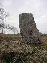
Menhir | |
 Soligny-les-Étangs | |
|
Location within Grand Est region  Soligny-les-Étangs | |
| Coordinates: 48°24′29″N 3°30′38″E / 48.4081°N 3.5106°ECoordinates: 48°24′29″N 3°30′38″E / 48.4081°N 3.5106°E | |
| Country | France |
| Region | Grand Est |
| Department | Aube |
| Arrondissement | Nogent-sur-Seine |
| Canton | Nogent-sur-Seine |
| Intercommunality | Nogentais |
| Government | |
| • Mayor (2008–2014) | Raphaëlle Lanthiez |
| Area1 | 15.94 km2 (6.15 sq mi) |
| Population (2008)2 | 220 |
| • Density | 14/km2 (36/sq mi) |
| Time zone | CET (UTC+1) |
| • Summer (DST) | CEST (UTC+2) |
| INSEE/Postal code | 10370 / 10400 |
|
1 French Land Register data, which excludes lakes, ponds, glaciers > 1 km² (0.386 sq mi or 247 acres) and river estuaries. 2 Population without double counting: residents of multiple communes (e.g., students and military personnel) only counted once. | |
Soligny-les-Étangs is a commune in the Aube department in north-central France.
Population
| Historical population | ||
|---|---|---|
| Year | Pop. | ±% |
| 1962 | 160 | — |
| 1968 | 196 | +22.5% |
| 1975 | 151 | −23.0% |
| 1982 | 133 | −11.9% |
| 1990 | 146 | +9.8% |
| 1999 | 180 | +23.3% |
| 2008 | 220 | +22.2% |
See also
References
| Wikimedia Commons has media related to Soligny-les-Étangs. |
This article is issued from Wikipedia - version of the 2/23/2013. The text is available under the Creative Commons Attribution/Share Alike but additional terms may apply for the media files.