Bréviandes
| Bréviandes | ||
|---|---|---|
| ||
 Bréviandes | ||
|
Location within Grand Est region  Bréviandes | ||
| Coordinates: 48°15′25″N 4°05′47″E / 48.2569°N 4.0964°ECoordinates: 48°15′25″N 4°05′47″E / 48.2569°N 4.0964°E | ||
| Country | France | |
| Region | Grand Est | |
| Department | Aube | |
| Arrondissement | Troyes | |
| Canton | Troyes-7 | |
| Intercommunality | Troyenne | |
| Government | ||
| • Mayor (2008–2014) | Thierry Blasco | |
| Area1 | 6.14 km2 (2.37 sq mi) | |
| Population (2012)2 | 2,416 | |
| • Density | 390/km2 (1,000/sq mi) | |
| Time zone | CET (UTC+1) | |
| • Summer (DST) | CEST (UTC+2) | |
| INSEE/Postal code | 10060 / 10450 | |
| Elevation |
109–131 m (358–430 ft) (avg. 117 m or 384 ft) | |
|
1 French Land Register data, which excludes lakes, ponds, glaciers > 1 km² (0.386 sq mi or 247 acres) and river estuaries. 2 Population without double counting: residents of multiple communes (e.g., students and military personnel) only counted once. | ||

Bréviandes is a commune in the Aube department in north-central France.
Population
| Historical population | ||
|---|---|---|
| Year | Pop. | ±% |
| 1962 | 925 | — |
| 1968 | 1,095 | +18.4% |
| 1975 | 1,501 | +37.1% |
| 1982 | 1,683 | +12.1% |
| 1990 | 1,687 | +0.2% |
| 1999 | 1,926 | +14.2% |
| 2008 | 2,212 | +14.8% |
| 2012 | 2,416 | +9.2% |
See also
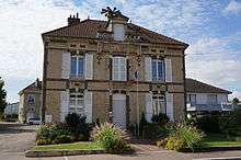
City Hall
References
| Wikimedia Commons has media related to Bréviandes. |
This article is issued from Wikipedia - version of the 9/17/2015. The text is available under the Creative Commons Attribution/Share Alike but additional terms may apply for the media files.