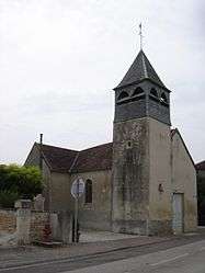
Montmartin-le-Haut
| Montmartin-le-Haut | |
|---|---|
 | |
 Montmartin-le-Haut | |
|
Location within Grand Est region  Montmartin-le-Haut | |
| Coordinates: 48°12′32″N 4°33′12″E / 48.2089°N 4.5533°ECoordinates: 48°12′32″N 4°33′12″E / 48.2089°N 4.5533°E | |
| Country | France |
| Region | Grand Est |
| Department | Aube |
| Arrondissement | Troyes |
| Canton | Essoyes |
| Intercommunality | Rivières |
| Government | |
| • Mayor (2008–2014) | Martine Moreau |
| Area1 | 1.61 km2 (0.62 sq mi) |
| Population (2008)2 | 58 |
| • Density | 36/km2 (93/sq mi) |
| Time zone | CET (UTC+1) |
| • Summer (DST) | CEST (UTC+2) |
| INSEE/Postal code | 10252 / 10140 |
|
1 French Land Register data, which excludes lakes, ponds, glaciers > 1 km² (0.386 sq mi or 247 acres) and river estuaries. 2 Population without double counting: residents of multiple communes (e.g., students and military personnel) only counted once. | |
Montmartin-le-Haut is a commune in the Aube department in north-central France.
Population
| Historical population | ||
|---|---|---|
| Year | Pop. | ±% |
| 1962 | 81 | — |
| 1968 | 89 | +9.9% |
| 1975 | 76 | −14.6% |
| 1982 | 69 | −9.2% |
| 1990 | 45 | −34.8% |
| 1999 | 57 | +26.7% |
| 2008 | 58 | +1.8% |
See also
References
| Wikimedia Commons has media related to Montmartin-le-Haut. |
This article is issued from Wikipedia - version of the 2/22/2013. The text is available under the Creative Commons Attribution/Share Alike but additional terms may apply for the media files.