Exeter Township, Michigan


Exeter Township is a civil township of Monroe County in the U.S. state of Michigan. The population was 3,727 at the 2000 census.
Geography
According to the United States Census Bureau, the township has a total area of 36.6 square miles (95 km2), of which 36.5 square miles (95 km2) is land and 0.1 square miles (0.26 km2) (0.25%) is water.
Demographics
As of the census[1] of 2000, there were 3,727 people, 1,262 households, and 1,004 families residing in the township. The population density was 102.0 per square mile (39.4/km²). There were 1,307 housing units at an average density of 35.8 per square mile (13.8/km²). The racial makeup of the township was 91.82% White, 6.14% African American, 0.30% Native American, 0.38% Asian, 0.03% Pacific Islander, 0.40% from other races, and 0.94% from two or more races. Hispanic or Latino of any race were 0.94% of the population.
There were 1,262 households out of which 37.1% had children under the age of 18 living with them, 68.8% were married couples living together, 6.7% had a female householder with no husband present, and 20.4% were non-families. 16.2% of all households were made up of individuals and 5.6% had someone living alone who was 65 years of age or older. The average household size was 2.95 and the average family size was 3.33.
In the township the population was spread out with 27.7% under the age of 18, 8.1% from 18 to 24, 31.1% from 25 to 44, 23.5% from 45 to 64, and 9.6% who were 65 years of age or older. The median age was 36 years. For every 100 females there were 104.7 males. For every 100 females age 18 and over, there were 105.8 males.
The median income for a household in the township was $63,806, and the median income for a family was $69,429. Males had a median income of $50,718 versus $26,818 for females. The per capita income for the township was $24,308. About 2.7% of families and 4.8% of the population were below the poverty line, including 8.1% of those under age 18 and 5.0% of those age 65 or over.
Communities
Maybee
Maybee is a village in southwestern Exeter Township at 42°00′14″N 83°30′56″W / 42.00389°N 83.51556°W. It was established in 1873 and incorporated as a village in 1899. The population was 505 at the 2000 census. It is the only incorporated municipality within the township.
Scofield

Scofield is a small unincorporated community about two miles (1.2 km) northeast of Maybee. It is located at 42°01′17″N 83°28′55″W / 42.02139°N 83.48194°W near the intersections of Scofield Road and Sumpter Road. As an unincorporated community, Scofield has no legal boundaries or demographic statistics of its own, and the community itself is under the control of the township.[4] Scofield is served by Monroe Public Schools.[5]
Scofield was once an incorporated village and contained its own post office, although it no longer holds any legal autonomy as a village. It was built along a railway line. In 1890, the township built its first township hall, which sits at 6158 Scofield Road. The Exeter Township Hall is designated as a Michigan State Historic Site.[3]
References
- 1 2 "American FactFinder". United States Census Bureau. Retrieved 2008-01-31.
- ↑ U.S. Geological Survey Geographic Names Information System: Exeter Township, Michigan
- 1 2 State of Michigan (2009). "Exeter Township Hall". Retrieved August 2, 2010.
- ↑ U.S. Geological Survey Geographic Names Information System: Exeter Township, Michigan
- ↑ Michigan Department of Information Technology (March 2008). "Monroe County school boundaries" (PDF). Retrieved February 23, 2010.
Municipalities and communities of Monroe County, Michigan, United States | ||
|---|---|---|
| Cities | 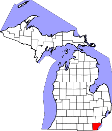 | |
| Villages | ||
| Charter townships | ||
| General law townships | ||
| CDPs | ||
| Other unincorporated communities | ||
| Footnotes | ‡This populated place also has portions in an adjacent county or counties | |