Lambertville, Michigan
| Lambertville, Michigan | |
|---|---|
| CDP | |
|
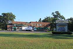
Olde Schoolhouse Commons, Monroe & Secor Rds. | |
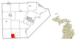 Location in Monroe County and the state of Michigan | |
| Coordinates: 41°45′57″N 83°37′41″W / 41.76583°N 83.62806°WCoordinates: 41°45′57″N 83°37′41″W / 41.76583°N 83.62806°W | |
| Country | United States |
| State | Michigan |
| County | Monroe |
| Township | Bedford Township |
| Area | |
| • Total | 6.1 sq mi (15.8 km2) |
| • Land | 6.1 sq mi (15.7 km2) |
| • Water | 0.02 sq mi (0.04 km2) |
| Elevation | 669 ft (204 m) |
| Population (2010) | |
| • Total | 9,953 |
| • Density | 1,600/sq mi (630/km2) |
| Time zone | Eastern (EST) (UTC-5) |
| • Summer (DST) | EDT (UTC-4) |
| ZIP code | 48144 |
| Area code(s) | 734 |
| FIPS code | 26-45420[1] |
| GNIS feature ID | 0630097[2] |
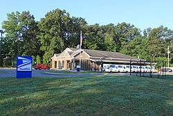
Lambertville is a census-designated place (CDP) in Monroe County in the U.S. state of Michigan. It is served by the Lambertville Post Office. The Lambertville ZIP code, 48144, serves the southwest part of Bedford Township and portions of adjacent Whiteford Township.[3] The CDP is entirely within Bedford Township, and the population was 9,953 at the 2010 census.[4]
History
The Lambertville post office opened as "West Erie" on June 13, 1834. The name changed to Lambertville on January 15, 1836. It was discontinued on March 23, 1865, and reestablished on December 4, 1865.[5] Lambertville was platted in 1888, and named for John Lambert, the original owner of the town site.[6]
Geography
According to the United States Census Bureau, the CDP has a total area of 6.1 square miles (16 km2), of which 6.1 square miles (16 km2) is land and 0.04 square miles (0.10 km2), or 0.33%, is water.
Demographics
As of the census[1] of 2000, there were 9,299 people, 3,315 households, and 2,665 families residing in the CDP. The population density was 1,530.1 per square mile (590.5/km²). There were 3,376 housing units at an average density of 555.5 per square mile (214.4/km²). The racial makeup of the CDP was 97.89% White, 0.33% African American, 0.06% Native American, 0.57% Asian, 0.34% from other races, and 0.80% from two or more races. Hispanic or Latino of any race were 1.69% of the population.
There were 3,315 households out of which 38.6% had children under the age of 18 living with them, 69.4% were married couples living together, 7.6% had a female householder with no husband present, and 19.6% were non-families. 16.0% of all households were made up of individuals and 7.1% had someone living alone who was 65 years of age or older. The average household size was 2.80 and the average family size was 3.15.
In the CDP the population was spread out with 28.1% under the age of 18, 6.5% from 18 to 24, 29.1% from 25 to 44, 26.2% from 45 to 64, and 10.1% who were 65 years of age or older. The median age was 38 years. For every 100 females there were 98.4 males. For every 100 females age 18 and over, there were 97.4 males.
The median income for a household in the CDP was $62,221, and the median income for a family was $69,911. Males had a median income of $51,989 versus $34,973 for females. The per capita income for the CDP was $26,475. About 3.2% of families and 4.8% of the population were below the poverty line, including 6.2% of those under age 18 and 7.1% of those age 65 or over.
References
- 1 2 "American FactFinder". United States Census Bureau. Retrieved 2008-01-31.
- ↑ U.S. Geological Survey Geographic Names Information System: Lambertville, Michigan
- ↑ 48144 5-Digit ZCTA, 481 3-Digit ZCTA - Reference Map - American FactFinder, U.S. Census Bureau, 2000 census
- ↑ "Geographic Identifiers: 2010 Demographic Profile Data (G001): Lambertville CDP, Michigan". U.S. Census Bureau, American Factfinder. Retrieved January 9, 2013.
- ↑ U.S. Geological Survey Geographic Names Information System: Lambertville Post Office
- ↑ "Some Historical Facts On Bedford Township". Toledo Blade. May 6, 1986. pp. N2. Retrieved 2 May 2015.
Municipalities and communities of Monroe County, Michigan, United States | ||
|---|---|---|
| Cities | 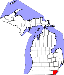 | |
| Villages | ||
| Charter townships | ||
| General law townships | ||
| CDPs | ||
| Other unincorporated communities | ||
| Footnotes | ‡This populated place also has portions in an adjacent county or counties | |