Flat Rock, Michigan
| Flat Rock, Michigan | |
|---|---|
| City | |
| City of Flat Rock | |
|
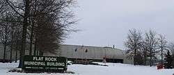
The Flat Rock Municipal Building at Gibraltar Road in December 2010 | |
 Location in Wayne County and the U.S. state of Michigan | |
| Coordinates: 42°6′7″N 83°16′22″W / 42.10194°N 83.27278°WCoordinates: 42°6′7″N 83°16′22″W / 42.10194°N 83.27278°W | |
| Country | United States |
| State | Michigan |
| Counties | Monroe, Wayne |
| Area[1] | |
| • Total | 6.67 sq mi (17.28 km2) |
| • Land | 6.53 sq mi (16.91 km2) |
| • Water | 0.14 sq mi (0.36 km2) |
| Elevation | 597 ft (182 m) |
| Population (2010)[2] | |
| • Total | 9,878 |
| • Estimate (2012[3]) | 9,795 |
| • Density | 1,512.7/sq mi (584.1/km2) |
| Time zone | EST (UTC-5) |
| • Summer (DST) | EDT (UTC-4) |
| ZIP code | 48134 |
| Area code(s) | 734 |
| FIPS code | 26-28360[4] |
| GNIS feature ID | 0626146[5] |
Flat Rock is a city in Wayne County of the U.S. state of Michigan. A very small portion of the city extends into Monroe County. At the 2010 census, the city population was 9,878.[6] Flat Rock is home to the Flat Rock Assembly Plant, owned by Ford Motor Company. As of 2012 it produces the 5th generation Ford Mustang, and is soon to make the Lincoln Continental. Flat Rock is the namesake of the famous Flat Rock Speedway, located in Berlin Charter Township in neighboring Monroe County.
History
Flat Rock began as a Wyandot settlement. It was later designated as a reservation for the Wyandot, and still functioned as such in 1830.[7]
The first Euro-American settlers in Flat Rock were Michael Vreeland and his five grown sons between 1811 and 1820. Michael had been captured by British Rangers during the Revolutionary War and released after American independence. The family purchased 800 acres (3.2 km2). The town was called the Village of Vreeland until 1838 when the Vreeland family sold off the majority of the land and relinquished control of the area. The Vreeland families built the first grain and lumber mill, having brought the grinding stones from New York. Descendants of Michael Vreeland still live in the town and attend Flat Rock public schools, being the seventh generation to reside in the town their family founded.
The first mention of any settlers in the area later to become Flat Rock was made by a French priest, Father Jean Dilhet. In describing his parish in 1798 he included "Grosse Roche", referring to a settlement named after the outcropping of limestone rock on the south side of the Huron River.
In 1818, a land office opened in Detroit, and Soloman Sibley purchased 330.93 acres (1.3392 km2) of land. In 1824 it was sold to Michael and Jacob Vreeland. The villages of Vreelandt and Smooth Rock were platted on part of this acreage. At this time there were Huron, Seneca, and Wyandot Indian villages in the area.
With the opening of the Erie Canal in 1825, large numbers of people, especially from New York, came to Michigan to settle. By 1828 the village had four stores, two saw mills, a wood carding mill, a flour mill, and 250 inhabitants - serving as a center mainly for farmers who lived in the area immediately surrounding the settlement.
The village of Flat Rock was platted and recorded in 1838 by the Gibraltar and Flat Rock Land Co. They were attempting to build a canal to connect Lake Erie with Lake Michigan. This effort ultimately failed.
Henry Ford was attracted to the water power of the Huron River, and in 1925 he established the Ford Motor Company Lamp Factory along its banks.
The area was incorporated as a village in 1923 and as a city in 1965. While Flat Rock is a rapidly growing community today, even with its growth, it remains a unique "small town" with many of its residents having roots reaching back to the 1800s.
From the 1930s until the early 1960s an airport was located in Flat Rock. The grass airfield was known as Nan-Bar Airport, named for the owner's two daughters, Nancy and Barbara. During World War II Nan-Bar Airport served as an accessory airfield for Naval Air Station Grosse Ile. Navy pilots used the airfield for short field landing instruction, as well as for emergency landings.
Flat Rock's massive growth from a small village to a medium-sized suburb began with the construction of Huron River Estates from 1953-1954.
Geography
According to the United States Census Bureau, the city has a total area of 6.67 square miles (17.28 km2), of which 6.53 square miles (16.91 km2) is land and 0.14 square miles (0.36 km2) is water.[1] The city is primarily within Wayne County, but a portion of the city lies in Monroe County, because the border along the Huron River follows the course of the river in 1923, the year Flat Rock was incorporated as a village. At the time, the river had two meanders, but they have since been filled in.
Economy
Mazda's operation at the Flat Rock Assembly Plant, which opened in the 1980s, was the first Japanese auto manufacturing in the U.S. industrial heartland.[8][9] Since then, the assembly plant was bought by Ford Motor Company.
Demographics
| Historical population | |||
|---|---|---|---|
| Census | Pop. | %± | |
| 1880 | 373 | — | |
| 1930 | 1,231 | — | |
| 1940 | 1,467 | 19.2% | |
| 1950 | 1,931 | 31.6% | |
| 1960 | 4,696 | 143.2% | |
| 1970 | 5,643 | 20.2% | |
| 1980 | 6,853 | 21.4% | |
| 1990 | 7,290 | 6.4% | |
| 2000 | 8,488 | 16.4% | |
| 2010 | 9,878 | 16.4% | |
| Est. 2015 | 9,914 | [10] | 0.4% |
2010 census
As of the census[2] of 2010, there were 9,878 people, 3,754 households, and 2,684 families residing in the city. The population density was 1,512.7 inhabitants per square mile (584.1/km2). There were 3,995 housing units at an average density of 611.8 per square mile (236.2/km2). The racial makeup of the city was 91.1% White, 4.1% African American, 0.5% Native American, 0.8% Asian, 0.6% from other races, and 2.9% from two or more races. Hispanic or Latino of any race were 4.4% of the population.
There were 3,754 households of which 38.9% had children under the age of 18 living with them, 49.8% were married couples living together, 16.6% had a female householder with no husband present, 5.1% had a male householder with no wife present, and 28.5% were non-families. 23.6% of all households were made up of individuals and 8.1% had someone living alone who was 65 years of age or older. The average household size was 2.62 and the average family size was 3.10.
The median age in the city was 36.9 years. 27.4% of residents were under the age of 18; 8.4% were between the ages of 18 and 24; 26.6% were from 25 to 44; 27.1% were from 45 to 64; and 10.4% were 65 years of age or older. The gender makeup of the city was 48.1% male and 51.9% female.
2000 census
As of the census[4] of 2000, there were 8,488 people, 3,181 households, and 2,306 families residing in the city. The population density was 1,266.9 per square mile (489.1/km²). There were 3,291 housing units at an average density of 491.2 per square mile (189.7/km²). The racial makeup of the city was 95.32% White, 1.43% African American, 0.49% Native American, 0.47% Asian, 0.64% from other races, and 1.65% from two or more races. Hispanic or Latino of any race were 2.70% of the population.
There were 3,181 households out of which 39.8% had children under the age of 18 living with them, 51.7% were married couples living together, 16.6% had a female householder with no husband present, and 27.5% were non-families. 22.9% of all households were made up of individuals and 8.6% had someone living alone who was 65 years of age or older. The average household size was 2.66 and the average family size was 3.12.
In the city the population was spread out with 29.3% under the age of 18, 10.1% from 18 to 24, 30.3% from 25 to 44, 20.8% from 45 to 64, and 9.5% who were 65 years of age or older. The median age was 33 years. For every 100 females there were 93.9 males. For every 100 females age 18 and over, there were 87.7 males.
The median income for a household in the city was $44,084, and the median income for a family was $54,186. Males had a median income of $43,967 versus $27,348 for females. The per capita income for the city was $21,256. About 8.5% of families and 8.8% of the population were below the poverty line, including 11.3% of those under age 18 and 4.8% of those age 65 or over.
Community growth
In the last 10 years Flat Rock has grown from a sleepy suburb on the fringes of Wayne County to a booming development area. Property values have substantially increased and population in the next census is also expected to increase. New construction projects begun or completed since 2000 include:
- Flat Rock Playscape
- Flat Rock High School
- Flat Rock Community Baseball Complex
- Flat Rock Public Library
- Downriver Linked Greenways
- Flat Rock Historical Park
- Flat Rock Fountain/Ice Skating Rink
- Flat Rock Community Recreation Center
- Condominiums
- High School Track and football field bathrooms
Schools
For fiscal year 2006, Flat Rock Community Schools received $7,619USD from the State of Michigan per student.[12]
- Bobcean Elementary School
- Students: 597
- Grades: K-2
- Mascot: Rams
- Barnes Elementary School
- Students: 407
- Grades: 3-5
- Mascot: Rams
- Simpson Junior High School
- Students: 407
- Grades: 6-8
- Mascot: Rams
- Flat Rock Community High School
- Students: 496
- Grades: 9-12
- Mascot: Rams
- Colors: Green and Gold
A portion of the city is in the Gibraltar School District.[13][14]
In addition, Summit Academy Schools, which is a slowly growing and prominent charter school in the area, begun at the Flat Rock campus. The Flat Rock campus still continues to operate.
Miscellaneous data
Flat Rock has a higher overall tornado average than the state of Michigan as a whole, and a 66% greater average than the United States as a whole.[15] Two F4 tornadoes have hit Flat Rock - one in 1956, another in 1965 resulting in 23 deaths and over 300 injuries.
Flat Rock is the childhood hometown of Dann Florek, who plays Captain Donald Cragen in the television series Law & Order and Law & Order: Special Victims Unit.
References
- Specific
- 1 2 "US Gazetteer files 2010". United States Census Bureau. Archived from the original on January 24, 2012. Retrieved 2012-11-25.
- 1 2 "American FactFinder". United States Census Bureau. Retrieved 2012-11-25.
- ↑ "Population Estimates". United States Census Bureau. Archived from the original on June 17, 2013. Retrieved 2013-06-03.
- 1 2 "American FactFinder". United States Census Bureau. Archived from the original on September 11, 2013. Retrieved 2008-01-31.
- ↑ U.S. Geological Survey Geographic Names Information System: Flat Rock, Michigan
- ↑ "Race, Hispanic or Latino, Age, and Housing Occupancy: 2010 Census Redistricting Data (Public Law 94-171) Summary File (QT-PL), Flat Rock city, Michigan". U.S. Census Bureau, American FactFinder 2. Archived from the original on September 11, 2013. Retrieved September 6, 2011.
- ↑ Helen Hornbeck Tanner. Atlas of Great Lakes Indian History. (Norman: University of Oklahoma Press, 1987) p. 134
- ↑ Fucini, p. 98.
- ↑ Fucini, p. 101.
- ↑ "Annual Estimates of the Resident Population for Incorporated Places: April 1, 2010 to July 1, 2015". Retrieved July 2, 2016.
- ↑ "Census of Population and Housing". Census.gov. Archived from the original on January 1, 1970. Retrieved June 4, 2015.
- ↑ Financial report for all Wayne County Schools p.45, accessed 7.13.2006
- ↑ "Gibraltar District Map" (Archived 2014-06-15 at WebCite). Gibraltar School District. Retrieved on June 15, 2014.
- ↑ "SCHOOL DISTRICT REFERENCE MAP (2010 CENSUS): Wayne County, MI" (DC10SD_C26163_001.pdf) (Archived 2014-06-15 at WebCite). U.S. Census Bureau. Retrieved on June 15, 2014.
- ↑ City Data - Flat Rock, MI
- General
- Fucini, Joseph J. Working for the Japanese. Simon & Schuster, June 30, 2008. ISBN 1439106487, 9781439106488.
External links
- City of Flat Rock official website
- Flat Rock Downtown Development Authority
- Flat Rock Historical Society
- Flat Rock Public Library
 |
Huron Charter Township | Brownstown Charter Township, Woodhaven | Trenton | |
| |
Gibraltar | |||
| ||||
| | ||||
| Ash Township | Rockwood Berlin Charter Township, South Rockwood |
Brownstown Charter Township |
Municipalities and communities of Monroe County, Michigan, United States | ||
|---|---|---|
| Cities | 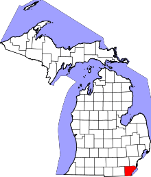 | |
| Villages | ||
| Charter townships | ||
| General law townships | ||
| CDPs | ||
| Other unincorporated communities | ||
| Footnotes | ‡This populated place also has portions in an adjacent county or counties | |
Municipalities and communities of Wayne County, Michigan, United States | ||
|---|---|---|
| Cities |
|  |
| Charter townships | ||
| General law townships | ||
| Unincorporated community | ||
| Footnotes | ‡This populated place also has portions in an adjacent county or counties | |
| Topics |  | |
|---|---|---|
| Detroit | ||
| Municipalities over 80,000 | ||
| Municipalities 40,000 to 80,000 | ||
| Cultural enclaves | ||
| Satellite cities | ||
| Counties in MSA | ||
| Counties in CSA | ||