Santa Clara, Chiriquí
| Santa Clara | |
|---|---|
| Town and corregimiento | |
 Santa Clara | |
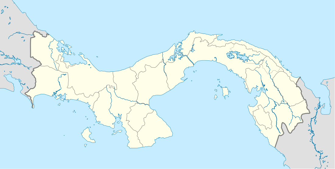
| Coordinates: 8°50′0″N 82°45′30″W / 8.83333°N 82.75833°WCoordinates: 8°50′0″N 82°45′30″W / 8.83333°N 82.75833°W | |
| Country |
|
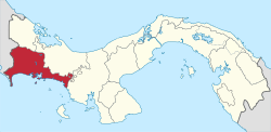
| Province | Chiriquí |
| District | Renacimiento |
| Established | April 30, 2003[1] |
| Area[1] | |
| • Land | 67 km2 (26 sq mi) |
| Population (2010)[1] | |
| • Total | 2,642 |
| • Density | 39.5/km2 (102/sq mi) |
| Population density calculated based on land area. | |
| Time zone | EST (UTC−5) |
Santa Clara is a town and corregimiento in Renacimiento District, Chiriquí Province, Panama. It has a land area of 67 square kilometres (26 sq mi) and had a population of 2,642 as of 2010, giving it a population density of 39.5 inhabitants per square kilometre (102/sq mi).[1] The corregimiento was created by Law 41 of April 30, 2003.[1]
The town includes a transient population of Ngöbe and other indigenous people who labor in the fields. It is located approximately 12 miles (19 km) northwest of Volcan, the location of Volcano Baru. Rio Sereno, the governmental seat of the area known as Renacimiento and the Costa Rican border are about 6 kilometers to the west.
Its primary source of income is coffee, supplemented by other crops. It is home to Cafe Duran, whose coffee is widely distributed in Panama, Finca Hartman, Cafe Balboa and Cafe Flor de Chiriqui. There are currently several producers of organic, shade grown coffee, members of APAASAC, an agro-environmental group. The rich volcanic soil also produces plantains, various types of beans, oranges, avocados, and more.
Climate and other data
Santa Clara receives ample rainfall, estimated at 4 metres (13 ft) per year. The rainy season extends from April through mid-January. At an altitude of 1,200 metres (3,900 ft), the area is cooler than coastal Panama. Temperatures range from 20 to 30 °C (68 to 86 °F).
Ecological significance
The Mesoamerican Biological Corridor (aka MBC, in Spanish "Corridor Biológico Mesoamericano") passes nearby. As a result, the area attracts a wide variety of birds and other migrating creatures. Finca Hartmann brings scientists, Smithsonian tours and birders eager to observe the more than 250 bird species reported in the area. There are sightings of the Quetzal, tinamou, a wide variety of hummingbirds, hawks, toucans and more, including some that are unique to Santa Clara.
The Chiriqui Highlands, in which Santa Clara is located, forms part of the Talamanca Mountain Range, which has the highest biodiversity index of the Central American isthmus. In 2001 the Range was designated a Worldwide Biosphere Reserve by UNESCO. The area contains the International Park la Amistad and the Volcan Baru Park. It is part of the PAMBAC (Panamanian Atlantic Mesoamerican Biological Corridor, itself a section of the Meso-American Biological Corridor) which extends from the Colombian border to the Costa Rican frontier.
The forested area also provides a significant contribution to carbon sequestration. In 2009 the University of Northern Colorado studied the district of Renacimiento, whose capital is Rio Sereno. The study seeks to determine current land use, degree of deforestation and potential incentives for landowners to maintain or increase their forested areas.
Panamanian environmental authorities began to develop a general land use and environmental monitoring plan starting in the 1996. It was part of a regional study of the MBC sponsored by the Global Environmental Facility (GEF) Global Environment Facility and International Bank for Reconstruction and Promotion (the World Bank). Under ANAM, the Panamanian government's environmental agency, the effort identified biological corridors and began to focus GEF funds on still intact areas. This project became known as the Panamanian Atlantic Mesoamerican Biological Corridor Project (PAMBC). The objective of the project was to promote biodiversity and sustainable development. The Chiriqui Highlands was one of the areas which have received attention in this project. Groups including APAASAC,have engaged in reforestation, organic agriculture and other sustainable development projects as a result.
Another important element is the La Amistad International Park, in Spanish La Parque Internacional La Amistad. It was declared a world heritage site in 1983. "The location of this unique site in Central America, where Quaternary glaciers have left their mark, has allowed the fauna and flora of North and South America to interbreed. Tropical rain forests cover most of the area. Four different Indian tribes inhabit this property, which benefits from close co-operation between Costa Rica and Panama." [2]
Environmental threats
Aside from agro-chemical contamination, there are several pending threats to the environment.
Mining
Gold and other minerals are found in the Tierras Altas. As of March 2010 a gold mine permit is under consideration very close to Santa Clara. Gold extraction requires the use of toxic chemicals.[3]
Hydro-electric plants
The government of Panama under Martín Torrijos Espino approved numerous hydroelectric projects on the Rio Viejo Chiriqui. Several are underway as of 2010. Each project is required to conduct an environmental study. However, as of May 2010 there has been no study of the environmental impact of the cumulative effect of the projects, which would canalize significant portions of the river. Furthermore, up to 90% of the water in the watershed can be diverted to electrical generation, which can be used domestically or sold to other countries. (For Panamanian press coverage see, for example La Prensa "Cuenca del río Chiriquí Viejo, tomado por hidroeléctricas".)
According to the environmental impact study performed for the Pando and Monte Lirio to be developed by Electron Investment S.A. there are three main environmental impacts: "a. Potential cumulative impacts on aquatic ecosystems and adjacent terrestrial habitats related to changes in hydrology and disruption of river continuity; b. Potential cumulative impacts on water use, including ecotourism and rafting activities, due to changes in hydrology, barriers effects of the dams and potential changes in water quality; and c. Potential cumulative impact on estuary's habitat due to sediments trapping (erosion) and potential changes in water quality (including salinity) and effects on estuary habitat."Monte Lirio Panda Project See link to # (PDF) Pando Monte Lirio Hydroelectric Project Environmental & Social Strategies September 24, 2009.
In 2010 ADATA, an organization composed of environmentally concerned groups, decided to oppose the projects until an environmental impact study is done and the percentage of water distribution changes to 50%/50% from the current 90%/10%.
Government
Santa Clara has a local governing body which seldom meets. It has a representative in the regional government of Renacimiento located in Rio Serreno. There are several committees, such as health, water, and roads.
Infrastructure
Santa Clara has electrical service which reaches most houses. The water system is near universal as well; major improvements were made in 2010. Trash service is provided through the regional government, but this started only in 2010. Prior to this, locals burned or buried their trash, including plastic and glass. The area is served by a winding road that goes to the communities of Rio Sereno in the west and Volcan.
There is no local road cleanup except through the occasional efforts of volunteers.
Health
The community has a health center staffed once a week by nurses. Every other month doctors hold a clinic. There is a larger clinic in Rio Sereno. The nearest hospital is in David, more than an hour away by ambulance. There is no helicopter service.
There is extensive use of agro-chemicals in the area, as most coffee producers have sun grown trees, which require chemical applications of pesticides, fertilizers and fumigants. Locals report the use of such products as Round-Up for weed control. Agro-chemical run off causes algae growth and reductions in fish populations in the rivers, streams and coastal areas. Coastal mangrove swamps are threatened. Agro-chemical use contributes to erosion by destroying grasses and other flora which help hold the soil in place.
Locals report some early teen pregnancy and some churches have sponsored sex education talks organized by Peace Corps volunteers.
Transport
Santa Clara is served by taxis from Rio Sereno, private vehicles and buses. Buses leave Sereno for David about every 45–50 minutes, with exceptions due to a variety of reasons. Buses are of the type called Coasters, seating about 24 people but at often filled with standing passengers. Fares to David as of 2010 are $3.90 and take 2 1⁄2 hours, to Volcan $1.90, taking 45 minutes. Both trips involve travel on the very windy, hilly road between Santa Clara and Volcan.
References
- 1 2 3 4 5 "Cuadro 11 (Superficie, población y densidad de población en la República...)" [Table 11 (Area, population, and population density in the Republic...)] (.xls). In "Resultados Finales Básicos" [Basic Final Results] (in Spanish). National Institute of Statistics and Census of Panama. Retrieved May 26, 2015.
- ↑ Unesco.
- ↑ Enviroliteracy.org.