Sanniriya
| Sanniriya | |
|---|---|
| Other transcription(s) | |
| • Arabic | صنّيريّه |
|
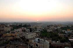
Sanniriya sunset | |
 Sanniriya Location of Sanniriya within the Palestinian territories | |
| Coordinates: 32°07′42″N 35°02′49″E / 32.12833°N 35.04694°ECoordinates: 32°07′42″N 35°02′49″E / 32.12833°N 35.04694°E | |
| Palestine grid | 154/170 |
| Governorate | Qalqilya |
| Founded | 14th century |
| Government | |
| • Type | Village council |
| Population (2007) | |
| • Jurisdiction | 2,780 |
| Name meaning | Senirieh p.n.[1] |
Sanniriya (Arabic: صنّيريّه) is a Palestinian town in the Qalqilya Governorate in the western area of the West Bank, located south of Qalqilya and 36 kilometers (22 mi) southwest of Nablus. According to the Palestinian Central Bureau of Statistics, the village had a population of approximately 2,780 inhabitants in 2007.[2]
History
Sanniriya was founded in the 14th century by Issa as-Saniri, a holy man from Syria, who is buried in the village.[3] Because of his tomb which is venerated by the local inhabitants, religious festivals were held in the village and the old mosque was built adjacent to it also in the 14th century. The prominent clans of the immediate area today—Sheikh, Omar, Ahmad, and Younis—are descendants of as-Saniri. The Abu Hadgi clan migrated to Sanniriya from Deir Istiya.[4]
Potsherds from the Mamluk era has been found in the village, and the mosque has an vaulted burial chamber, and an Arabic inscription from AH 876 (1460 C.E.).[5]
Ottoman era
In 1870, during the late Ottoman era, the French explorer Victor Guérin visited the village, which he found situated on the top of a hill, with about 700 inhabitants. Many of the houses appeared newly built, only some cisterns appeared old. At the highest point of the hill was a small mosque.[6]
In 1882 the Palestine Exploration Fund's Survey of Western Palestine (SWP) the village (called "Senirieh"), was described as a "small stone village, on a ridge, surrounded with olives, supplied by cisterns."[7]
British Mandate era
In the 1922 census of Palestine, conducted by the British Mandate authorities, Sanniriya (called "Sainiriyeh") had a population of 529, all Muslims,[8] increasing in the 1931 census when Sannirya (including Khirbat Azztun) had 165 occupied houses and a population of 722, again all Muslim.[9] In 1945 the population of Sanniriya was 990 Arabs, while the total land area was 12,685 dunams, according to an official land and population survey.[10] Of this, 2,895 were allocated for plantations and irrigable land, 4,432 for cereals,[11] while 45 dunams were classified as built-up areas.[12]
1948-1967
In the wake of the 1948 Arab–Israeli War, and after the 1949 Armistice Agreements, Husan came under Jordanian rule.
The Ahmad and Omar clans began to work the fields west of the village where the land was suitable for agriculture in the 1930s. However, in the 1950s, in order to avoid continuous long-distance travels, the Ahmad and Omar clans established the villages of Azzun Atma and Beit Amin, respectively. Because of the migration of the two clans, Younis and Sheikh became the dominant families of Sanniriya. Initially, at the beginning of Jordanian rule in the 1950s, water for domestic use was obtained from the nearby Wadi al-Qana. After receiving funds from residents living in the Persian Gulf States, the village economy substantially improved which included a boost in agricultural production, leading to the export of oranges and other products to the Gulf States. Increased income in the village allowed for the inhabitants to dig the first public well in Sanniriya in 1964.[4]
Post-1967
Sanniriya was not involved in the 1967 Six-Day War between Israel and a coalition of Arab states which ended in the occupation of the village as well as all of the West Bank by the former. However, in 1969, several residents participated in a battle against Israeli forces in the Jordan Valley. Between the late 1970s to 2000, the Israeli settlements of Etz Efraim and Elkana were built on lands, previously considered part of the Sanniriya expanse, that had been privately purchased decades earlier by Jewish groups.[13] Today those settlements are separated from Sanniriya proper by the West Bank barrier, constructed following the Second Intifada.[4]
During the First Intifada that began in 1987, a number of residents were imprisoned for participation in the uprising and two homes were demolished.
References
- ↑ Palmer, 1881, p. 241
- ↑ 2007 PCBS Census. Palestinian Central Bureau of Statistics
- ↑ Israeli forces invade Qalqiliya-area village. Ma'an News Agency. 2009-08-26.
- 1 2 3 Sanniriya, Azun Atme and Beit Amin Village Profile. International Women's Peace Service (IWPS). April 2003.
- ↑ Finkelstein et al., 1997, p. 293
- ↑ Guérin, 1875, p. 175 ff
- ↑ Conder and Kitchener, 1882, SWP II, p. 287
- ↑ Barron, 1923, Table IX, Sub-district of Nablus, p. 26
- ↑ Mills, 1932, p. 64
- ↑ Government of Palestine, Department of Statistics. Village Statistics, April, 1945. Quoted in Hadawi, 1970, p. 61.
- ↑ Government of Palestine, Department of Statistics. Village Statistics, April, 1945. Quoted in Hadawi, 1970, p. 107.
- ↑ Government of Palestine, Department of Statistics. Village Statistics, April, 1945. Quoted in Hadawi, 1970, p. 157.
- ↑ B'Tselem | The Israeli Information Center for Human Rights in the Occupied Territories By Hook and By Crook, Israeli Settlement Policy in the West Bank, footnote 127, p. 34 .
Bibliography
| Wikimedia Commons has media related to Sanniriya. |
- Barron, J. B., ed. (1923). Palestine: Report and General Abstracts of the Census of 1922. Government of Palestine.
- Conder, Claude Reignier; Kitchener, H. H. (1882). The Survey of Western Palestine: Memoirs of the Topography, Orography, Hydrography, and Archaeology. 2. London: Committee of the Palestine Exploration Fund.
- Finkelstein, Israel; Lederman, Zvi, eds. (1997). Highlands of many cultures. Tel Aviv: Institute of Archaeology of Tel Aviv University Publications Section. ISBN 965-440-007-3.
- Guérin, Victor (1875). Description Géographique Historique et Archéologique de la Palestine (in French). 2: Samarie, pt. 2. Paris: L'Imprimerie Nationale.
- Hadawi, Sami (1970). Village Statistics of 1945: A Classification of Land and Area ownership in Palestine. Palestine Liberation Organization Research Center.
- Mills, E., ed. (1932). Census of Palestine 1931. Population of Villages, Towns and Administrative Areas. Jerusalem: Government of Palestine.
- Palmer, E. H. (1881). The Survey of Western Palestine: Arabic and English Name Lists Collected During the Survey by Lieutenants Conder and Kitchener, R. E. Transliterated and Explained by E.H. Palmer. Committee of the Palestine Exploration Fund.
External links
- Welcome To Sanniriya
- Survey of Western Palestine, Map 14: IAA, Wikimedia commons
- Sanniriya Village (Fact Sheet), ARIJ
- Sanniriya Village Profile, ARIJ
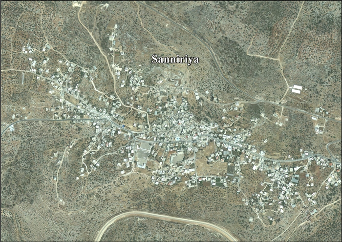
- Sanniriya, aerial photo, ARIJ
| Cities |  | |
|---|---|---|
| Municipalities |
| |
| Villages |
| |