San Mateo (canton)
| San Mateo | ||
|---|---|---|
|
Cantón | ||
 | ||
| ||
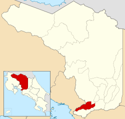 Location of San Mateo Canton in Alajuela Province | ||
| Country | Costa Rica | |
| Province | Alajuela | |
| Founded | 7 August 1868 | |
| Government | ||
| • Mayor | Jairo Emilio Guzmán Soto (PLN) | |
| Area | ||
| • Total | 125.90 km2 (48.61 sq mi) | |
| Population (June 2013) | ||
| • Total | 6,630 | |
| • Density | 53/km2 (140/sq mi) | |
| Time zone | Central Standard Time (UTC-6) | |
| Postal code | 20202 | |

San Mateo is the fourth canton in the province of Alajuela in Costa Rica. The canton covers an area of 125.90 square kilometres (48.61 sq mi),[1] and has a population of 6,630 (estimate as of 2013).[2]
The capital city of the canton is also called San Mateo.
Geography
The northern border of the elongated province is formed by the Río Jesús María, Río Machuca, Río Agua Agría, Río Calera and Quebrada Zapote. The Quebrada Concepción, Río Grande de Tárcoles and the Río Machuca establish the southern border. Cerro La Lana is a landmark that delineates a northeast tip of the canton.
Districts
The canton of San Mateo is subdivided into three districts (distritos):[3]
- San Mateo
- Desmonte
- Jesús María
History
The canton was established by a decree of August 7, 1868.
References
- ↑ Instituto Geográfico Nacional (IGN), 2001.
- ↑ Estadísticas Vitales 2013 - INEC
- ↑ "División Territorial Administrativa de Costa Rica" (PDF) (in Spanish). Instituto de Fomento y Asesoria Municipal (IFAM). 5 May 2009.
Coordinates: 9°57′45″N 84°33′40″W / 9.96250°N 84.56111°W