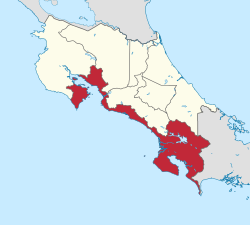
Puntarenas Province
| Puntarenas | |||
|---|---|---|---|
| Province | |||
| |||
 | |||
| Coordinates: 9°58′N 84°50′W / 9.967°N 84.833°WCoordinates: 9°58′N 84°50′W / 9.967°N 84.833°W | |||
| Country | Costa Rica | ||
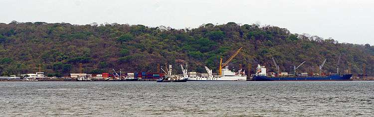
| Capital city | Puntarenas (pop. 102,504) | ||
| Largest city | Puntarenas | ||
| Area | |||
| • Total | 11,266 km2 (4,350 sq mi) | ||
| Population (2011) | |||
| • Total | 410,929 | ||
| • Density | 36/km2 (94/sq mi) | ||
| ISO 3166 code | CR-P | ||
Puntarenas (Spanish pronunciation: [puntaˈɾenas]) is a province of Costa Rica. It is located in the western part of the country, covering most of Costa Rica's Pacific Ocean coast, and it is the largest province in Costa Rica. Clockwise from the northwest it borders on the provinces Guanacaste, Alajuela, San José and Limón, and the neighbouring country of Panama.
Overview
The capital is Puntarenas. The province covers an area of 11,266 square kilometres (4,350 sq mi), and has a population of 410,929.[1] It is subdivided into eleven cantons. For administrative purposes, the island Isla del Coco, 500 kilometres (310 mi) offshore in the Pacific Ocean, is considered a part of this province.
Canton (Capital):
- Buenos Aires (Buenos Aires)
- Corredores (Ciudad Neily)
- Coto Brus (San Vito)
- Esparza (Esparza)
- Garabito (Jacó)
- Golfito (Golfito)
- Montes de Oro (Miramar)
- Osa (Ciudad Cortés)
- Parrita (Parrita)
- Puntarenas (Puntarenas)
- Quepos (Quepos)
Notable places
La Casona Ngäbe Buglé indigenas.
References
External links
![]() Media related to Puntarenas Province at Wikimedia Commons
Media related to Puntarenas Province at Wikimedia Commons