Hojancha (canton)
Coordinates: 10°03′32″N 85°25′10″W / 10.05889°N 85.41944°W
| Hojancha | |
|---|---|
|
Cantón | |
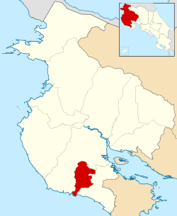 Location of Hojancha Canton in Guanacaste Province | |
| Country | Costa Rica |
| Province | Guanacaste |
| Area | |
| • Total | 261.42 km2 (100.93 sq mi) |
| Population (2013) | |
| • Total | 7,623 |
| • Density | 29/km2 (76/sq mi) |
Hojancha is the 11th canton in the province of Guanacaste in Costa Rica. The canton covers an area of 261.42 km²,[1] and has a population of 7,623.[2]
The canton is in the midsection of the Nicoya Peninsula. It is relatively compact, with a single tentacle reaching south to encompass a small portion of the Pacific coastline from Playa Carrillo southward to the mouth of the Río Ora.
Districts
The canton of Hojancha is subdivided into four districts (distritos):[3]
| District | Postal code | Alt. (m) | Area (km2) | Pop. (2008) | Coordinates |
|---|---|---|---|---|---|
| Hojancha | 51101 | 350 | 79.61 | 4,289 | 10°03′32″N 85°25′10″W / 10.05889°N 85.41944°W |
| Poblados: Ángeles, Arena, Ceiba, Cuesta Blanca, Libertad, Maravilla, Matambú, Palo de Jabón, Pilangosta, San Juan Bosco, San Rafael, Santa Elena (part), Varillal | |||||
| Monte Romo | 51102 | 685 | 74.85 | 843 | 09°59′58″N 85°22′57″W / 9.99944°N 85.38250°W |
| Poblados: Altos del Socorro, Bajo Saltos, Cabrera, Cuesta Roja, Delicias, Guapinol, Loros, Mercedes, Palmares, Río Zapotal, San Isidro, Trinidad | |||||
| Puerto Carrillo | 51103 | 40 | 75.5 | 1,416 | 09°52′02″N 85°28′45″W / 9.86722°N 85.47917°W |
| Poblados: Angostura, Arbolito, Cuesta Malanoche, Estrada, Jobo, Lajas, Quebrada Bonita (part), San Miguel, Santa María | |||||
| Huacas | 51104 | 570 | 31.46 | 741 | 10°01′22″N 85°22′02″W / 10.02278°N 85.36722°W |
| Poblados: Avellana, Pita Rayada, Río Blanco Oeste, Tres Quebradas | |||||
History
The canton was established by law on November 2, 1971.
On September 5, 2012, a magnitude 7.6 earthquake struck 12 kilometers northeast of Hojancha, destroying houses in the canton.[4][5]
References
- ↑ Instituto Geográfico Nacional (IGN), 2001.
- ↑ Estadísticas Vitales 2013 - INEC
- ↑ "División Territorial Administrativa de Costa Rica" (PDF) (in Spanish). Instituto de Fomento y Asesoria Municipal (IFAM). 5 May 2009.
- ↑ "M7.6 - 12km ENE of Hojancha, Costa Rica". United States Geological Survey. September 5, 2012. Retrieved October 3, 2012.
- ↑ Mata Blanco, Alonso (September 6, 2012). "Sismo Destruyó Viviendas en Varios Cantones de Guanacaste y Alajuela" [Earthquake Destroyed Homes in Several Cantons of Guanacaste and Alajuela]. La Nación (in Spanish). Retrieved October 3, 2012.
This article is issued from Wikipedia - version of the 3/24/2015. The text is available under the Creative Commons Attribution/Share Alike but additional terms may apply for the media files.