Salisbury, Vermont
| Salisbury, Vermont | |
|---|---|
| Town | |
|
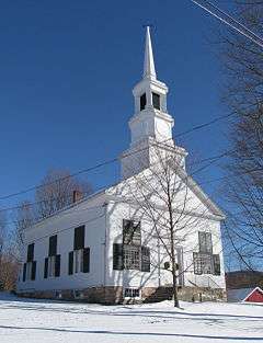
Salisbury Congregational Church | |
 Salisbury, Vermont | |
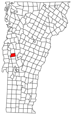
 Salisbury, Vermont Location in the United States | |
| Coordinates: 43°54′50″N 73°6′25″W / 43.91389°N 73.10694°WCoordinates: 43°54′50″N 73°6′25″W / 43.91389°N 73.10694°W | |
| Country | United States |
| State | Vermont |
| County | Addison |
| Chartered | 1761[1] |
| Area | |
| • Total | 30.0 sq mi (77.7 km2) |
| • Land | 28.9 sq mi (74.8 km2) |
| • Water | 1.2 sq mi (3.0 km2) |
| Elevation | 413 ft (126 m) |
| Population (2010) | |
| • Total | 1,136 |
| • Density | 39/sq mi (15.2/km2) |
| Time zone | Eastern (EST) (UTC-5) |
| • Summer (DST) | EDT (UTC-4) |
| ZIP code | 05769 |
| Area code | 802 |
| FIPS code | 50-62575[2] |
| GNIS feature ID | 1462200[3] |
| Website |
townofsalisbury |
Salisbury is a town in Addison County, Vermont, United States. The population was 1,136 at the 2010 census.[4]
History
Salisbury was chartered on November 3, 1761 as one of the New Hampshire Grants issued by Benning Wentworth.[5] The town may have been named after Salisbury, Connecticut,[6] or for James Cecil, 6th Earl of Salisbury.[5]
Geography
Salisbury is located in southern Addison County along the western edge of the Green Mountains and the eastern edge of the Champlain Valley. U.S. Route 7 passes through the town leading north to Middlebury and south to Brandon and Rutland. The northern half of Lake Dunmore is in the eastern part of the town, and is the site of Branbury State Park.
According to the United States Census Bureau, Salisbury has a total area of 30.0 square miles (77.7 km2) of which 28.9 square miles (74.8 km2) is land and 1.2 square miles (3.0 km2), or 3.81%, is water.[4]
Demographics

| Historical population | |||
|---|---|---|---|
| Census | Pop. | %± | |
| 1790 | 446 | — | |
| 1800 | 644 | 44.4% | |
| 1810 | 709 | 10.1% | |
| 1820 | 721 | 1.7% | |
| 1830 | 907 | 25.8% | |
| 1840 | 942 | 3.9% | |
| 1850 | 1,027 | 9.0% | |
| 1860 | 853 | −16.9% | |
| 1870 | 902 | 5.7% | |
| 1880 | 775 | −14.1% | |
| 1890 | 740 | −4.5% | |
| 1900 | 692 | −6.5% | |
| 1910 | 693 | 0.1% | |
| 1920 | 635 | −8.4% | |
| 1930 | 632 | −0.5% | |
| 1940 | 581 | −8.1% | |
| 1950 | 573 | −1.4% | |
| 1960 | 575 | 0.3% | |
| 1970 | 649 | 12.9% | |
| 1980 | 881 | 35.7% | |
| 1990 | 1,024 | 16.2% | |
| 2000 | 1,090 | 6.4% | |
| 2010 | 1,136 | 4.2% | |
| Est. 2014 | 1,131 | [7] | −0.4% |
| U.S. Decennial Census[8] | |||
As of the census[2] of 2000, there were 1,090 people, 423 households, and 302 families residing in the town. The population density was 37.4 people per square mile (14.4/km2). There were 628 housing units at an average density of 21.5 per square mile (8.3/km2). The racial makeup of the town was 98.17% White, 0.09% Native American, 0.28% Asian, 0.18% from other races, and 1.28% from two or more races. Hispanic or Latino of any race were 0.28% of the population.
There were 423 households out of which 34.3% had children under the age of 18 living with them, 58.9% were married couples living together, 8.3% had a female householder with no husband present, and 28.4% were non-families. 22.9% of all households were made up of individuals and 8.0% had someone living alone who was 65 years of age or older. The average household size was 2.54 and the average family size was 2.96.
In the town the age distribution of the population shows 25.6% under the age of 18, 6.1% from 18 to 24, 28.8% from 25 to 44, 27.2% from 45 to 64, and 12.4% who were 65 years of age or older. The median age was 39 years. For every 100 females there were 100.4 males. For every 100 females age 18 and over, there were 97.8 males.
The median income for a household in the town was $39,500, and the median income for a family was $45,455. Males had a median income of $27,107 versus $21,827 for females. The per capita income for the town was $19,306. About 5.1% of families and 7.7% of the population were below the poverty line, including 8.6% of those under age 18 and 2.5% of those age 65 or over.
Parks and recreation
Branbury State Park, a 69-acre (28 ha) park on the shore of Lake Dunmore, is located in Salisbury. The park has 1,000 feet (300 m) of natural sandy beach, hiking trails, waterfalls, caves and camping areas. The park originally operated as a farm and then a summer boys' camp before being named a state park in 1945.[9][10]
Notable people
- Henry Olin, congressman from Vermont and sixth Lieutenant Governor of Vermont[11]
- Wilbur F. Storey, 19th Century editor and publisher, owned Detroit Free Press and Chicago Times
Climate
This climatic region is typified by large seasonal temperature differences, with warm to hot (and often humid) summers and cold (sometimes severely cold) winters. According to the Köppen Climate Classification system, Salisbury has a humid continental climate, abbreviated "Dfb" on climate maps.[12]
References
- ↑ "About Salisbury, Vermont". Virtual Vermont. Retrieved November 6, 2012.
- 1 2 "American FactFinder". United States Census Bureau. Retrieved 2008-01-31.
- ↑ "US Board on Geographic Names". United States Geological Survey. 2007-10-25. Retrieved 2008-01-31.
- 1 2 "Geographic Identifiers: 2010 Demographic Profile Data (G001): Salisbury town, Addison County, Vermont". U.S. Census Bureau, American Factfinder. Retrieved August 30, 2013.
- 1 2 "About Salisbury, Vermont". Virtual Vermont. Retrieved November 6, 2012.
- ↑ "Profile for Salisbury, Vermont, VT". ePodunk. Retrieved November 6, 2012.
- ↑ "Annual Estimates of the Resident Population for Incorporated Places: April 1, 2010 to July 1, 2014". Retrieved June 4, 2015.
- ↑ "U.S. Decennial Census". United States Census Bureau. Retrieved May 16, 2015.
- ↑ "Branbury State Park". Vermont State Parks. Retrieved November 6, 2012.
- ↑ "Branbury State Park". Vermont Campground Association. Retrieved November 6, 2012.
- ↑ "OLIN, Henry, (1768 - 1837)". Biographical Directory of the United States Congress. Retrieved November 6, 2012.
- ↑ Climate Summary for Salisbury, Vermont
External links
| Wikimedia Commons has media related to Salisbury, Vermont. |
- Town of Salisbury official website
- City-Data.com
- Virtual Vermont: Salisbury Vermont
- ePodunk: Profile for Salisbury Vermont
- Vermont State Parks: Branbury State Park
Municipalities and communities of Addison County, Vermont, United States | ||
|---|---|---|
| City | 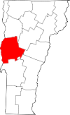 | |
| Towns | ||
| CDPs | ||
| Other communities | ||