Saint-Julien, Var
| Saint-Julien | ||
|---|---|---|
|
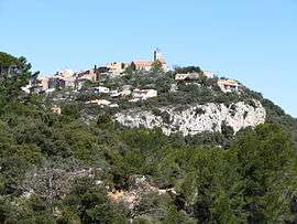
A general view of Saint-Julien-le-Montagnier | ||
| ||
 Saint-Julien | ||
|
Location within Provence-A.-C.d'A. region  Saint-Julien | ||
| Coordinates: 43°41′31″N 5°54′28″E / 43.6919°N 5.9078°ECoordinates: 43°41′31″N 5°54′28″E / 43.6919°N 5.9078°E | ||
| Country | France | |
| Region | Provence-Alpes-Côte d'Azur | |
| Department | Var | |
| Arrondissement | Brignoles | |
| Canton | Rians | |
| Intercommunality | Verdon Mont Major | |
| Government | ||
| • Mayor (2001–2008) | Francis Gillet | |
| Area1 | 75.88 km2 (29.30 sq mi) | |
| Population (2006)2 | 1,637 | |
| • Density | 22/km2 (56/sq mi) | |
| Time zone | CET (UTC+1) | |
| • Summer (DST) | CEST (UTC+2) | |
| INSEE/Postal code | 83113 / 83560 | |
| Elevation |
297–596 m (974–1,955 ft) (avg. 578 m or 1,896 ft) | |
|
1 French Land Register data, which excludes lakes, ponds, glaciers > 1 km² (0.386 sq mi or 247 acres) and river estuaries. 2 Population without double counting: residents of multiple communes (e.g., students and military personnel) only counted once. | ||
.svg.png)
Saint-Julien (also known as Saint-Julien-le-Montagnier) is a commune in the Var department in the Provence-Alpes-Côte d'Azur region in southeastern France.
See also
References
| Wikimedia Commons has media related to Saint-Julien, Var. |
This article is issued from Wikipedia - version of the 2/12/2016. The text is available under the Creative Commons Attribution/Share Alike but additional terms may apply for the media files.