Saint-Zacharie
| Saint-Zacharie | ||
|---|---|---|
|
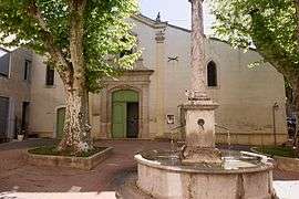
The church of Saint-Zacharie | ||
| ||
 Saint-Zacharie | ||
|
Location within Provence-A.-C.d'A. region  Saint-Zacharie | ||
| Coordinates: 43°23′03″N 5°42′24″E / 43.3842°N 5.7067°ECoordinates: 43°23′03″N 5°42′24″E / 43.3842°N 5.7067°E | ||
| Country | France | |
| Region | Provence-Alpes-Côte d'Azur | |
| Department | Var | |
| Arrondissement | Brignoles | |
| Canton | Saint-Maximin-la-Sainte-Baume | |
| Intercommunality | Pays d'Aubagne et de l'Etoile | |
| Government | ||
| • Mayor (1980–2014) | Pierre Coulomb | |
| Area1 | 27.02 km2 (10.43 sq mi) | |
| Population (2010)2 | 4,997 | |
| • Density | 180/km2 (480/sq mi) | |
| Time zone | CET (UTC+1) | |
| • Summer (DST) | CEST (UTC+2) | |
| INSEE/Postal code | 83120 / 83640 | |
| Elevation |
239–756 m (784–2,480 ft) (avg. 362 m or 1,188 ft) | |
|
1 French Land Register data, which excludes lakes, ponds, glaciers > 1 km² (0.386 sq mi or 247 acres) and river estuaries. 2 Population without double counting: residents of multiple communes (e.g., students and military personnel) only counted once. | ||
.svg.png)
Saint-Zacharie is a commune in the Var department in the Provence-Alpes-Côte d'Azur region in southeastern France.
Points of interest
- Parc du Moulin Blanc
- Eglise saint-jean baptiste
- Château de Montvert
- L'Huveaune
See also
References
| Wikimedia Commons has media related to Saint-Zacharie (Var). |
This article is issued from Wikipedia - version of the 1/29/2015. The text is available under the Creative Commons Attribution/Share Alike but additional terms may apply for the media files.