Rosedale, South Australia
| Rosedale South Australia | |||||||||||||
|---|---|---|---|---|---|---|---|---|---|---|---|---|---|
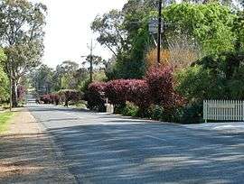 Rosedale street view | |||||||||||||
 Rosedale | |||||||||||||
| Coordinates | 34°33′S 138°51′E / 34.55°S 138.85°ECoordinates: 34°33′S 138°51′E / 34.55°S 138.85°E | ||||||||||||
| Established | 1849 | ||||||||||||
| Postcode(s) | 5350 | ||||||||||||
| Location | |||||||||||||
| LGA(s) |
| ||||||||||||
| State electorate(s) | Schubert | ||||||||||||
| Federal Division(s) | Wakefield | ||||||||||||
| |||||||||||||
| |||||||||||||
| Footnotes | |||||||||||||
Rosedale is a small town in the south western Barossa Valley in South Australia. Prior to renaming placenames of enemy origin in 1918, Rosedale was named Rosenthal.

Rosedale sign showing former name of Rosenthal
The locality of Rosedale spans the North Para River which is the boundary between two local government areas. North of the river is in the Light Regional Council. South of it is in the Barossa Council.[1] The Turretfield Research Centre is on the north bank of the river just outside the township.
References
- 1 2 "Placename Details: Rosedale". Property Location Browser. Government of South Australia. 6 February 2007. SA0058907. Retrieved 6 May 2016.
- ↑ "Monthly climate statistics: Summary statistics ROSEDALE (TURRETFIELD RESEARCH CENTRE)". Commonwealth of Australia , Bureau of Meteorology. Retrieved 16 April 2016.
External links
![]() Media related to Rosedale, South Australia at Wikimedia Commons
Media related to Rosedale, South Australia at Wikimedia Commons
This article is issued from Wikipedia - version of the 5/10/2016. The text is available under the Creative Commons Attribution/Share Alike but additional terms may apply for the media files.