Red Bank, South Carolina
| Red Bank, South Carolina | |
|---|---|
| CDP | |
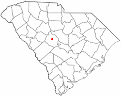 Location of Red Bank, South Carolina | |
| Coordinates: 33°55′55″N 81°13′49″W / 33.93194°N 81.23028°WCoordinates: 33°55′55″N 81°13′49″W / 33.93194°N 81.23028°W | |
| Country | United States |
| State | South Carolina |
| County | Lexington |
| Government | |
| • Type | None |
| Area | |
| • Total | 12.1 sq mi (31.4 km2) |
| • Land | 11.9 sq mi (30.8 km2) |
| • Water | 0.2 sq mi (0.6 km2) |
| Elevation | 341 ft (104 m) |
| Population (2000) | |
| • Total | 8,811 |
| • Density | 740.6/sq mi (286.0/km2) |
| Time zone | Eastern (EST) (UTC-5) |
| • Summer (DST) | EDT (UTC-4) |
| ZIP code | 29073 |
| Area code(s) | 803 |
| FIPS code | 45-59110[1] |
| GNIS feature ID | 1250298[2] |
Red Bank is a census-designated place (CDP) in Lexington County, South Carolina, United States. The population was 8,811 at the 2000 census. It is part of the Columbia, South Carolina Metropolitan Statistical Area
Geography
Red Bank is located at 33°55′55″N 81°13′49″W / 33.93194°N 81.23028°W (33.932005, -81.230211).[3]
According to the United States Census Bureau, the CDP has a total area of 12.1 square miles (31.4 km²), of which, 11.9 square miles (30.8 km²) of it is land and 0.2 square miles (0.6 km²) of it (1.90%) is water.
Demographics
As of the census[1] of 2000, there were 8,811 people, 3,281 households, and 2,480 families residing in the CDP. The population density was 740.6 people per square mile (285.9/km²). There were 3,498 housing units at an average density of 294.0/sq mi (113.5/km²). The racial makeup of the CDP was 88.74% White, 8.84% African American, 0.35% Native American, 0.49% Asian, 0.03% Pacific Islander, 0.93% from other races, and 0.61% from two or more races. Hispanic or Latino of any race were 1.90% of the population.
There were 3,281 households out of which 43.4% had children under the age of 18 living with them, 58.6% were married couples living together, 12.8% had a female householder with no husband present, and 24.4% were non-families. 19.4% of all households were made up of individuals and 3.6% had someone living alone who was 65 years of age or older. The average household size was 2.68 and the average family size was 3.09.
In the CDP the population was spread out with 29.8% under the age of 18, 7.6% from 18 to 24, 37.2% from 25 to 44, 20.3% from 45 to 64, and 5.1% who were 65 years of age or older. The median age was 32 years. For every 100 females there were 93.1 males. For every 100 females age 18 and over, there were 92.6 males.
The median income for a household in the CDP was $42,072, and the median income for a family was $50,838. Males had a median income of $36,347 versus $26,016 for females. The per capita income for the CDP was $18,664. About 5.8% of families and 7.9% of the population were below the poverty line, including 11.1% of those under age 18 and 7.2% of those age 65 or over.
References
- 1 2 "American FactFinder". United States Census Bureau. Retrieved 2008-01-31.
- ↑ "US Board on Geographic Names". United States Geological Survey. 2007-10-25. Retrieved 2008-01-31.
- ↑ "US Gazetteer files: 2010, 2000, and 1990". United States Census Bureau. 2011-02-12. Retrieved 2011-04-23.
Municipalities and communities of Lexington County, South Carolina, United States | ||
|---|---|---|
| Cities | 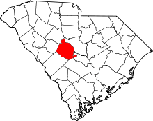 | |
| Towns | ||
| CDPs | ||
| Footnotes | ‡This populated place also has portions in an adjacent county or counties | |