West Columbia, South Carolina
| West Columbia, South Carolina | |
|---|---|
| City | |
|
| |
| Motto: "Bridging Past, Present, And Future"[1] | |
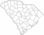 Location in Lexington County, South Carolina | |
| Coordinates: 33°59′27.8″N 81°4′23.4″W / 33.991056°N 81.073167°WCoordinates: 33°59′27.8″N 81°4′23.4″W / 33.991056°N 81.073167°W | |
| Government | |
| • Type | City Council, City Administrator |
| • Mayor | Bobby Horton[2] |
| Area | |
| • Total | 16.3 km2 (6.3 sq mi) |
| • Land | 15.7 km2 (6.1 sq mi) |
| • Water | 0.5 km2 (0.2 sq mi) |
| Elevation | 87 m (285 ft) |
| Population (2010) | |
| • Total | 14,988 |
| • Density | 831.0/km2 (2,152/sq mi) |
| Time zone | EST (UTC-5) |
| • Summer (DST) | EDT (UTC-4) |
| Area code(s) | 803 |
| FIPS code | 45-75850 |
| GNIS feature ID | 1251380[3] |
| Website | www.westcolumbiasc.gov |
West Columbia, part of the greater Columbia, SC metropolitan statistical area, is a city in the suburban eastern sections of Lexington County, South Carolina, United States. According to the 2010 census, the population was 14,988.
West Columbia lies west of Columbia, South Carolina, directly across the Congaree River. It's near Columbia's city center or downtown district as well as the South Carolina State House and the Congaree Vista, known locally as "the Vista."
West Columbia is bordered to the south by its sister suburb, Cayce, South Carolina.
History
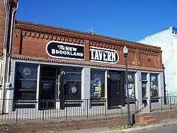
West Columbia was incorporated in 1894 as Brookland, but the United States Postal Service called the town "New Brookland" since there was another town called Brookland. In 1936, the name was changed to West Columbia to emphasize its proximity to Columbia, South Carolina.[1] Numerous businesses, churches and a high school retain the Brookland and New Brookland names.
The Gervais Street Bridge, Mount Hebron Temperance Hall, New Brookland Historic District, and Saluda Factory Historic District are listed on the National Register of Historic Places.[4]
Geography
West Columbia lies to the south and west of the Saluda and Congaree Rivers.
According to the United States Census Bureau, the city has a total area of 6.3 square miles (16.3 km²), of which 6.1 square miles (15.7 km²) is land and 0.2 square mile (0.5 km²) (3.18%) is water.
Demographics
| Historical population | |||
|---|---|---|---|
| Census | Pop. | %± | |
| 1900 | 1,089 | — | |
| 1910 | 900 | −17.4% | |
| 1920 | 1,793 | 99.2% | |
| 1930 | 1,722 | −4.0% | |
| 1940 | 1,744 | 1.3% | |
| 1950 | 1,543 | −11.5% | |
| 1960 | 6,410 | 315.4% | |
| 1970 | 7,838 | 22.3% | |
| 1980 | 10,409 | 32.8% | |
| 1990 | 10,588 | 1.7% | |
| 2000 | 13,064 | 23.4% | |
| 2010 | 14,988 | 14.7% | |
| Est. 2015 | 16,060 | [5] | 7.2% |
| U.S. Decennial Census[6] 2012 Estimate[7] | |||
As of the census of 2000, there were 13,064 people, 5,968 households, and 3,300 families residing in the city. The population density was 2,150.6 people per square mile (831.0/km²). There were 6,436 housing units at an average density of 1,059.5 per square mile (409.4/km²). The racial makeup of the city was 74.54% White, 19.81% African American, 0.28% Native American, 1.71% Asian, 0.02% Pacific Islander, 2.04% from other races, and 1.61% from two or more races. Hispanic or Latino of any race were 4.66% of the population.
There were 5,968 households out of which 22.0% had children under the age of 18 living with them, 37.5% were married couples living together, 14.3% had a female householder with no husband present, and 44.7% were non-families. 36.1% of all households were made up of individuals and 13.0% had someone living alone who was 65 years of age or older. The average household size was 2.13 and the average family size was 2.76.
In the city the population was spread out with 18.8% under the age of 18, 10.1% from 18 to 24, 30.0% from 25 to 44, 22.1% from 45 to 64, and 19.0% who were 65 years of age or older. The median age was 39 years. For every 100 females there were 88.5 males. For every 100 females age 18 and over, there were 86.1 males.
The median income for a household in the city was $30,999, and the median income for a family was $40,253. Males had a median income of $30,033 versus $24,637 for females. The per capita income for the city was $18,135. About 12.8% of families and 16.8% of the population were below the poverty line, including 24.5% of those under age 18 and 11.4% of those age 65 or over.
See also
References
- 1 2 "City of West Columbia South Carolina". City of West Columbia South Carolina. Retrieved October 3, 2012.
- ↑ "City Council". City of West Columbia. Retrieved 1 May 2015.
- ↑ "US Board on Geographic Names". United States Geological Survey. 2007-10-25. Retrieved 2008-01-31.
- ↑ National Park Service (2010-07-09). "National Register Information System". National Register of Historic Places. National Park Service.
- ↑ "Annual Estimates of the Resident Population for Incorporated Places: April 1, 2010 to July 1, 2015". Retrieved July 2, 2016.
- ↑ United States Census Bureau. "Census of Population and Housing". Retrieved August 14, 2013.
- ↑ "Annual Estimates of the Resident Population: April 1, 2010 to July 1, 2012". Retrieved August 14, 2013.
External links
| Wikimedia Commons has media related to West Columbia, South Carolina. |
Municipalities and communities of Lexington County, South Carolina, United States | ||
|---|---|---|
| Cities | 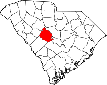 | |
| Towns | ||
| CDPs | ||
| Footnotes | ‡This populated place also has portions in an adjacent county or counties | |